
5.7
PDI
9.9 mi
DISTANCE
1,473 ft
GAINED
2.6 %
AVG. GRADE
FULL CLIMB STATS
Page Contributor(s): Dash Weber
INTRO
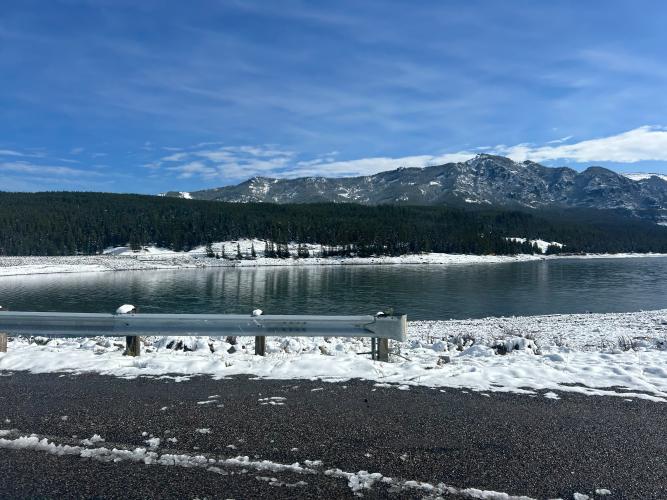
Hyalite Canyon is Bozeman's backyard climb, a steady paved ascent up Hyalite Canyon Road into the Custer Gallatin National Forest, gaining roughly 1,300-1,600 feet over about 10 miles from the 19th Avenue turnoff to Hyalite Reservoir. The grade stays moderate for most of the climb, averaging in the low single digits with a few steeper pitches mixed in, so it's more of a steady grinder than a leg-breaker.
The road was fully repaved through to the dam in 2021, and it's become a favorite local training route, especially during the annual spring closure, when Custer Gallatin National Forest shuts Hyalite Road to motor vehicles from April 1 through May 15 for spring breakup. For six weeks, the whole canyon belongs to cyclists, runners, and walkers.
Past the reservoir the pavement ends and Forest Service gravel continues deeper into the mountains for riders who want more. Along the way you're riding through prime grizzly country beneath the Gallatin Range, with waterfalls, fishing access, and campgrounds lining the route.
PLAN YOUR ROUTE
 We've partnered with Sherpa-Map.com to bring you the best route planning tool. With a PRO Membership you can use this climb as a reference when creating your route.
 See more details and tools regarding this climb's grade via our interactive Profile Tool.
Roadway: Paved the entire way to Hyalite Dam — the upper stretch was repaved in 2021 and is in great shape. Beyond the dam, it turns to Forest Service gravel.
Traffic: This is the main access road to a popular reservoir, so expect moderate weekend traffic from campers, anglers, and hikers in summer. From April 1 to May 15 each year the road closes to motor vehicles for spring breakup — that's the quietest, most bike-friendly window.
Parking: The Blackmore lot partway up the canyon almost always has space, or start from a pullout near Langohr Campground. To ride the full climb, start from the 19th Avenue turnoff south of town.
There's nothing out here once you leave Bozeman — no gas stations, stores, or bike shops along Hyalite Canyon Road, so fill bottles and top off fuel before you turn off 19th Avenue.
Vault toilets and drinking water are available at the Hyalite day-use pavilion near the reservoir, about two-thirds of the way up.
This is grizzly country — bear spray is a smart addition if you're stopping to hike or fish along the way. Even in summer, mornings at this elevation (over 6,700 ft at the top) can be cold, so bring a layer for the descent.
Before heading out on any cycling adventure check out our Things to Bring on a Cycling Trip and use our interactive check list to ensure you don't forget anything.
Time it around the spring closure if you can — Hyalite Road is shut to motor vehicles from April 1 to May 15 each year, turning the whole canyon into a quiet, car-free training ground for cyclists.
Outside that window, start early. Mornings avoid both weekend recreation traffic and the afternoon mountain thunderstorms that build up over the Gallatin Range in summer.
Bozeman is about 15 miles north with all the food, lodging, and bike shops you'd need — there's nothing along the route itself, so stage there before you head up the canyon.
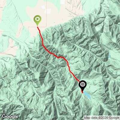
ROUTE MAP
MEMBER RATING
CURRENT WEATHER
PJAMM TRIPS ADVENTURE STARTER BUNDLES
Check out PJAMM Adventure's prepackaged (self-guided) cycling trips. They will help you plan, document and conquer your next adventure.
NEARBY CLIMBS (0) RADIAL PROXIMITY
FROM No Climbs Found
MEMBER REVIEWS & COMMENTS
Let us know what you thought of this climb. Signup for our FREE membership to write a review or post a comment.
Already have an account?
LOG IN HERE
