Page Contributor(s): Leo Lagos, Chile
INTRO
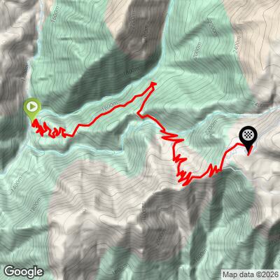
Farellones is the mountain village where Santiago's cyclists disappear into the Andes. The climb starts at what locals call "curve 0," the point where Camino a Farellones splits from Camino La Disputada just north of Corral Quemado in the Lo Barnechea foothills, and works up through more than 40 numbered switchbacks - riders here count curve numbers the way European climbers count kilometers to the summit - to the village itself at roughly 2,340 meters (7,675 ft).
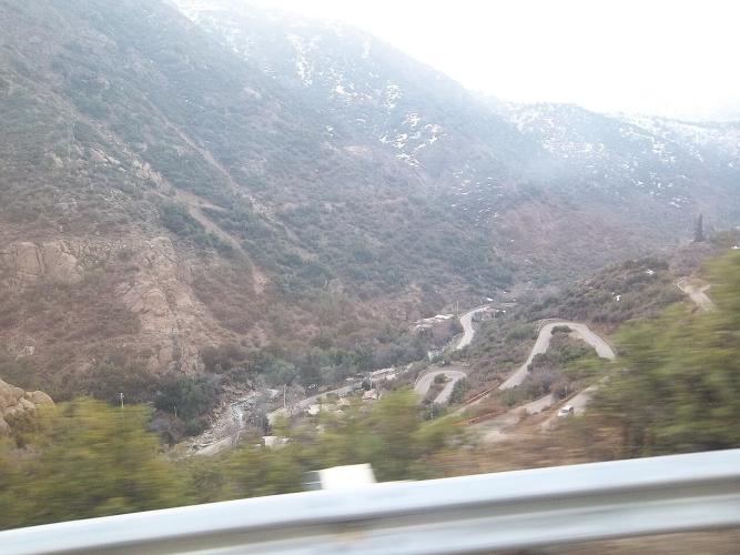
What makes the climb distinctive is the sheer density of hairpins stacked into its upper two-thirds. The stretch from curve 1 to curve 41 is the defining test of the road, a relentless staircase carved into bare, cactus-studded slopes with the smog line of Santiago sinking away below and, on a good day, an Andean condor riding the thermals overhead.
It's also where British star Tom Pidcock sometimes chooses to hide from the European winter: his Q36.5 team based its 2026 altitude camp in the Farellones area, and Pidcock currently holds the Strava KOM for the curve 1-to-41 segment at 1:13:03.
Ruta G-21 is the only paved road into Chile's largest ski area, feeding Farellones, La Parva, El Colorado and Valle Nevado from this same base - see our Routes in the Area tool for the other climbs sharing curve 0.
PLAN YOUR ROUTE
 We've partnered with Sherpa-Map.com to bring you the best route planning tool. With a PRO Membership you can use this climb as a reference when creating your route.
Farellones is a grinder, not a wall. Strava's segment covering the numbered switchback core - curve 1 to curve 41, the part of the climb everyone means when they talk about "Farellones" - runs about 30.7 km (19.1 mi) and averages close to 5%, with pitches into double digits concentrated in the tightest hairpins rather than any single sustained ramp. European climb databases rate the full ascent Hors Categorie, and from curve 0 near Corral Quemado (about 1,370 m) to the village at roughly 2,340 m, riders gain close to 1,000 meters (3,300 ft) before the road forks toward the higher resorts.
There's a YPF gas station with a convenience store right around curve 1, near the base of the switchback section, and it's worth treating as your last reliable water stop - once you're into the hairpins there's nothing until Farellones itself. The village has restaurants and cafes, but most of them cater to the ski season and keep shorter hours or close outright in summer, so don't count on them being open when you ride.
The Andean sun is intense at this altitude even on a cool day, so sunscreen and eye protection matter more than the modest elevation gain suggests. Pack a light shell for the descent - temperatures at 2,340 m drop fast once you stop climbing, even in the Chilean summer.
Farellones sits about 35 km northeast of downtown Santiago in the Lo Barnechea commune, reached entirely via Ruta G-21 - there's no other way up. The best cycling window is the Chilean summer, roughly November through April, when the ski season's traffic controls and chain requirements aren't in effect and the switchbacks are simply yours. Tom Pidcock's team picked January and February for exactly this reason.
Weekday mornings are the quietest time to ride; if you're here on a weekend, start early to beat both the day-tripper traffic out of Santiago and the afternoon heat building in the valley. Because Farellones is also where the road forks toward La Parva, El Colorado and Valle Nevado, it's worth combining this climb with one of its neighbors - our Routes in the Area tool shows the other climbs that share this same curve 0.
ROUTE MAP