
19.5
PDI
8.2 mi
DISTANCE
3,094 ft
GAINED
6.9 %
AVG. GRADE
FULL CLIMB STATS
INTRO
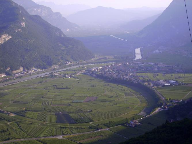
Monte Finonchio from Noriglio climbs 13.2 km (8.2 mi) from the eastern edge of Rovereto to the hamlet of Gelmi at 1305 m (4282 ft), gaining 943 m (3094 ft) at a 6.9% average. Monte Finonchio is the broad, meadow-topped mountain that rises above the Vallagarina between Rovereto and the Folgaria plateau, and this is the Rovereto-side road toward it.
It's a climb of two very different halves. The first 8 km (5.0 mi) wind up through Noriglio, Cisterna and Moietto at a friendly 6.6%, on a road that gets quieter with every hairpin. After Moietto the road dips about 20 m (65 ft) to join the road up from Volano, and from there it's a dead end and a different climb: 4.2 km (2.6 mi) at 9.6% through the forest, with the steepest kilometer at 11.3%, on a narrower and rougher surface.
The road ends at Gelmi, and this is where road riders turn around. The summit and the SAT's Rifugio Fratelli Filzi (1603 m / 5259 ft) sit about 300 m (980 ft) higher, a walk on forest road and trail - and worth it for one of the great balconies of Trentino, with the whole Adige valley below and the Brenta, Adamello, Monte Baldo, Pasubio and Piccole Dolomiti all around.
PLAN YOUR ROUTE
 We've partnered with Sherpa-Map.com to bring you the best route planning tool. With a PRO Membership you can use this climb as a reference when creating your route.
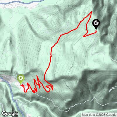
From Noriglio at 394 m (1293 ft) to Gelmi at 1305 m (4282 ft), this climb covers 13.2 km (8.2 mi) and gains 943 m (3094 ft) at an average of 6.9%.
The average hides two different climbs. The first 8 km (5.0 mi) to Moietto average 6.6% and are steady, with every kilometer between 5.4% and 7.3%. After a short dip of about 2% past the Volano junction, the final 4.2 km (2.6 mi) average 9.6% with almost no relief.
That last section is where all the hard numbers live: the steepest kilometer averages 11.3%, the steepest 2 km (1.2 mi) 10.8%, and the steepest short ramp hits 12.7%.
Roadway: Paved to the finish at Gelmi. The lower half from Noriglio to Moietto is the better road, with smooth asphalt up to around 900 m (2950 ft). Above the Volano junction the surface gets noticeably rougher, and the upper hairpins are often dirty, with stones and rubble washed onto the road - take the descent slowly.
Traffic: Light. Below Moietto you'll share the road with local traffic in Noriglio and the hamlets above it. Above the Volano junction the road is a dead end serving Gelmi and the trailheads for Monte Finonchio, so the only cars belong to locals and hikers.
Parking: Noriglio is a residential frazione with little room for cars, so the simplest option is to park in Rovereto - the station on the Verona-Brennero railway makes an easy meeting point - and ride the few kilometers up to the start. At the top, a small hikers' parking area sits at the end of the road at Gelmi.
Gear: The first 8 km (5.0 mi) are compact-crankset territory, but the final 4.2 km (2.6 mi) at 9.6% call for a 32- or 34-tooth low cog. Tires of 28 mm or wider make the rough, stony upper road more comfortable. If you plan to walk on to the summit, bring shoes you can hike in.
Provisions: Stock up in Rovereto before you start - there are no shops on the upper road, though there's a spring at the Moietto junction. Rifugio Fratelli Filzi serves food and drink daily from about 20 June to 20 September and on fine-weather weekends the rest of the year, but it's a hike, not a ride, from the end of the road.
Before heading out on any cycling adventure check out our Things to Bring on a Cycling Trip and use our interactive check list to ensure you don't forget anything.
Rovereto is one of the best small-city bases in Trentino. The Mart, the Museum of Modern and Contemporary Art of Trento and Rovereto, is one of Italy's major modern art museums. The Museo Storico Italiano della Guerra fills Rovereto's castle with the story of the First World War on this front. And every evening on the hill of Miravalle, the Campana dei Caduti - Maria Dolens, one of the largest ringing bells in the world, cast from the bronze of wartime cannons - tolls 100 times for the fallen of all wars.
If you walk on from Gelmi to the Rifugio Fratelli Filzi, you'll find a hut first opened in 1930, destroyed in the Second World War and rebuilt in 1957, named for Fabio and Fausto Filzi, two brothers from Trentino who died in the Great War. The meadows on top were once the hay reserve for Volano, Noriglio, Terragnolo and Folgaria, and on the far side an old military road drops to Serrada on the Folgaria plateau.
Rovereto sits in the middle of a dense cluster of climbs - Passo Bordala, Passo di Santa Barbara, Scanuppia and Sega di Ala are all close by. See other climbs nearby, or build a custom route from here, with our Routes in the Area tool.
ROUTE MAP
MEMBER RATING
CURRENT WEATHER
PJAMM TRIPS ADVENTURE STARTER BUNDLES
Check out PJAMM Adventure's prepackaged (self-guided) cycling trips. They will help you plan, document and conquer your next adventure.
NEARBY CLIMBS (0) RADIAL PROXIMITY
FROM No Climbs Found
MEMBER REVIEWS & COMMENTS
Let us know what you thought of this climb. Signup for our FREE membership to write a review or post a comment.
Already have an account?
LOG IN HERE
