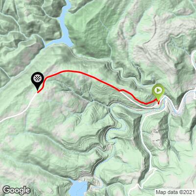
9.7
PDI
5.5 mi
DISTANCE
1,764 ft
GAINED
5.8 %
AVG. GRADE
FULL CLIMB STATS
Page Contributor(s): Nigel Brockton (Dr. BulletSki) Fairfax, VA, USA
INTRO
"The east side of Route 135 starts out moderate but once out of the small town of Bloomington, MD you encounter stout grade for the next 1.5 miles. A moderate mile follows and then a short descent appears. Climbing resumes over moderate grade until a flat which leads to one more stretch of shallow climbing up to climb end at the giant warning signs that alert drivers of the downhill to come. The descent of the east side of Route 135 is pretty quick." (This quote provided with the approval of John Summerson from his book, The Complete Guide to Climbing (by Bike), 2nd Edition, pg. 90.)
PLAN YOUR ROUTE
See more details and tools regarding this climb's grade via our interactive Profile Tool.
Information Not Available
If you have any information regarding this climb, we'd like to hear from you. Click the CONTRIBUTE button to share your thoughts with us.
Information Not Available
If you have any information regarding this climb, we'd like to hear from you. Click the CONTRIBUTE button to share your thoughts with us.
Before heading out on any cycling adventure check out our Things to Bring on a Cycling Trip and use our interactive check list to ensure you don't forget anything.
Information Not Available
If you have any information regarding this climb, we'd like to hear from you. Click the CONTRIBUTE button to share your thoughts with us.
ROUTE MAP
MEMBER RATING
CURRENT WEATHER
PJAMM TRIPS ADVENTURE STARTER BUNDLES
Check out PJAMM Adventure's prepackaged (self-guided) cycling trips. They will help you plan, document and conquer your next adventure.
NEARBY CLIMBS (0) RADIAL PROXIMITY
FROM No Climbs Found
MEMBER REVIEWS & COMMENTS
Let us know what you thought of this climb. Signup for our FREE membership to write a review or post a comment.
Already have an account?
LOG IN HERE
msmendis
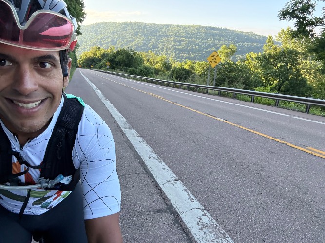
Hit this mid week in the morning. The traffic wasn’t bad and there’s a big enough shoulder to feel comfortable. The grade is relatively steady and the road is very straight so it’s easy to settle into a zone. I came down Savage River road to access it. Amazing and beautiful descent.
DustinStory
A long (for MD) climb with plenty of relief gradients. The shoulder is awesome and the road was perfectly smooth. Very little traffic on top of that. The road feels extremely straight, and the views don't vary much.
I followed this up descending Kitzmiller, up to Elk Garden and back. Then down Swanton/Spring Lick/Savage River Rd which was a GLORIOUS descent along the river. 10/10 recommend looping down that way. My ride got 3 of the Maryland top 10 climbs (and a WV) done, which certainly makes this worth the drive.
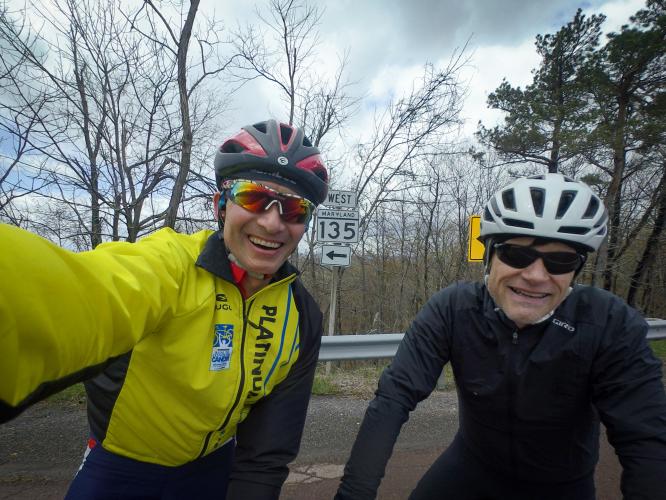
DrBullet


We started this climb into an horrendous headwind but at least in sunshine...but it quickly turned to cold rain. The lower third starts fairly gradually then steepens. There is a decent shoulder and traffic was not a problem despite our extremely slow progress. I wish I had paid more attention to the profile tool because I was really not certain when the climb was finished (although it turned out that my Garmin did know all along!). The views may be better on a nicer day but I would not call this part of our route "scenic"...although it does lead to more scenic roads if you make a loop of it. The middle third feels like it should deliver you to the top and I kept looking around wondering how there could possibly be another ~600ft of elevation gain when there didn't seem to be any higher ground! However, the final "summit" is only reach after ~1mile of flat and a final 1/3mile ramp. Without the wind, this would not have been too bad; against the wind and rain, it was a soggy grind.