6
PDI
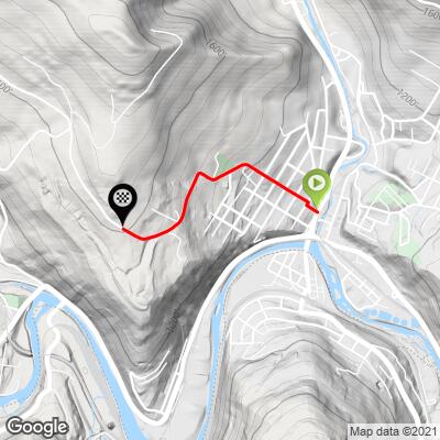
1.1 mi
DISTANCE
663 ft
GAINED
11.7 %
AVG. GRADE
FULL CLIMB STATS
Page Contributor(s): Dan Razum, San Jose, CA
INTRO
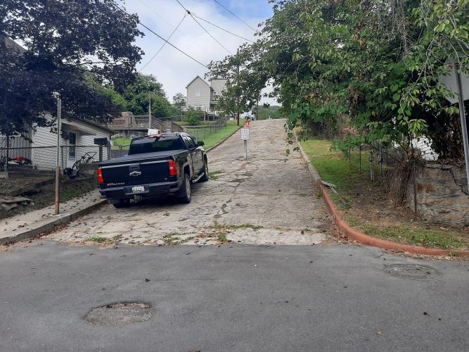
This 1.1 mile bike climb is located in MD, USA. The average gradient is 11.7% and there is a total elevation gain of 663 ft, finishing at 1,608 ft.
Use the profile tool, route map, and weather forecast to conquer this cycling climb.
Use the profile tool, route map, and weather forecast to conquer this cycling climb.
PLAN YOUR ROUTE
See more details and tools regarding this climb's grade via our interactive Profile Tool.
Information Not Available
If you have any information regarding this climb, we'd like to hear from you. Click the CONTRIBUTE button to share your thoughts with us.
Information Not Available
If you have any information regarding this climb, we'd like to hear from you. Click the CONTRIBUTE button to share your thoughts with us.
Before heading out on any cycling adventure check out our Things to Bring on a Cycling Trip and use our interactive check list to ensure you don't forget anything.
Information Not Available
If you have any information regarding this climb, we'd like to hear from you. Click the CONTRIBUTE button to share your thoughts with us.
ROUTE MAP
MEMBER RATING
CURRENT WEATHER
PJAMM TRIPS ADVENTURE STARTER BUNDLES
Check out PJAMM Adventure's prepackaged (self-guided) cycling trips. They will help you plan, document and conquer your next adventure.
NEARBY CLIMBS (0) RADIAL PROXIMITY
FROM No Climbs Found
MEMBER REVIEWS & COMMENTS
Let us know what you thought of this climb. Signup for our FREE membership to write a review or post a comment.
Already have an account?
LOG IN HERE
DustinStory
The first quarter mile is certainly an experience! Make sure you get a bit of a warmup in before you hit this one.
At the top of the closed block (broken concrete in the photo) there is now a guard rail and a blacktop curb on the right hand side. I had to use a foot to get over this, but if you swing into it it might be rideable. And then it doesn't stop there, with the road continuing up the mountain, which is a fun addition. A must-ride if you're in town.
chblue321
The tough part of the climb is the Westernport Wall. A section of crumbling pavement that hits up to 25% and is closed to vehicular traffic. This section is on the Savageman Tri race, and completing the hill on your pedals earns you a brick in the roadway.