Black Mountain Bike Climb - PJAMM Cycling

10
PDI
5.3 mi
DISTANCE
1,734 ft
GAINED
6.2 %
AVG. GRADE

FULL CLIMB STATS

Page Contributor(s): Dan Razum, Campbell, CA, USA.

INTRO

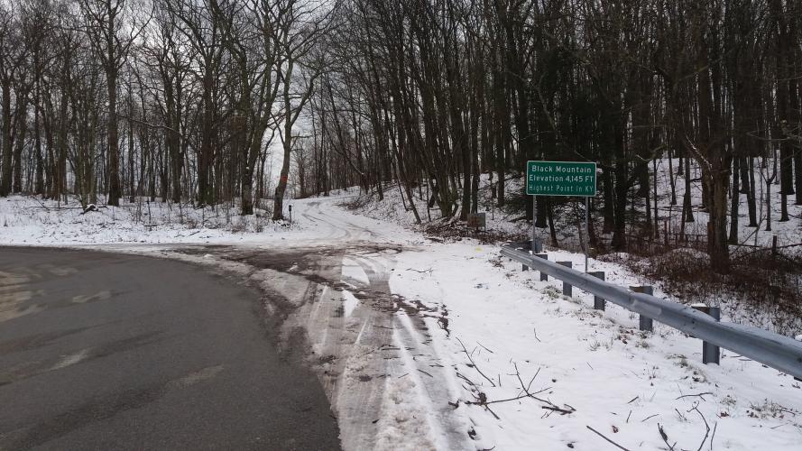
Cycling Black Mountain from the Kentucky side.

See more details and tools regarding this climb's grade via our interactive Profile Tool.
Information Not Available

If you have any information regarding this climb, we'd like to hear from you. Click the CONTRIBUTE button to share your thoughts with us.

Information Not Available

If you have any information regarding this climb, we'd like to hear from you. Click the CONTRIBUTE button to share your thoughts with us.

Before heading out on any cycling adventure check out our Things to Bring on a Cycling Trip and use our interactive check list to ensure you don't forget anything.
Information Not Available

If you have any information regarding this climb, we'd like to hear from you. Click the CONTRIBUTE button to share your thoughts with us.

ROUTE MAP

MEMBER RATING

Not Yet Rated
-
Road
-
Traffic
-
Scenery

CURRENT WEATHER

PJAMM TRIPS ADVENTURE STARTER BUNDLES

Check out PJAMM Adventure's prepackaged (self-guided) cycling trips. They will help you plan, document and conquer your next adventure.
ALL TRIPS
Browse all of our prepackaged trips and find your next adventure!
Smoky Mountain National Park
United States (NC,TN)
17 ROUTES
31 POIs
ROUTE STATS (TOTAL)
181.8
mi
DISTANCE
34,253
ft
ELEV. GAIN
The Blue Ridge Parkway (North)
United States (NC,TN,VA)
38 ROUTES
70 POIs
ROUTE STATS (TOTAL)
716.5
mi
DISTANCE
75,697
ft
ELEV. GAIN
The Blue Ridge Parkway (South)
United States (NC,TN,VA)
30 ROUTES
63 POIs
ROUTE STATS (TOTAL)
690.7
mi
DISTANCE
74,180
ft
ELEV. GAIN

NEARBY CLIMBS (0) RADIAL PROXIMITY

FROM
No Climbs Found

MEMBER REVIEWS & COMMENTS

Let us know what you thought of this climb. Signup for our FREE membership to write a review or post a comment.
Already have an account?
ROUTE MAP
PROFILE TOOL
Route Data
S.G. (%)
hide
Segment Data
hide
CLIMB SUMMARY

Climb Summary Hwy 160 (Black Mt)


Climb summary by PJAMM’s Dan Razum, Campbell, CA, USA.

The climb starts about a mile past Lynch, KY.


Start

The road is 2 lane, without a shoulder but there isn't much traffic, so it feels safe.


Black Mountain 5 mile up.

 The surface is decent, with a few rough patches. The road surface is poorer than on the Virginia side of rt 160, but it isn't too bad. Most of the curves aren't too sharp so the descent isn't too  technical.

We start off climbing through a thick forest but the trees start to thin out fairly quickly and we can see the

adjacent mountains and valley in between.

The slope is fairly steady, there aren't any bad steep sections. We can see the peak in the background fairly early in the climb, so we can gauge the effort to reach our target. Around mid way up we can see a long stretch of the road in front of us which makes it easy to see and hear any traffic long before it reaches us.

There are views at various points along the climb but they are limited to the nearby mountain and valley, we

don't really get a wide view of the distant Kentucky landscape. The scenery is still interesting though, and

shows the scale of the mountain. When we reach the top there is a parking area with wide views of the Virginia

side of the mountain.