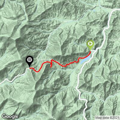
6.3
PDI
3 mi
DISTANCE
1,038 ft
GAINED
6.7 %
AVG. GRADE
FULL CLIMB STATS
INTRO
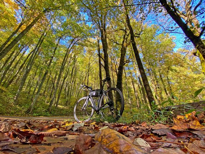
This climb is part of Georgia’s Six Gap Century, and is entirely within Georgia’s revered Vogel State Park (233 acres, established 1931, one of the two oldest Georgia state parks).
PLAN YOUR ROUTE
Average grade is 6.7% - gain 1,037' with 0 descent. 11% of the climb is at 0-5% and 89% is at 5-10%. The steepest quarter-mile is 8%.
See more details and tools regarding this climb's grade via the “Profile Tool” button.
Roadway: Two lane road in good shape with a double yellow center line and no shoulder.
Traffic: There is mild traffic on this rural route.
Parking: Park on the right side of the road just before the start of the climb (Map; Street View).
Provisions: The closest place to good food and water is at Blood Mountain Cabins & Country Store 3.5 miles south (Map).
Before heading out on any cycling adventure check out our Things to Bring on a Cycling Trip and use our interactive check list to ensure you don't forget anything.
A very fun out and back is to include Wolfpen Gap West, five miles gaining 1,020' (Map). Wolfpen Gap is one of the gaps included in the 103.8 mile/11,230 vertical feet Six Gap Century (including Neels Gap, Hogpen Gap, Unicoi Gap, Jack’s Gap, Wolfpen Gap, and Woody Gap). A route map of the Six Gap Century can be found here.
Use the “Routes in Area” button on the menu bar to see other bike climbs in this area.
ROUTE MAP
MEMBER RATING
CURRENT WEATHER
PJAMM TRIPS ADVENTURE STARTER BUNDLES
Check out PJAMM Adventure's prepackaged (self-guided) cycling trips. They will help you plan, document and conquer your next adventure.
NEARBY CLIMBS (0) RADIAL PROXIMITY
FROM No Climbs Found
MEMBER REVIEWS & COMMENTS
Let us know what you thought of this climb. Signup for our FREE membership to write a review or post a comment.
Already have an account?
LOG IN HERE