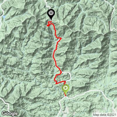
Neel Gap South Bike Climb - PJAMM Cycling

1.8
FIETS
8.1 mi
DISTANCE
1,823 ft
GAINED
3.7 %
AVG. GRADE

FULL CLIMB STATS

INTRO

This is a fairly tame climb on a fairly busy state highway. The steepest half-mile segment reaches only 3.6% and is easily manageable. If you only have time for a couple of the gaps, we’d recommend Hogpen and Wolfpen long before Neel Gap. We include this page primarily for those assessing the gaps included in the annual Six Gap ride summarized in more detail below.
Average grade is 3.6% (4.3% climb only) and the bulk of the climb is at 0-10%, with 38% at 0-5% and 51% at 5-10%.  The steepest quarter-mile is 6.8% and steepest mile 6.2%.

See more details and tools regarding this climb's grade via the “Profile Tool” button.
Roadway:  Two lane highway in good condition with a narrow shoulder most of the climb.

Traffic:  Mild to mild-moderate. 

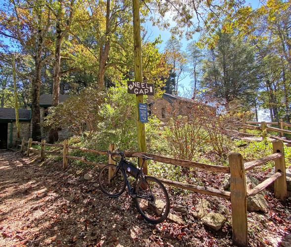
Parking:  Either at the top and ride down to the bottom and start, or ask to park at Riverside Tavern at the start of the climb (MapStreet View). 
Provisions:  Turner's Corner General Store 3/10ths of a mile west on Highway 19 (Map).
Before heading out on any cycling adventure check out our Things to Bring on a Cycling Trip and use our interactive check list to ensure you don't forget anything.
Consider doing an out and back for both sides of Neel Gap - 22 miles with 2,753' gained (Map). 

Neel Gap is one of the gaps included in the 103.8 mile/11,230 vertical feet Six Gap Century (Neel Gap, Hogpen Gap, Unicoi Gap, Jack’s Gap, Wolfpen Gap, and Woody Gap). A route map of the Six Gap Century can be found here.

Use the “Routes in Area” button on the menu bar to see other bike climbs in this area. 

ROUTE MAP

MEMBER RATING

Difficulty: Moderate
5
Road
3
Traffic
3
Scenery

CURRENT WEATHER

PJAMM TRIPS ADVENTURE STARTER BUNDLES

Check out PJAMM Adventure's prepackaged (self-guided) cycling trips. They will help you plan, document and conquer your next adventure.
ALL TRIPS
Browse all of our prepackaged trips and find your next adventure!
Smoky Mountain National Park
United States (NC,TN)
17 ROUTES
31 POIs
ROUTE STATS (TOTAL)
181.8
mi
DISTANCE
34,253
ft
ELEV. GAIN

NEARBY CLIMBS (0) RADIAL PROXIMITY

FROM
No Climbs Found

MEMBER REVIEWS & COMMENTS

Let us know what you thought of this climb. Signup for our FREE membership to write a review or post a comment.
Already have an account?

Oct 28, 2021
difficulty: Moderate
scenery: 3
traffic: 3
road: 5
Oct 28, 2021
scenery: 3
traffic: 3
road: 5
Steady gradients, perfect road conditions, nice store and views at the top. A nice road to climb, an even better one to descend.
ROUTE MAP
PROFILE TOOL
Route Data
S.G. (%)
hide
Segment Data
hide

Climb Profile Not Found
CLIMB SUMMARY

Cycling Neel Gap South, Georgia - bike parked next to wooden sign on post pointing to Neel Gap

Cycling Neel(s) Gap South, Georgia

Ride 7.9 miles gaining 1,616’ at 3.6% average grade. 

This is a fairly tame climb on a fairly busy state highway.  The steepest half mile segment reaches only 6.3% and is easily manageable.  If you only have time for a couple of the gaps, we’d recommend Hogpen and Wolfpen long before Neels Gap.  We include this page primarily for those assessing the gaps included in the annual Six Gap ride summarized in more detail below.

Cycling Neel Gap South, Georgia - photo collage, bike parked next to road sign for steep grade, two-lane highway road, dense foliage, PJAMM Cycling logo in corner

Neels Gap is located in the Blue Ridge Mountains.

Neels Gap is one of the gaps included in the 103.8 mile/11,230 vertical feet  Six Gap Century (Neels Gap, Hogpen Gap, Unicoi Gap, Jack’s Gap, Wolfpen Gap, and Woody Gap).  A route map of the Six Gap Century can be found here.

While this is not the most scenic or challenging of the six Gaps, it is the only one with an information/gift shop at the top.  The climb is on Blood Mountain and is within Vogel State Park in the Chattahoochee National Forest.  Vogel State Park was established in 1931, is the second oldest Georgia State Park, and consists of 233 acres.

Cycling Neel Gap South, Georgia - photo collage, Appalachian Trail crossing Neels Gap, informational signs and plaques, PJAMM Cycling logo in corner

The Appalachian Trail crosses Neels Gap.

Cycling Neel Gap South, Georgia - bike parked in front of historical sign for Blood Mountain

Blood Mountain is the highest peak of the Appalachian Trail in Georgia.

Cycling Neel Gap South, Georgia - inside and outside views of Neel Gap Information Center and Gift Shop, PJAMM Cycling logo in corner

Neel Gap Information Center and Gift Shop.