30.2
PDI
6.8 mi
DISTANCE
3,692 ft
GAINED
9.7 %
AVG. GRADE
FULL CLIMB STATS
INTRO
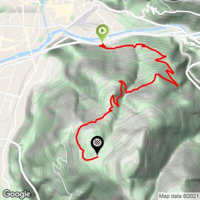
Colle bivio Seit takes its name from the Italian word for crossroads (bivio) - the pass where the climb's north and south approaches meet, about two-thirds of the way up. This north side, from the southeastern edge of Bolzano, climbs 6.8 miles at a 9.7% average grade, gaining 3,692 feet to a finish above 4,400 feet.
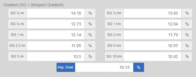
It's a narrow forest road nearly the entire way, without the wide-open views some Dolomite climbs offer - what you lose in scenery you gain in pure difficulty. The grade tips into double digits almost immediately, the steepest kilometer (beginning around km 1.5) averages 14.6%, and a short pitch near the base spikes past 24%.
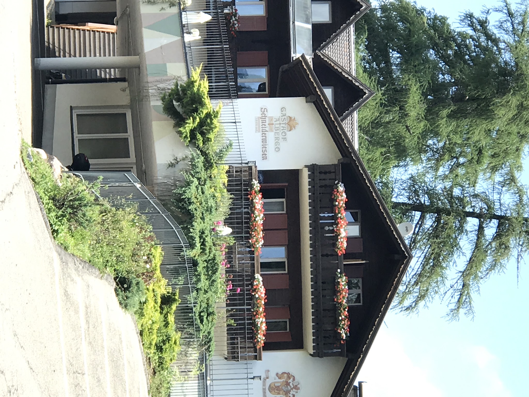
The road climbs past the mountain hamlet of Kohlern around km 8 - home to the historic Gasthof Kohlern, built in 1899 alongside what was Italy's first passenger cable car - before reaching the bivio itself near km 9.5, where this route meets the steeper south approach from San Giacomo. Push on past the crossroads for the final 0.8 miles to the true high point at Albergo Schneiderwiesen.
Kohlern is also a genuine local getaway for Bolzano residents, with a playground and hiking trails around the cable car's mountain station, so expect a bit more foot and local traffic near the hamlet than on the forested switchbacks below it.
PLAN YOUR ROUTE
 We've partnered with Sherpa-Map.com to bring you the best route planning tool. With a PRO Membership you can use this climb as a reference when creating your route.
 This climb averages 9.7% over its 6.8 miles, gaining 3,692 feet from 1,000 feet to a finish above 4,400 feet. The grade goes double-digit almost immediately - the steepest kilometer, beginning around km 1.5, averages 14.6%, and the steepest half-kilometer touches 17.4%, with a short pitch near the base spiking past 24%.
There's little relief anywhere on the lower two-thirds of the route. Grades ease somewhat in the final stretch near Kohlern and on toward the bivio itself.
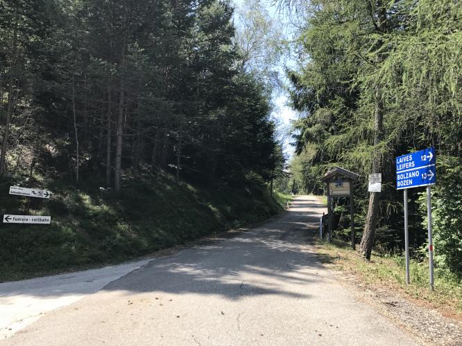
Roadway: Paved the entire way and narrow for nearly its full length, running through dense forest with few sightlines. This is a lightly-trafficked mountain road rather than a maintained tourist route, so expect some rougher patches, particularly on the steepest pitches near the base.
Traffic: Minimal for most of the route, which sees limited through-traffic given the narrow forest road and dead-end-style layout. Expect a bit more local and foot traffic near Kohlern itself, a popular day-trip destination for Bolzano residents with its own cable car, hiking trails, and mountain inn.
Parking: The climb starts at the southeastern edge of Bolzano on Via Campegno, at its "T" intersection with Via Ponte Campiglio, just off the A22 motorway - Map. Bolzano is a full city, so street parking is available near the base.
There's real relief partway up this one: Gasthof Kohlern, a four-star mountain inn dating to 1899, sits right at the hamlet of Kohlern around km 8, serving South Tyrolean and Italian dishes with a wine cellar of over 300 labels - a legitimate, well-regarded stop rather than a basic snack bar. Below Kohlern, though, the narrow forest road has nothing, so carry water and food to cover the first two-thirds of the climb.
Before heading out on any cycling adventure check out our Things to Bring on a Cycling Trip and use our interactive check list to ensure you don't forget anything.
Kohlern (Colle di Bolzano) has been a mountain retreat for Bolzano since the 1890s, when the valley's first cable car was built specifically to reach it - the Kohlerer Bahn still runs today, so riding up and gliding back down (or the reverse) is a real option if you'd rather not descend the way you came. The hamlet has a playground and marked hiking trails fanning out from the cable car's mountain station, worth a wander if you're not racing the clock.
Bolzano itself, the historic capital of Alto Adige/Sudtirol at the base, is worth a full day on its own - the old town's arcaded streets, the Otzi the Iceman museum, and a genuine mix of Italian and Austrian culture make it a great base for a South Tyrol cycling trip. See other climbs nearby with our Routes in the Area tool, since this region has one of Europe's densest concentrations of serious road climbs.
ROUTE MAP
MEMBER RATING
CURRENT WEATHER
PJAMM TRIPS ADVENTURE STARTER BUNDLES
Check out PJAMM Adventure's prepackaged (self-guided) cycling trips. They will help you plan, document and conquer your next adventure.
NEARBY CLIMBS (0) RADIAL PROXIMITY
FROM No Climbs Found
MEMBER REVIEWS & COMMENTS
Let us know what you thought of this climb. Signup for our FREE membership to write a review or post a comment.
Already have an account?
LOG IN HERE