![Cycling Bushcombe Lane, England sign for 25% grade]()
Cycling Bushcombe Lane, England
Ride 1.4 kilometers gaining 164 meters at 12% average grade.
This is Simon Warren’s (100 Greatest Cycling Climbs, UK) pick as #8 on England’s hardest bike climbs list. Though a brief climb at 1.4 kilometers, this climb averages 12% and has a 300-meter segment averaging an astonishing 20.5%.
![Cycling Bushcombe Lane, England photo collage; narrow, one-lane roadway lined with dense forestation and greenery, sign for 25% grade]()
The climb begins at the eastern edge of Bishop’s Cleeve and travels east towards Nottingham Hill.
July 2022 climb summary from PJAMM Cycling’s Brad Butterfield:
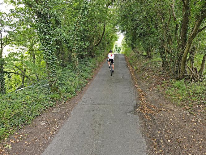
Bushcombe Lane begins in a very upscale neighborhood (to my eye at least). I parked on a sideroad just adjacent to our start point and had no verbal issues from the local residents. That said, a few gave me strange looks and didn’t seem too pleased I’d parked there. At the summit, there is a large dirt section that looks to be used by hikers, which is probably the safest bet for parking in the area. The double-digit gradients take you past very nice homes and you’ll likely contend with a few local cars driving the route. The road is narrow and nearly one lane soon into the climb on up to our summit, with very few pull-outs for passing. Take that descent with caution! Most of the corners are blind.
![Cycling Bushcombe Lane, England Aerial drone view of PJAMM Cyclist riding on Bushcombe lane next to road sign for 25% grade]()
Bishop’s Cleeve. Cleeve derives Old English word cliff or “steep hill” -- YES!
![Cycling Bushcombe Lane, England photo collage shows view of narrow roadway canopied by trees; ponies in field along roadside, aerial drone view of the top of the climb looking back down to Bishop's Cleeve]()
Photo upper left is a good representation of the narrow road.
Photo bottom right is an aerial view from the top of the climb looking back down to Bishop’s Cleeve.
Cycling Uphill writes of this monster:
“. . . Recently, I made a wish that I had a compact chainset. Today, a compact was really a necessity rather than just a nice desire. I was really struggling in my bottom gear of 39*25. My cadence and speed was so low, I could almost have done a track stand. (My speed got down to 2.9mph) – which is a cadence of about 23rpm. The hill climb pride, wouldn’t let me stop, so I kept pulling up the 25% slope. Though if the gradient and continued for much longer, I would have had to get off and walk! It was really hard work and a tremendous grovel to make it to the top. I was aching in parts of the body, I hadn’t felt since mid hill climb season. I was relieved the last section of the climb was a bit more manageable. . . .Previously I had assumed if you wanted a real leg breaker, you had to head to the Lake District of Yorkshire, but Bushcombe Lane is up there with Wrynose and Park Rash. I won’t be doing it on a winter hack with lowest gear of 39*25 in a rush” (Cycling Uphill).
![Cycling Bushcombe Lane, England climb finish at cattle guard]()
Finish at the cattle grid.

 We've partnered with Sherpa-Map.com to bring you the best route planning tool. With a PRO Membership you can use this climb as a reference when creating your route.

