Col de la Lombarde Bike Climb - PJAMM Cycling

31.3
PDI
12.4 mi
DISTANCE
4,654 ft
GAINED
7.1 %
AVG. GRADE

FULL CLIMB STATS

INTRO

A top French climb beginning in the lovely little ski town of Isola that winds its way through a canyon to, through a ski resort, up through wide open range land to the French/Italian border. 

See more details and tools regarding this climb's grade via our interactive Profile Tool.
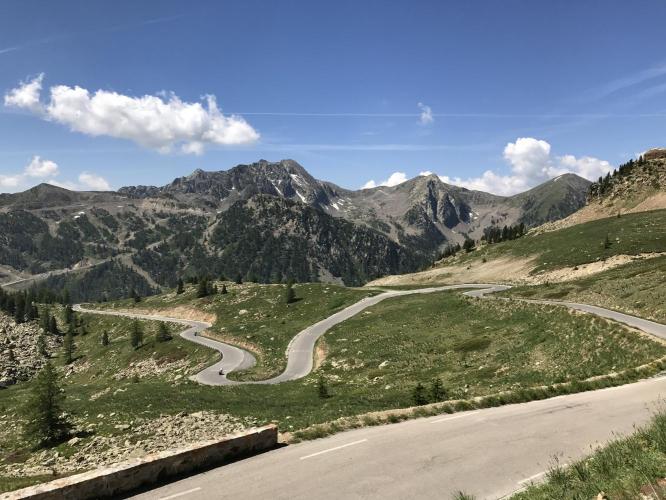
Climb through a long canyon, past a ski resort before breaking above tree line with spectacular views of surrounding mountains to the French/Italian border.
Information Not Available

If you have any information regarding this climb, we'd like to hear from you. Click the CONTRIBUTE button to share your thoughts with us.

Before heading out on any cycling adventure check out our Things to Bring on a Cycling Trip and use our interactive check list to ensure you don't forget anything.
Information Not Available

If you have any information regarding this climb, we'd like to hear from you. Click the CONTRIBUTE button to share your thoughts with us.

ROUTE MAP

MEMBER RATING

Not Yet Rated
-
Road
-
Traffic
-
Scenery

CURRENT WEATHER

PJAMM TRIPS ADVENTURE STARTER BUNDLES

Check out PJAMM Adventure's prepackaged (self-guided) cycling trips. They will help you plan, document and conquer your next adventure.
ALL TRIPS
Browse all of our prepackaged trips and find your next adventure!

NEARBY CLIMBS (0) RADIAL PROXIMITY

FROM
No Climbs Found

MEMBER REVIEWS & COMMENTS

Let us know what you thought of this climb. Signup for our FREE membership to write a review or post a comment.
Already have an account?
ROUTE MAP
PROFILE TOOL
Route Data
S.G. (%)
hide
Segment Data
hide
CLIMB SUMMARY

Climb Summary

A top French climb beginning in the lovely little ski town of Isola that winds its way through a canyon to, through a ski resort, up through wide open range land to the French/Italian border.

IMG_0377.JPG

Start in the quaint Ski town of Isola

     IMG_0384.JPG

Ride through deep canyon on the way to Isola 2000 Ski Resort (below)

IMG_7029.JPG 

    IMG_7141.JPG


     IMG_0616.JPG

IMG_7113.JPG   

  Above treeline

  IMG_7104.JPG


  The Col

IMG_7122.JPG

     IMG_7120.JPG


IMG_3013.JPG

The climb is manageable, but is not a slouch at 7.1% average grade for a healthy 12.4 miles.  The steepest mile is 9.3% and there is an 11% ¼ mile stretch.  This is a fun climb that is worth your while if you are in the Nice and southeastern area of France.  This is also a high hairpin zone with roughly 42 of those beauties on the way to the Italian border.

Steepest kilometer begins at 600 m (11.64%)