![Cycling Dunkery Beacon, UK Cycling Dunkery Beacon, UK - road sign for Dunkery Beacon and Whedon Cross, large trees and ferns near sign, Simon Warren's 100 Greatest Cycling Climbs #5 logo in corner]()
Cycling Dunkery Beacon, England
Ride two miles 1,074’ at 10.4% average grade.
This is a very scenic and quite challenging climb, ranked as the sixth hardest in England by Simon Warren.
![Cycling Dunkery Beacon, England photo collage shows white street signs for Cloutsham, Dunkery Beacon, Horner Parlock, large stone monument]()
In the far south-western farm lands of England lies the Dunkery Beacon climb. The climb starts among a narrow network of farming and residential roads. I recommend driving up the climb and using one of the dirt lots or pull outs for parking as there are very few options at the base of the climb. The narrow steep road will likely be shared by hikers as there is an extensive network of trails that line the hillside. At the summit coordinates, there is a dirt path that ends at the Dunkery Beacon lookout point. It is about a mile in length and quite rocky - but rideable on a standard road bike.
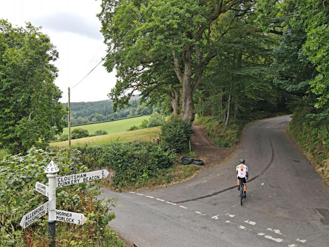
![Cycling Dunkery Beacon, England photo collage shows PJAMM Cyclist at climb's start, intersection; street signs read Cloutsham, Dunkery Beacon, Luccombe, Minehead]()
![Cycling Dunkery Beacon, UK Cycling Dunkery Beacon, UK - photo collage, dense tree border and coverage along roadside, very tall and lush green trees]()
Tree border and cover the first 1.4 kilometers of the climb.
![Cycling Dunkery Beacon, England photo collage shows PJAMM Cyclist riding on densely forested narrow country road]()
The first third of this climb we are surrounded by tree cover. For the last two-thirds of the ride we have wide open views, including some scenic looks back to the north of Bristol Channel.
![Cycling Dunkery Beacon, England photo collage shows views of English countryside, purple heather blossoming in pastures]()
A gorgeous ride any time, but particularly when the heather is in bloom.
Simon Warren writes of this climb:
“This corner of Exmoor is hill-climbing heaven, with a plethora of nasty steep roads to grind up and fly down. It's hard to single out one climb that sets itself apart from all others, but the road heading away from Luccombe up to the Beacon is a beast,” (100 Greatest Cycling Climbs, A Road Cyclist’s Guide to Britain’s Hills, p. 23).
![Cycling Dunkery Beacon, England bike parked in grass on roadside at climb's finish, looking down over Bristol Channel]()
Finish with great views back to Bristol Channel.
DUNKERY HILL
![Cycling Dunkery Beacon, England bike parked on stone platform at base of stone monument, Dunkery Hill]()
![Cycling Dunkery Beacon, England photo collage shows how rough the gravel roadway is on the climb to Dunkery Beacon]()
It’s a rough ride but worth it.
From the finish, ride the rocky road 0.6 miles at 13% average grade to Dunkery Beacon.
![Cycling Dunkery Beacon, England photo collage shows bike parked at stone monument, Dunkery Beacon, National Trust plaque]()
“. . . Dunkery Hill was part of the "Royal Forest of Exmoor,” established by Henry II according to the late 13th-century Hundred Rolls. There has been some debate about the origin of the name "Dunkery" and its predecessors "Duncrey" and "Dunnecray.” Eilert Ekwall suggests that it comes from the Welsh din meaning ‘hillfort’ and creic or creag meaning ‘rock’” (Dunkery Hill).
![Cycling Dunkery Beacon, England]()
![]()
That’s a wrap!

 We've partnered with Sherpa-Map.com to bring you the best route planning tool. With a PRO Membership you can use this climb as a reference when creating your route.

