28.8
PDI
6.8 mi
DISTANCE
3,539 ft
GAINED
9.9 %
AVG. GRADE
FULL CLIMB STATS
INTRO
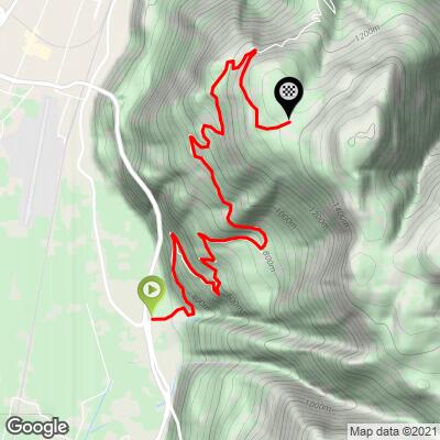
Colle bivio Seit is the crossroads (bivio in Italian) where two very different, very steep roads meet in the mountains south of Bolzano - this page covers the southern approach, which climbs out of San Giacomo (St. Jakob), a village at 240 m (787 ft) just off the SS12 state road in the Adige Valley. Over 10.9 km (6.8 mi) the route gains 1,079 m (3,539 ft) at a 9.9% average grade, finishing at 1,317 m (4,321 ft).
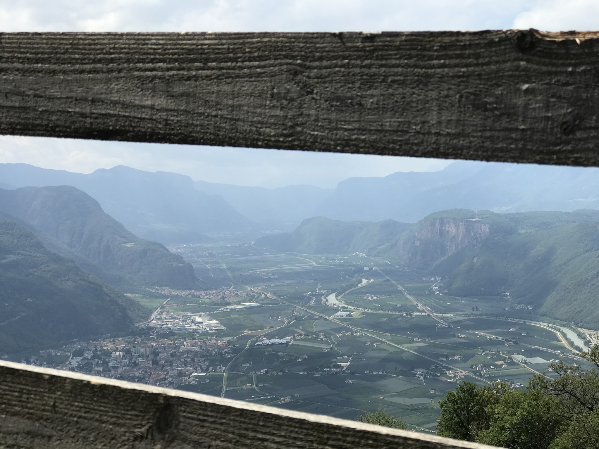
The grade goes into double digits within the first kilometer and rarely lets up - this is a forest road with a narrow profile and few flat stretches, so there is no coasting to recover. What it lacks in Dolomite-postcard views it makes up for with occasional clearings that open up toward Bolzano to the north and the Adige Valley toward Trento to the south.
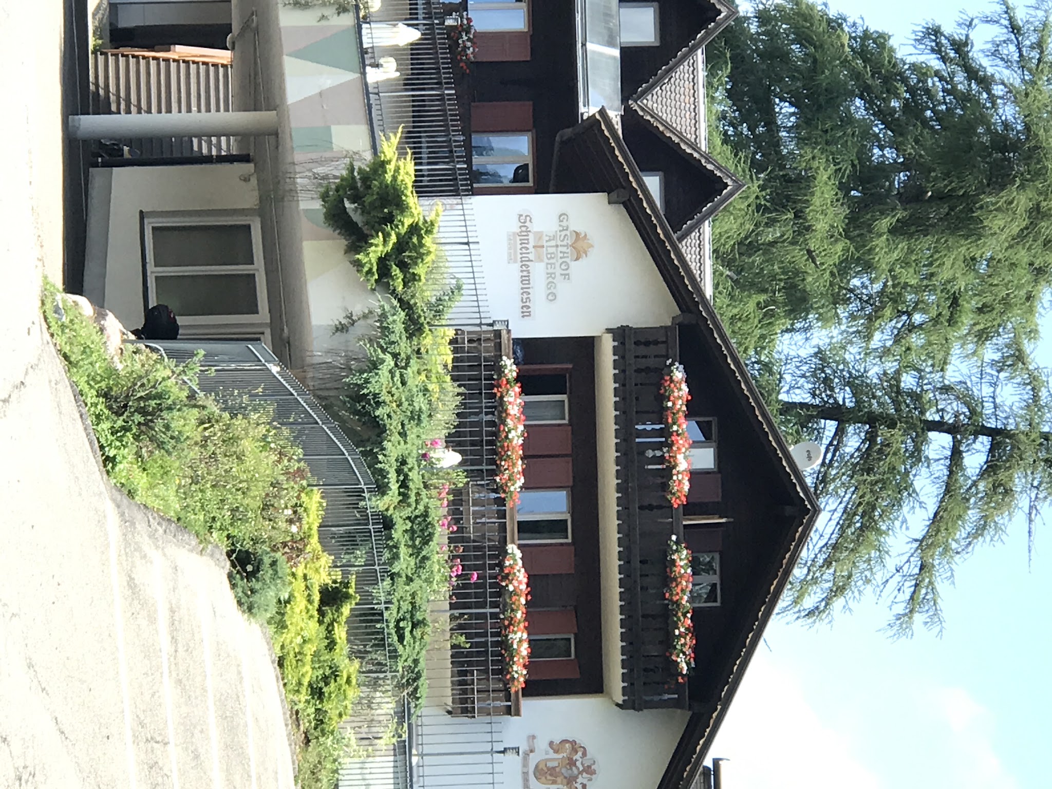
This route and the steeper northern approach out of Bolzano via Kohlern merge at the bivio crossroads with about 1.3 km (0.8 mi) still to go. From there, continue on to the true high point at Albergo Schneiderwiesen, on a final stretch that eases slightly to roughly 8.8%.
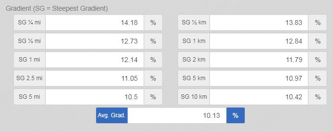
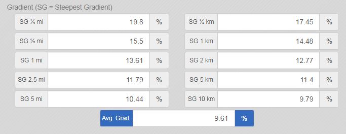
The steepest stretch on this side comes fairly late, around km 6.8, where the grade briefly touches close to 12.8% - worth knowing before you commit to the final push.
PLAN YOUR ROUTE
 We've partnered with Sherpa-Map.com to bring you the best route planning tool. With a PRO Membership you can use this climb as a reference when creating your route.
 From San Giacomo (240 m / 787 ft), this side of Colle bivio Seit climbs 10.9 km (6.8 mi) to 1,317 m (4,321 ft) at a 9.9% average grade - one of the steeper sustained climbs in the area. There is little relief anywhere on the route: the grade sits in double digits from close to the start, and the steepest kilometer comes around km 6.8, averaging close to 12.8%. The final 1.3 km (0.8 mi) past the bivio crossroads to Albergo Schneiderwiesen eases slightly, averaging around 8.8%.
Roadway: Paved the entire way, this is a narrow forest road for nearly its full length with few sightlines - a lightly-used mountain lane rather than a maintained tourist route, so expect occasional rough pavement on the steepest pitches. It is a different physical road than the north approach out of Bolzano; the two only meet at the bivio crossroads near the top.
Traffic: Light. San Giacomo (St. Jakob) itself has seen through-traffic drop off since the Laives road tunnel opened, and the climb, which dead-ends at the bivio and Albergo Schneiderwiesen, carries little beyond local and recreational traffic.
Parking: The climb starts at San Giacomo's intersection of Via Maso Renner and the SS12 state road, a village on the southeastern edge of the Bolzano/Laives area. Roadside parking is available near the village center at the base.
Gear: Compact or triple gearing is close to mandatory here - the grade is in double digits almost immediately and stays there for most of the route, with the steepest stretch, around km 6.8, touching close to 12.8%.
Provisions: San Giacomo has a few small shops and cafes at the base, but there is nothing along the climb itself until Albergo Schneiderwiesen at the very top - the same inn the north route from Bolzano also finishes at - so carry water and food for the full 10.9 km (6.8 mi).
Before heading out on any cycling adventure check out our Things to Bring on a Cycling Trip and use our interactive check list to ensure you don't forget anything.
San Giacomo (St. Jakob) is a quiet village belonging to Laives, just south of Bolzano along the Adige Valley - a good, low-key base if you would rather skip the city center. The Bolzano wine region (Strada del Vino) runs along this side of the valley, with vineyards and cellar-door tastings a short ride or drive from San Giacomo.
At the top, this route and the steeper north approach from Bolzano's Kohlern hamlet converge at Albergo Schneiderwiesen - see our Colle bivio Seit - Bolzano page for more on Kohlern's cable car and mountain inn if you are planning to link the two sides into a there-and-back or loop. Bolzano's old town, a short ride or drive north, is worth a full day on its own for anyone based in the area.
ROUTE MAP
MEMBER RATING
CURRENT WEATHER
PJAMM TRIPS ADVENTURE STARTER BUNDLES
Check out PJAMM Adventure's prepackaged (self-guided) cycling trips. They will help you plan, document and conquer your next adventure.
NEARBY CLIMBS (0) RADIAL PROXIMITY
FROM No Climbs Found
MEMBER REVIEWS & COMMENTS
Let us know what you thought of this climb. Signup for our FREE membership to write a review or post a comment.
Already have an account?
LOG IN HERE