
16
PDI
7.2 mi
DISTANCE
2,595 ft
GAINED
6.9 %
AVG. GRADE
FULL CLIMB STATS
INTRO
Halfway up, a barrier drops across the road at the Gaboń car park and the cars stop. From there to the top it's you, the forest and a strip of asphalt that hardly lets up - from km 7 to the end, no kilometer drops below 9%. That second half is the reason to come. From Gołkowice Górne it's 11.5 km (7.1 mi) and 791 m (2595 ft) of climbing at 6.9%, from 327 m (1073 ft) to 1118 m (3668 ft).
The first 6 km don't give much away. The road climbs gently through Skrudzina and Gaboń at 3-6%, past farmhouses and roadside shrines, and you'll be wondering where the hard part is. It arrives in the forest beyond the barrier: kilometer 7 is 8%, and from there it's 9.8%, 11.2%, 10% and 10.2%, with very few places to ease off. Find a cadence you can hold for half an hour, because there's hardly a spot on the upper road to recover.
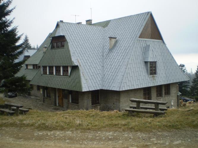
The asphalt ends near the transmitter tower. The PTTK shelter on Przehyba is a short ride on packed dirt beyond it, with a terrace out the back, a buffet inside and, on a clear day, a view that reaches the Pieniny and the Tatras. If you've timed it for lunch, that terrace is the place to sit.
PLAN YOUR ROUTE
 We've partnered with Sherpa-Map.com to bring you the best route planning tool. With a PRO Membership you can use this climb as a reference when creating your route.
The climb to Przehyba from Gołkowice runs 11.5 km (7.1 mi) from 327 m (1073 ft) to 1118 m (3668 ft), with 791 m (2595 ft) of climbing at an average of 6.9%.
km 0-3: 2.7 to 3.8% - through Gołkowice Górne and Skrudzina
km 3-6: 4.9 to 5.6% - through Gaboń to the barrier at about km 5
km 6-7: 8%
km 7-8: 9.8%
km 8-9: 11.2% - the steepest kilometer
km 9-10: 10%
km 10-11: 10.1%
km 11-11.5: about 9% to the end of the asphalt
The last 5.5 km (3.4 mi) average about 9.7%. The steepest kilometer averages 11.1%, the steepest half kilometer 11.5%, the steepest 2 km 10.9% and the steepest 5 km 10%.
Roadway: Paved to the end of our route near the Przehyba transmitter. The lower half through the villages is an ordinary local road; beyond the barrier at Gaboń (about km 5) it's a narrow forest road through the Poprad Landscape Park, closed to motor vehicles. Riders report the surface as mostly good, with only a few potholes. The last stretch to the shelter, past the end of the asphalt, is compacted dirt - rideable on a road bike if you go easy. The descent is long, steep and shaded, so check your brake pads before you start.
Traffic: Light through Gołkowice, Skrudzina and Gaboń, and next to nothing above the barrier - just the occasional forestry or service vehicle, walkers and other riders.
Parking: For the whole climb, park considerately in Gołkowice Górne near the start. To ride just the steep forest half, use the Gaboń car park at the barrier, about km 5 (map).
Gear: Five and a half kilometers at nearly 10% is the main event, so a compact with a 32 or 34 tooth largest cog is what most riders will want. The top is around 800 m (2600 ft) above the start and in the trees for most of the way down - bring a layer for a descent that keeps your hands on the brakes for a long time.
Provisions: Fill up in Stary Sącz or the shops in the villages below. Past the barrier at Gaboń, around km 5, there's nothing until the top, where the PTTK shelter on Przehyba serves hot meals from its buffet - easy to plan the climb around lunch.
Before heading out on any cycling adventure check out our Things to Bring on a Cycling Trip and use our interactive check list to ensure you don't forget anything.
Stary Sącz, 5 km down the road, is the place to stay and eat: a cobbled market square of low painted houses, and the Poor Clares convent founded by St. Kinga in the 13th century, still home to a community of nuns. It also sits on the VeloDunajec cycle route along the Dunajec valley, a flat, car-free way to spin the legs out the day after. Nowy Sącz, about 13 km away, has the bigger hotels, the station and the Sądecki ethnographic open-air museum.
The PTTK shelter on Przehyba has rooms, so you can make a night of it and ride down in the morning. The Radziejowa range runs on from here to Radziejowa, the highest point of the Beskid Sądecki, along the main ridge trail - on foot, not on a road bike. Our Przehyba - North page starts just down the road and shares most of this route.
ROUTE MAP

MEMBER RATING
CURRENT WEATHER
PJAMM TRIPS ADVENTURE STARTER BUNDLES
Check out PJAMM Adventure's prepackaged (self-guided) cycling trips. They will help you plan, document and conquer your next adventure.
NEARBY CLIMBS (0) RADIAL PROXIMITY
FROM No Climbs Found
MEMBER REVIEWS & COMMENTS
Let us know what you thought of this climb. Signup for our FREE membership to write a review or post a comment.
Already have an account?
LOG IN HERE
