
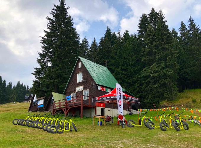
21.8
PDI
8.7 mi
DISTANCE
3,347 ft
GAINED
7.4 %
AVG. GRADE
FULL CLIMB STATS
Page Contributor(s): Ard Oostra, Montreux, Switzerland
INTRO
Martinske Hole (Martinské hole) is the big road climb above Slovakia's Turiec basin: 13.9 km (8.7 mi) from the railway town of Vrútky, gaining 1,020 m (3,347 ft) at a 7.3% average to finish at 1,414 m (4,640 ft) near the Martinky ski area in the Malá Fatra mountains. It ranks #804 on our list of the world's hardest climbs, and it climbs steadily from the first bend.
This is a steady grind rather than a climb with a single crux. The road leaves the valley behind and works its way up into forest on a narrowing ribbon of asphalt, with the steepest 2 km (1.2 mi) averaging 11.0%. Traffic is light and the mountain stays quiet outside ski season, but the surface gets rougher near the top, so take the descent carefully.
Current conditions are worth a look before you ride: in early August 2026 new signs went up on the ridge road above the lodges, limiting motor traffic beyond the designated parking areas to service vehicles only, with police doing spot checks.
PLAN YOUR ROUTE
 We've partnered with Sherpa-Map.com to bring you the best route planning tool. With a PRO Membership you can use this climb as a reference when creating your route.
 Martinske Hole averages 7.3% over 13.9 km (8.7 mi), and unlike many climbs of this length it hardly lets up. The steepest half kilometer (0.3 mi) averages 11.7%, the steepest full kilometer (0.6 mi) 11.3%, and the steepest 2 km (1.2 mi) 11.0%, so double-digit grades are not a brief spike here but a sustained section. Zoom out and the effort stays heavy: the steepest 5 km (3.1 mi) averages 8.6% and the steepest 10 km (6.2 mi) 8.0%, less than a point above the climb's overall average.
The practical takeaway is that pacing matters more than a single hard ramp. Expect to settle into a long, steady effort at 7-9% with a hard sustained push at 11%, and expect the road surface to get rougher toward the top.
Roadway: The climb is asphalt from Vrútky to the resort area, and the lower road is decent. Higher up the surface turns rougher, with cracked, deteriorated asphalt and stretches of old concrete-panel paving that shake a road bike, and past the hotels the road toward the Krížava transmitter is broken enough that it suits a gravel bike better. Riders describe the descent as the harder part, so take it carefully.
Traffic: Light. Once you leave Vrútky the road sees mostly local and resort traffic and other cyclists, with some walkers near the top where the road meets hiking trails. In early August 2026 new signs on the ridge road above the lodges banned regular cars and motorcycles beyond the designated parking areas (only vehicles serving the Krížava transmitter, the ski resort and Chata Javorina are allowed), and police have been doing spot checks.
Parking: Vrútky is a small railway-junction town of about 7,300 people, 3 km (1.9 mi) north of Martin. The bus stop, railway station and a parking lot sit together near the start, so you can either leave a car there or arrive by train and ride straight from the station.
Bring two full bottles and food: the climb is 13.9 km (8.7 mi) of mostly uninterrupted ascent, and the lodges near the top (Chata na Martinských holiach at about 1,250 m / 4,100 ft, and Chata Javorina) are the usual refreshment stops. A compact crankset with a wide-range cassette is worth having for the sustained 11% section. The finish sits near 1,414 m (4,640 ft), noticeably cooler than Vrútky at about 380 m (1,250 ft), so pack a light layer for the descent, and take care on the rough upper surface when braking.
Before heading out on any cycling adventure check out our Things to Bring on a Cycling Trip and use our interactive check list to ensure you don't forget anything.
Martin is the natural base for this climb: a Turiec-basin city with the Slovak Chamber Theatre, ethnographic museums, the Matica slovenská and the nearby castles of Blatnica and Sklabina, all good rest-day options. Above town, Winter Park Martinky sits between 1,150 m and 1,456 m (3,773-4,777 ft) and stays active in summer with hiking and mountain-biking trails.
For something different off the bike, Ferrata HZS, one of the oldest via ferrata routes in Slovakia, runs through the Martinské hole canyon about 0.8 km (0.5 mi) from the ski area, with a level B and a level C option and roughly four hours of climbing. Check its seasonal opening before you plan around it. Before you head up, check conditions at both the base and the ridge with our Weather tool.
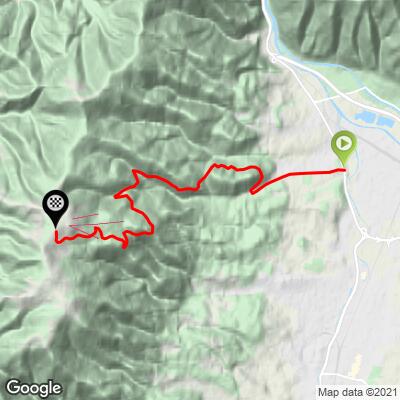
ROUTE MAP
MEMBER RATING
CURRENT WEATHER
PJAMM TRIPS ADVENTURE STARTER BUNDLES
Check out PJAMM Adventure's prepackaged (self-guided) cycling trips. They will help you plan, document and conquer your next adventure.
NEARBY CLIMBS (0) RADIAL PROXIMITY
FROM No Climbs Found
MEMBER REVIEWS & COMMENTS
Let us know what you thought of this climb. Signup for our FREE membership to write a review or post a comment.
Already have an account?
LOG IN HERE
