
27
PDI
10.2 mi
DISTANCE
4,051 ft
GAINED
7.6 %
AVG. GRADE
FULL CLIMB STATS
Page Contributor(s): Bryant Robbins, Palmer, AK, USA
INTRO
Vojak West climbs 16.4 km (10.2 mi) from Boljunsko Polje, a small village on the inland Istrian plateau, to Vojak - the 1,406 m (4,613 ft) high point of Mount Učka and the highest point on the entire Istrian peninsula. The average grade is 7.6% with 1,235 m (4,051 ft) of climbing, making it one of Croatia's toughest paved ascents.
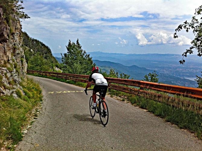
This is the quieter of Učka's two paved sides. The better-known route climbs from Ičići on the Kvarner coast and has occasionally hosted the "King of Učka" mountain race; this western approach instead rises from farmland and beech forest on the Istrian side, with noticeably less traffic throughout. After a moderate start, the road tips into its hardest section, where the steepest mile averages 12.1% and short ramps touch 14-15%. Along the way, riders pass the Josip II Fountain, a stone spring near 850 m elevation, before the road narrows for its final push to the junction with the road from Vela Učka and Poklon.
The summit is marked by a stone lookout tower built in 1911, standing beside a TV mast and radar station. On a clear day the view stretches across Croatia's Kvarner Gulf and its islands, and reportedly as far as Italy and Slovenia. The final kilometers of road below the tower are closed to private motor traffic, so cyclists share that last stretch mostly with hikers rather than cars.
PLAN YOUR ROUTE
 We've partnered with Sherpa-Map.com to bring you the best route planning tool. With a PRO Membership you can use this climb as a reference when creating your route.
 Vojak West climbs 16.4 km (10.2 mi) at an average grade of 7.6%, gaining 1,235 m (4,051 ft) from Boljunsko Polje (171 m / 562 ft) to the 1,406 m (4,613 ft) finish near the Vojak lookout tower. The opening kilometers are moderate before the climb's hardest stretch, where the steepest mile averages 12.1%, the steepest half-mile 13.0%, and the steepest 100 yards touches 14.4%. The final two kilometers, past the junction with the road from Poklon, ease back off as the route narrows toward the summit.
Roadway: The D500 and the signed Cesta za Vojak are paved the entire way from Boljunsko Polje to the summit. Rider reports as recent as mid-2026 describe good pavement throughout, including the narrower upper section near the Vela Učka junction. No closures have been reported on this side of the mountain; the road above Poklon is typically closed only by snow or ice in winter, so check current conditions before a late-season ride.
Traffic: Traffic is light for the entire climb. The road briefly passes near the A8 motorway's Lupoglav interchange at the base, then settles into quiet farm and forest roads with very little car traffic. The final kilometers below the summit are closed to private motor vehicles, so the last stretch to the tower is shared mainly with hikers rather than cars.
Parking: Boljunsko Polje is a small rural hamlet with no formal cyclist parking area; riders typically leave a car along the shoulder near the D500/Cesta za Vojak junction where the climb begins. There's no dedicated summit lot either - space near the tower is limited and shared with hikers arriving from the Poklon trailhead on the opposite side.
There are no provisions directly on the climb route itself, so plan to stock up before leaving the valley. Buffet Pizzeria Alba and Restoran Planik, both in Lupoglav a few kilometers from the start, are the closest options for a pre-ride meal, and Boljunska Konoba in nearby Boljun serves traditional Istrian fare.
About two-thirds of the way up, the Josip II Fountain near 850 m elevation is a reliable spot to refill a bottle with cold spring water. Restaurant Dopolavoro, near the Vela Učka junction close to the summit, is worth timing your ride around if it's open; otherwise, don't count on food or water at the top beyond an occasional seasonal souvenir stand near the tower.
Before heading out on any cycling adventure check out our Things to Bring on a Cycling Trip and use our interactive check list to ensure you don't forget anything.
Učka's two paved sides reach the same 1,406 m (4,613 ft) summit from opposite directions - this western climb from inland Istria, and a longer, more popular route from Ičići on the Kvarner coast.
If you're basing yourself in the area for more than a day, our Routes in the Area tool is worth checking for other climbs nearby, including the Ičići side and its connector from the Poklon saddle. Spring and fall bring the most comfortable temperatures for the exposed upper kilometers, while summer can run hot on the lower farmland before the forest offers shade. The Učka Nature Park's Poklon Visitor Centre, just below the summit on the Ičići side, is a useful stop for trail maps and current park conditions if you want to extend the trip with a hike.
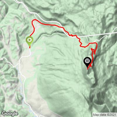
ROUTE MAP
MEMBER RATING
CURRENT WEATHER
PJAMM TRIPS ADVENTURE STARTER BUNDLES
Check out PJAMM Adventure's prepackaged (self-guided) cycling trips. They will help you plan, document and conquer your next adventure.
NEARBY CLIMBS (0) RADIAL PROXIMITY
FROM No Climbs Found
MEMBER REVIEWS & COMMENTS
Let us know what you thought of this climb. Signup for our FREE membership to write a review or post a comment.
Already have an account?
LOG IN HERE
