
25.8
PDI
9.7 mi
DISTANCE
3,862 ft
GAINED
7.5 %
AVG. GRADE
FULL CLIMB STATS
INTRO
Krvavec is the climb Tadej Pogačar calls home - 15.6 km (9.7 mi) from the village of Grad, near Cerklje na Gorenjskem, to Tiha dolina in the Krvavec ski area, gaining 1177 m (3,862 ft) at a 7.5% average grade from 427 m (1,401 ft) to 1592 m (5,223 ft). It currently ranks #506 in the world on our list.
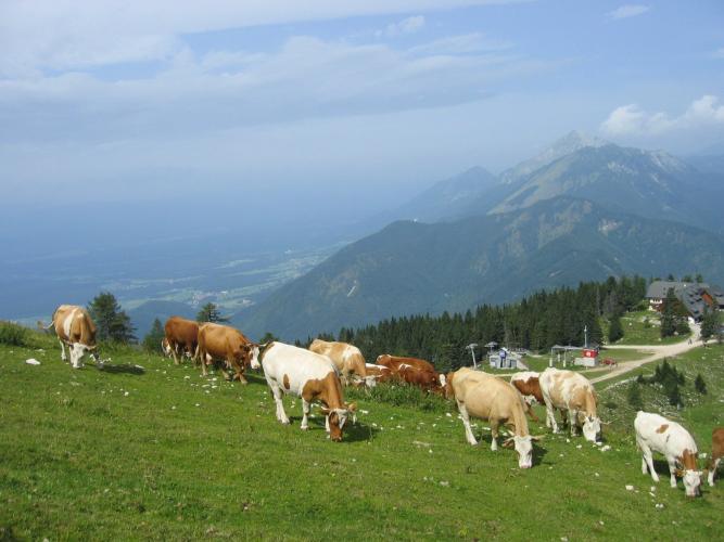
It is a genuinely hard climb. The steepest kilometer (12.0%) comes right away, the middle section through the scattered hilltop village of Ambrož pod Krvavcem holds close to 10% for several kilometers, and only the last few kilometers, across the high pastures of the Kamnik-Savinja Alps, give any relief. The views reach across the Ljubljana basin to the Julian Alps.
Pogačar took his first ever win here as a boy in 2009, and since 2025 he has hosted the Pogi Challenge on this road, giving a field of more than 1,000 amateurs a seven-minute head start before chasing them to the top - in both editions so far, the fastest amateur held him off. The Tour of Slovenia finished on Krvavec in 2024 (won by Pello Bilbao), and Primož Roglič beat Pogačar to the 2020 Slovenian road title on the lower half of this climb at Ambrož.
Heads-up for 2026: the top section above Planina Jezerca is under construction - see Roadway & Parking.
PLAN YOUR ROUTE
 We've partnered with Sherpa-Map.com to bring you the best route planning tool. With a PRO Membership you can use this climb as a reference when creating your route.
 The climb covers 15.6 km (9.7 mi) at an average of 7.5%, gaining 1,177 m (3,862 ft) from 427 m (1,401 ft) in Grad to 1,592 m (5,223 ft) at Tiha dolina. The steepest kilometer averages 12.0%, the steepest mile 11.7%, the steepest 2 km 10.7%, and the steepest 5 km 9.3%.
The opening 3 km (1.9 mi) average over 9%, with the second kilometer at 12%. Kilometer 4 is the only real breather, at barely 1%, before a run of big switchbacks.
From there it rarely lets up: kilometers 5 through 12 average about 8.8%, and the stretch from Ambrož pod Krvavcem (around km 8) to Planina Jezerca (around km 12, 1,420 m / 4,659 ft) averages 9.6% for 4 km (2.5 mi). The final 3.5 km (2.2 mi) through forest and open pasture ease to 3-5%.
Roadway: Paved the entire way on narrow local roads, climbing to Ambrož on the municipal road from Ravne to Planina Jezerca and continuing on the access road into the ski area. For 2026, the Municipality of Cerklje na Gorenjskem has two work zones on this route: alternating one-way traffic on the section just below Planina Jezerca through 31 December 2026 (work 7:00-17:00), and a full closure from the Planina Jezerca parking area to the upper gondola station through about 14 November 2026 while a sewer line is built. That upper section is open only from Saturday at 16:00 through Monday at 10:00 - on weekdays, plan to turn around at Planina Jezerca, and check the municipality's road closure notices at cerklje.si before you go.
Traffic: Light on weekdays. Winter ski traffic is heavy, and summer weekends bring hikers and visitors driving up to the pastures and mountain huts.
Parking: The Krvavec gondola valley station, signed from Grad just off the route, has a large free car park. There's more parking at Planina Jezerca.
Provisions: Cerklje na Gorenjskem, a couple of kilometers below the start, has shops and cafes, and Grad itself has a gostilna and a pizzeria near the start. On the climb, Ambrož pod Krvavcem has the Pr’ Ambružarju tourist farm, and the ski-area huts and hotels near the finish - including Dom na Krvavcu - serve food, but opening days vary outside the ski season, so carry what you need.
Gear: Bring a low gear - this climb averages 9-10% for long stretches, and the opening kilometers are the steepest. A 34x32 or lower is sensible for most riders. The finish sits near 1,600 m (5,249 ft), so pack a jacket for the descent even on a warm day in the valley.
Before heading out on any cycling adventure check out our Things to Bring on a Cycling Trip and use our interactive check list to ensure you don't forget anything.
Krvavec is the closest ski resort to Ljubljana, about 25 km (15.5 mi) away, and Ljubljana's Jože Pučnik Airport at Brnik sits in the same municipality as the start, making this one of the easiest serious climbs in Slovenia to reach straight off a flight.
Stop at the church of Saint Ambrose in Ambrož pod Krvavcem, the highest point of the village at 1,085 m (3,560 ft). The church is said to have been damaged in an Ottoman raid in 1471, and the village was known as Sveti Ambrož until 1955, when the postwar communist authorities stripped religious names from place names. Near the top, the ski pistes become grazing pastures in summer, and the RTV Slovenia transmitter on the 1,853 m (6,079 ft) summit of Krvavec is about an hour’s hike above the ski area.
If you want to test yourself against the locals, the Pogi Challenge runs on this road each year, and the long-running Kolesarski vzpon na Krvavec hill climb uses it too. At this altitude weather can turn quickly, so check current conditions at the top before you go with our Weather tool.
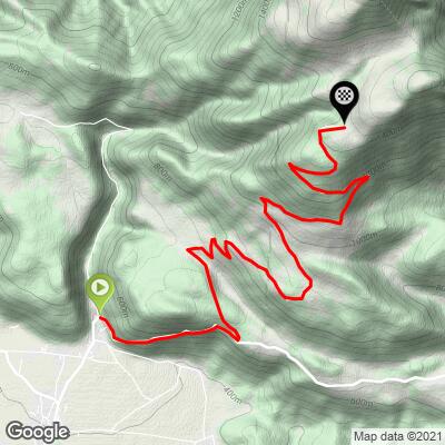
ROUTE MAP
MEMBER RATING
CURRENT WEATHER
PJAMM TRIPS ADVENTURE STARTER BUNDLES
Check out PJAMM Adventure's prepackaged (self-guided) cycling trips. They will help you plan, document and conquer your next adventure.
NEARBY CLIMBS (0) RADIAL PROXIMITY
FROM No Climbs Found
MEMBER REVIEWS & COMMENTS
Let us know what you thought of this climb. Signup for our FREE membership to write a review or post a comment.
Already have an account?
LOG IN HERE
