INTRO
PLAN YOUR ROUTE
 We've partnered with Sherpa-Map.com to bring you the best route planning tool. With a PRO Membership you can use this climb as a reference when creating your route.
 ROUTE MAP


 We've partnered with Sherpa-Map.com to bring you the best route planning tool. With a PRO Membership you can use this climb as a reference when creating your route.
Haytor Rocks at climb’s finish.
Haytor Vale is a rolling 5.4 kilometer climb that beginning just east of Bovey Tracey, Devon County, travelling through Haytor Vale, and ending at Haytor Rocks. As best we can tell, this Vale’s interesting name comes from the area of hay, as well as the word “tor,” which refers to the the rock formations in the area. A “tor” is a “large, free-standing rock outcrop that rises abruptly from the surrounding smooth and gentle slopes of rounded hill summit or ridge crest” (Tor).
“Haytor, also known as Haytor Rocks, Hay Tor, or occasionally Hey Tor, is a granite tor on the eastern edge of Dartmoor in the English county of Devon. It is at grid reference SX757770, near the village of Haytor Vale in the parish of Ilsington. There is an electoral ward with the same name. The population at the 2011 census is 2,862” (Haytor).
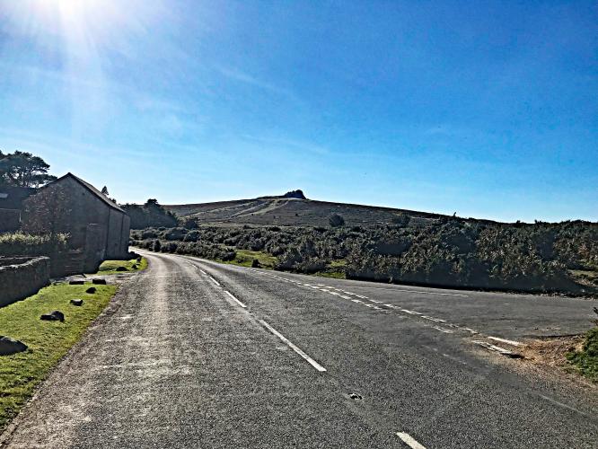
We ride through tree bordered roadway the first half of the climb, then into the open for the last 2 kilometers with the Haytor rocks in site. There is plenty of hiking to be done at the top. We saw no cyclists during our time on the hill, but many hikers enjoying the area.
This is a popular cycling area.
Haytor Vale hosted the British National Hill Climb Championships in 1979 (Jeff Williams) and 2019
Haytor Valel was the site of the 2019 British Hill Climb Championships
Won by Ed Laverack in 11:37
Photo: Twitter @edlaverack
Surrounded by trees for the first half of the climb.
This is what we’re playing for, and it’s worth it! Bring your hiking shoes (or 33mm+ tires - 👍).
The first half of the climb is in the trees, and as it opens up, a view of the rock formations on top of the hill will be your destination. If you want, you can hike to the top of the rocks.
This Southwestern England climb in Devon County is within the Dartmoor National Park (95,312 hectares / 235,520 acres) established in 1951 as a National Park of England.
Climb begins at the northeastern edge of Dartmoor National Park, established 1997 with 95,400 hectare (235,739 acres).
Road Cycling UK writes of this climb:
“Perhaps the most famous of the climbs we’re going to cover, thanks to its reputation as a recognised summit finish in the Tour if Britain, the climb of Haytor Vale is a 5.3km-long ascent that rolls its way from Bovey Tracey up to just aside the summit of Haytor hill. It’s rolling in profile, averaging an Alp-imitating six per cent with sections that peak at 12 percent along the B3387. You’ll start with a gradually increasing grade up to ten per cent for the first 1.5km, before a gentle easing.
It doesn’t last for long though as you round the ridge at 2.5km, hitting its 12 per cent peak, before returning to ten per cent ahead of a final flat section and a final rise up to 14 per cent for the last 500m blast.”
Cycling Uphill writes of the Haytor Vale cycling climb:
“Haytor Vale is a long exposed climb from the village of Bovey Tracey up to the top of Dartmoor. It is relatively sheltered for the first half, but then as you go through a couple of 12% corners it is open to the windswept Dartmoor moors – where you may either face a strong headwind or (if you are lucky) a rarer Easterly wind.
Haytor Vale is a long exposed climb from the village of Bovey Tracey up to the top of Dartmoor. It is relatively sheltered for the first half, but then as you go through a couple of 12% corners it is open to the windswept Dartmoor moors – where you may either face a strong headwind or (if you are lucky) a rarer Easterly wind.
There is a variable gradient throughout the climb – some flatter sections for recovery. There is a final kick for the line with a finish at 10%.
The Tour of Britain has often had a stage which finishes on Haytor Vale. In 2013 British rider Adam Yates won stage 6 on top of Haytor Vale.”
Thank you Federico!!