![Cycling The Road to Hell, Wales Cycling The Road to Hell - aerial view of straight portion of two lane road]()
Cycling the Road to Hell, Wales.
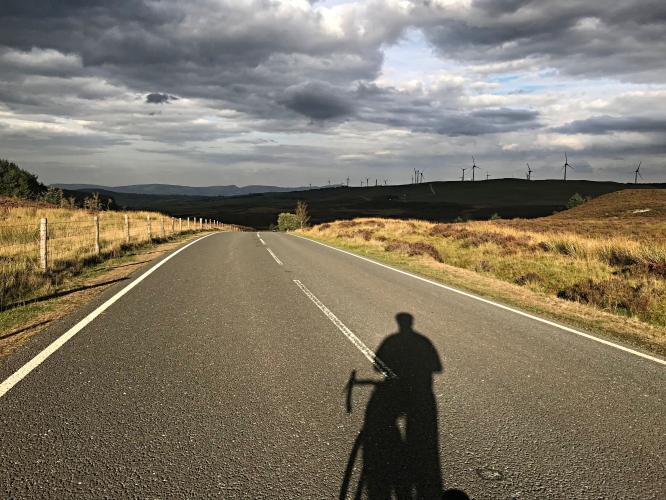
![Cycling The Road to Hell, Wales Cycling The Road to Hell, Wales - intense grey cloud formations along a winding portion of road]()
Of the Top 100 British Climbs, this had the best cloud formations.
We wondered why this climb is coined “The Road to Hell” -- and frankly, we still aren’t quite sure. There are no signs nor any indication of lucifer, hell, an inferno, underworld activity, spirits or otherwise - nothing. The name is really quite a head scratcher, as the climb is quite wonderful.
![]()
![Cycling The Road to Hell, Wales Cycling The Road to Hell, Wales - PJAMM cycling jersey draped over bike parked along roadway, stretches of two-lane roadway, grey clouds]()
From our internet research, as best we can tell, this climb was named The Road to Hell by the organizers of the Dave Lloyd Challenge (an event apparently run several times between 2000 and 2010, but no longer). The closest Simon Warren comes to explaining the name is at the end of his climb summary where he writes, “bending gently right, just one more strength-sapping push delivers you into the hands of the Devil.” (100 Greatest Cycling Climbs, Britain, p. 152, emphasis added).
We can attest that it is as windy as hell at the top . . . perhaps that explains it?
![Cycling The Road to Hell, Wales Cycling The Road to Hell, Wales - signs for "Brenig Wind Farm" - Natual Energy Powering Nature, PJAMM Cycling logo in corner]()
. . . the wind farm at the top of the climb.
This is one of the longest of the 100 Greatest Cycling Climbs, Britain at 11 km (the longest climb on that list is 11.3 km). The 11 km of this climb average only 3.2%, with the steepest stretch being 570 meters at 14.4% -- but even that is mitigated by a 1.5 km -4.1% descent immediately following it.
![Cycling The Road to Hell, Wales Cycling The Road to Hell, Wales - black and white cows coming toward camera to investigate]()
Ranches on the route in addition to the wind farm.
The first segment of roadway is quite narrow, but it widens about five km up the road.
![Cycling The Road to Hell, Wales Cycling The Road to Hell, Wales - bike parked in hedges next to 17% grade road sign along edge of one-lane roadway]()
The climb finishes near the northern tip of Lyn Brenig Reservoir, which used to control the flow of the River Dee.
![Cycling The Road to Hell, Wales Cycling The Road to Hell, Wales - aerial photo of pastureland with wetland area, grey and white clouds]()
We encountered some amazing cloud formations along this climb (consistent with other Top 100’s we completed in Wales).
![Cycling The Road to Hell, Wales Cycling The Road to Hell, Wales - PJAMM Cycling jersey draped across bike parked along section of two-lane roadway]()
![]()
Steepest kilometer begins at km 2.4 (11.4%).
![Cycling The Road to Hell, Wales Cycling The Road to Hell, Wales - stretches of pastureland, bike along two-lane roadway, aerial views of pastures and wetlands, 17% grade road sign, PJAMM Cycling logo in corner]()
Views along the climb (bottom left and right are drone photos).

 We've partnered with Sherpa-Map.com to bring you the best route planning tool. With a PRO Membership you can use this climb as a reference when creating your route.

