
21.1
PDI
10.4 mi
DISTANCE
3,630 ft
GAINED
6.2 %
AVG. GRADE
FULL CLIMB STATS
Page Contributor(s): Ard Oostra, Montreux, Switzerland
INTRO
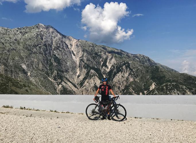
Our contributor Ard Oostra put it simply: epic. Qafa e Llogarasë, the Llogara Pass, is a bucket-list climb that rises from the Ionian Sea to a mountain pass in the Ceraunian Mountains. It covers 16.8 km (10.4 mi) and gains 1,106 m (3,630 ft) at a 6.2% average, the hardest climb in Albania in our database.
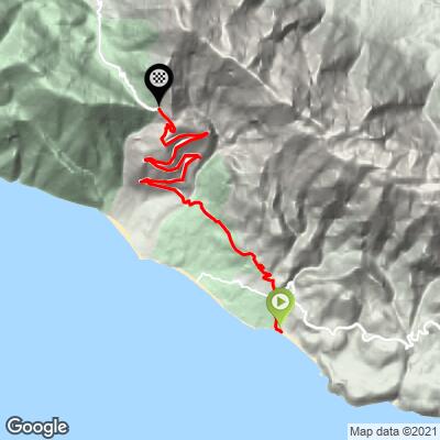
From the coast near Palasë and Dhërmi, the road switchbacks steadily above the sea, with little shade and constant views of the Ionian. After a short dip around km 4-6, the grade settles into a long haul: the steepest 5 km average 8.1% and the steepest kilometer 11.1%. The upper slopes lie in Llogara National Park (established in 1966), and the pass, about 1,027 m (3,369 ft) above sea level, is known for its wind-sculpted flag pines.
A bypass tunnel opened in 2024 and has taken much of the through traffic off the old pass road, which stays open and free, making the climb noticeably quieter than it used to be.
PLAN YOUR ROUTE
 We've partnered with Sherpa-Map.com to bring you the best route planning tool. With a PRO Membership you can use this climb as a reference when creating your route.
 The climb covers 16.8 km (10.4 mi) and gains 1,106 m (3,630 ft) at an average of 6.2%, starting at sea level. The grade is sustained and sometimes severe: the steepest 100 yards reach 16.6%, the steepest 0.5 km average 11.6%, and the steepest kilometer 11.1%.
Over longer stretches the climb stays hard: the steepest 2 km average 9.1%, the steepest 5 km 8.1% and the steepest 10 km 7.8%. About 73 m (240 ft) of total descent, mostly around km 4-6, gives a brief breather before the final push to the pass.
Roadway: Paved the whole way, with hairpins on the pass road and guardrails missing on some of the more exposed switchbacks. Heavy rain from late October through March can bring small rockfalls, and snow or ice is possible from December through February, so check conditions in the cooler months.
Traffic: Moderate. The 2024 bypass tunnel has taken much of the through traffic off the old pass road, but in July and August expect tour buses on the Dhërmi side of the pass, where a queue behind one can last a few minutes.
Parking: Start from the coast near Palasë or Dhërmi. The climb begins at sea level, so you can roll out from wherever you are staying along the shore.
Provisions: There is no fuel on the mountain section, and shade is scarce, so carry plenty of water, especially in summer. Mountain restaurants near the top serve grilled meats, and Dhërmi has cafés and shops at the bottom of the route.
Gear: Compact or wide-range gearing for the 11-12% ramps and sunscreen for the exposed lower slopes. Pack a wind layer for the descent, as the pass is cooler and often windy, and carry lights since morning fog is common from April through October and usually clears by late morning.
Before heading out on any cycling adventure check out our Things to Bring on a Cycling Trip and use our interactive check list to ensure you don't forget anything.
Llogara National Park covers about 10.1 sq km (3.9 sq mi) of pine and flag-pine forest at the top of the pass, and the summit viewpoint looks out over the Ionian Sea toward Dhërmi's beach below, with Corfu on the horizon on clear days. A paragliding launch is also in the park, and several mountain restaurants nearby serve roast lamb and other Albanian specialties.
Plan the day around the Albanian Riviera: Dhërmi, with its beaches, is the base at the bottom of the route, Himarë lies farther south along the coast, and Vlorë, with ferries to Italy, is the main city to the north. Summer afternoons are hot, so ride early, and check conditions at the pass before you go with our Weather tool.
ROUTE MAP
MEMBER RATING
CURRENT WEATHER
PJAMM TRIPS ADVENTURE STARTER BUNDLES
Check out PJAMM Adventure's prepackaged (self-guided) cycling trips. They will help you plan, document and conquer your next adventure.
NEARBY CLIMBS (0) RADIAL PROXIMITY
FROM No Climbs Found
MEMBER REVIEWS & COMMENTS
Let us know what you thought of this climb. Signup for our FREE membership to write a review or post a comment.
Already have an account?
LOG IN HERE
