![]()
Ride 24.2 kilometers gaining 1285 meters at 4.9% average grade.
Mont Ventoux makes its 17th appearance in the Tour de France when it is featured twice (from Sault and Bedoin) on July 7 stage 11.
See our 2021 Tour de France page for the most unique presentation of TdF climbs you have ever seen - guaranteed!
There are three paved routes (a 4th by mountain bike) to the top of this mighty mountain (Map), although the route from Bédoin is by far the most popular and well known.
- Fom Bédoin: Ride 21.5 kilometers gaining 1613 meters at 7.75% average grade.
- From Malaucene: 21.2 kilometers gaining 1522 meters at 7.2%,
- From Sault: 24.2 kilometers, 1285 meters at 4.9%.
DO ALL 3 IN A DAY AND GET YOUR BADGE 👍👍👍
Club Des Cinglés Du Mont-ventoux offers a very cool badge and certificate for climbing the 3 paved ascents of Mont Ventoux (137 kilometers, 4,440 meters), or 3 paved + 1 mountain bike (183 kilometers at 6,020 meters climbed), or, well hell, Everest the damn thing . . . (3 paved ascents twice = 274 kilometers at 8,800 meters).
![Radio Tower - Mont Ventoux]()
Photo courtesy of blissmoments Reddit.
![File:F5 tornado Elie Manitoba 2007.jpg - Wikimedia Commons]()
It can be a bit breezy at the top.
“Venteux” means windy in French, and this mountain climb certainly lives up to its moniker. Particularly at the summit, wind speeds as high as 200 mph (320 km/h) have been noted, and “the wind blows at 90+ km/h (56+ mph) 240 days a year” (Mont Ventoux - Wikipedia). Because of high winds, the road over the mountain is often closed, especially the "col des tempêtes" ("storm pass") just before the summit. The true origins of this mountain’s name “are thought to trace back to the 1st or 2nd century AD, when it was named 'Vintur' after a Gaulish god of the summits, or 'Ven-Top', meaning "snowy peak" in the ancient Gallic language. In the 10th century, the names Mons Ventosus and Mons Ventorius appear” Mont Ventoux - Wikipedia.
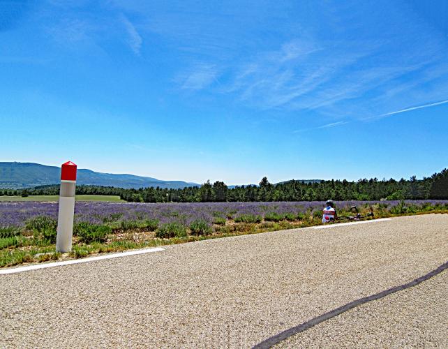
Riding to Mont Ventoux from Sault may be the most beautiful of the routes to the summit because we ride through beautiful lavender fields during the first several miles of the climb. Sault is in the Provence Region of France which is well known for its lavender fields. Sault is also home to the Lavender Festival (Fête de la Lavander) which is held every year on August 15. The best time to ride from Sault to Mont Ventoux is in the summer when the lavender fields are in full bloom. July and August are the hottest months in the area, but the average high temperatures are only in the mid 80’s during this time frame. If we were to return to Mont Ventoux (which we surely will), it will be around August 15 so that we can attend the Lavender Festival.
![]()
![]()
Sault to the turn up to Mont Ventoux at Chalet Reynard
18.1 kilometers gaining 820 meters at 4% average grade.
![Mount Ventoux - Le Chalet Reynard Cycling Mount Ventoux - Le Chalet Reynard]()
Turn left at Chalet Reynard and finish at the summit 6 kilometers uphill.
![]()
Kilometer and roadway markers lead us the final 6 kilometers to the summit.
THE SUMMIT
![Mont Ventoux - John Johnson Bike Climb Mont Ventoux - John Johnson PJAMM Cycling with bike at summit sign]()
![Mont Ventoux Food Cart Climbing Mont Ventoux with bicycle - food cart at summit]()
Many cyclists congregate at the top of the climb where there is plenty of great food to choose from.

 We've partnered with Sherpa-Map.com to bring you the best route planning tool. With a PRO Membership you can use this climb as a reference when creating your route.

