
32.8
PDI
13.2 mi
DISTANCE
4,997 ft
GAINED
7.2 %
AVG. GRADE
FULL CLIMB STATS
INTRO
Up Mont Ventoux from the backside - nearly as difficult a bike climb as from the classic (Mont Ventoux - Bedoin) side.
Mont Ventoux makes its 17th appearance in the Tour de France when it is featured twice (from Sault and Bedoin) on July 7 stage 11.
See our 2021 Tour de France page for the most unique presentation of TdF climbs you have ever seen - Guaranteed!
PLAN YOUR ROUTE
Average grade is 7.2%. 61% of the climb is at 5-10% and 15% is at 10-15% grade. The steepest 500 meters is 11% and steepest kilometer 10.6%.
See more details and tools regarding this climb's grade via the “Profile Tool” button above.
Roadway: 2 lane roadway in excellent condition and a center striped white line until kilometer 15 when the roadway narrows slightly and has no center stripe. There is no shoulder on this roadway.
Traffic: Mild.
Parking: On the right on D974 at the start of the climb - but get there early - Map; Street View.
Provisions: Chalet Liotard at kilometer 15 - Google Map + Reviews or at the top - Vendran Restaurant (Map + Reviews) or the food cart at the very top.
Before heading out on any cycling adventure check out our Things to Bring on a Cycling Trip and use our interactive check list to ensure you don't forget anything.
Consider also doing the famous Mont Ventoux - Bedoin and/or ride up to Mont Ventoux through fields of lavender from Mont Ventoux - Sault or do all three at one time - Club Des Cinglés Du Mont-ventoux offers a very cool badge and certificate for climbing the 3 paved ascents of Mont Ventoux (137 kilometers, 4,440 meters), or 3 paved + 1 mountain bike (183 kilometers at 6,020 meters climbed), or, well hell, Everest the damn thing . . . (3 paved ascents twice = 274 kilometers at 8,800 meters).
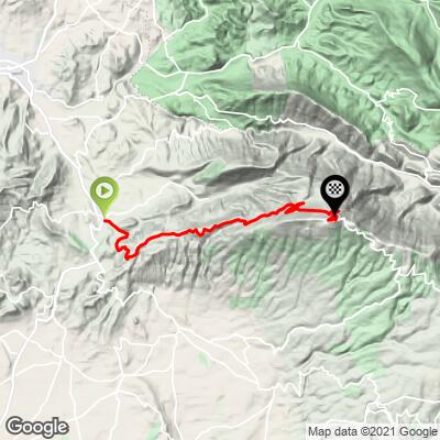
ROUTE MAP
MEMBER RATING
CURRENT WEATHER
PJAMM TRIPS ADVENTURE STARTER BUNDLES
Check out PJAMM Adventure's prepackaged (self-guided) cycling trips. They will help you plan, document and conquer your next adventure.
NEARBY CLIMBS (0) RADIAL PROXIMITY
FROM No Climbs Found
MEMBER REVIEWS & COMMENTS
Let us know what you thought of this climb. Signup for our FREE membership to write a review or post a comment.
Already have an account?
LOG IN HERE
jensoweber

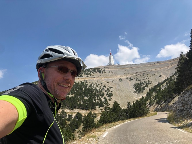

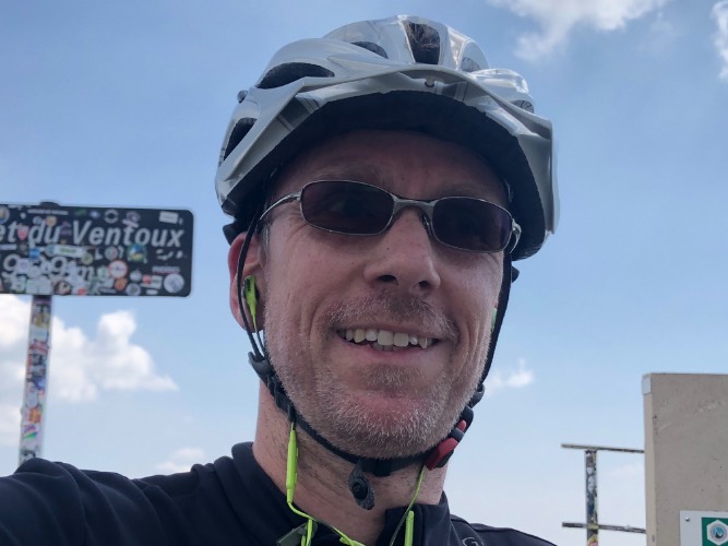

I drove up there on a hot summer day with temperatures above 37 degree celsius and no shade at all… I used my every day bike, since the tarmac is perfect every bike will be fine. The first opportunity to refill water was after ⅔ of the climb, on the summit there's a restaurant as well. The view is terrific