27.1
PDI
13.1 mi
DISTANCE
4,476 ft
GAINED
6.4 %
AVG. GRADE
FULL CLIMB STATS
Page Contributor(s): Jos Beckers, New Westminster, BC, CAN
INTRO
Apex from Hedley is one of the great gravel bike climbs of Canada: 21.1 km (13.1 mi) of dirt and rock up the Nickel Plate Road from the Similkameen Valley, gaining 1,364 m (4,476 ft) at a 6.4% average grade. It is the backside of Apex from Penticton, and on Strava it goes by the name "APEX, the hard way!" The road is all gravel but manageable on a road bike, and a gravel or cross bike is the more comfortable choice.
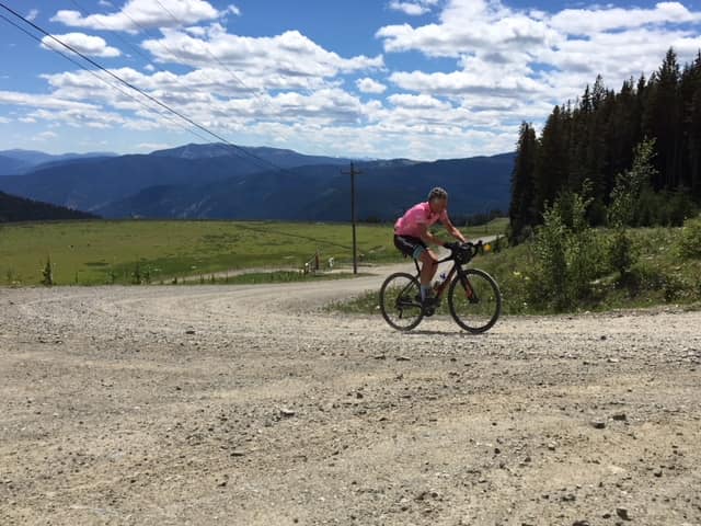
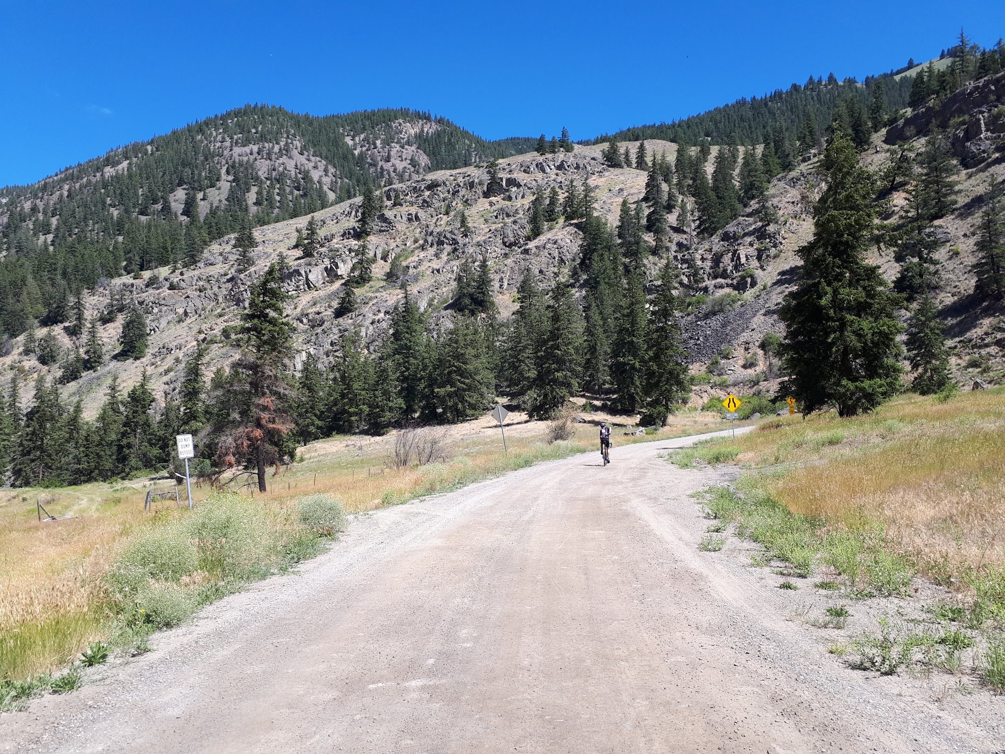
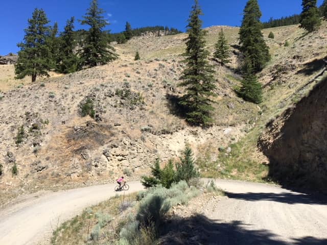
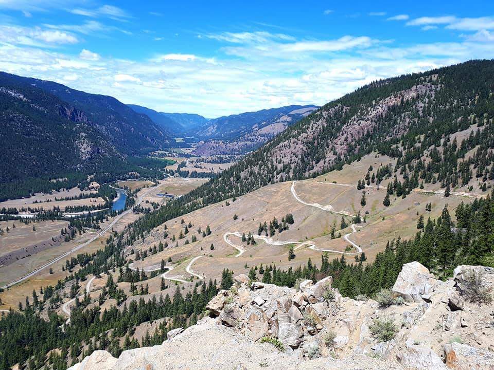
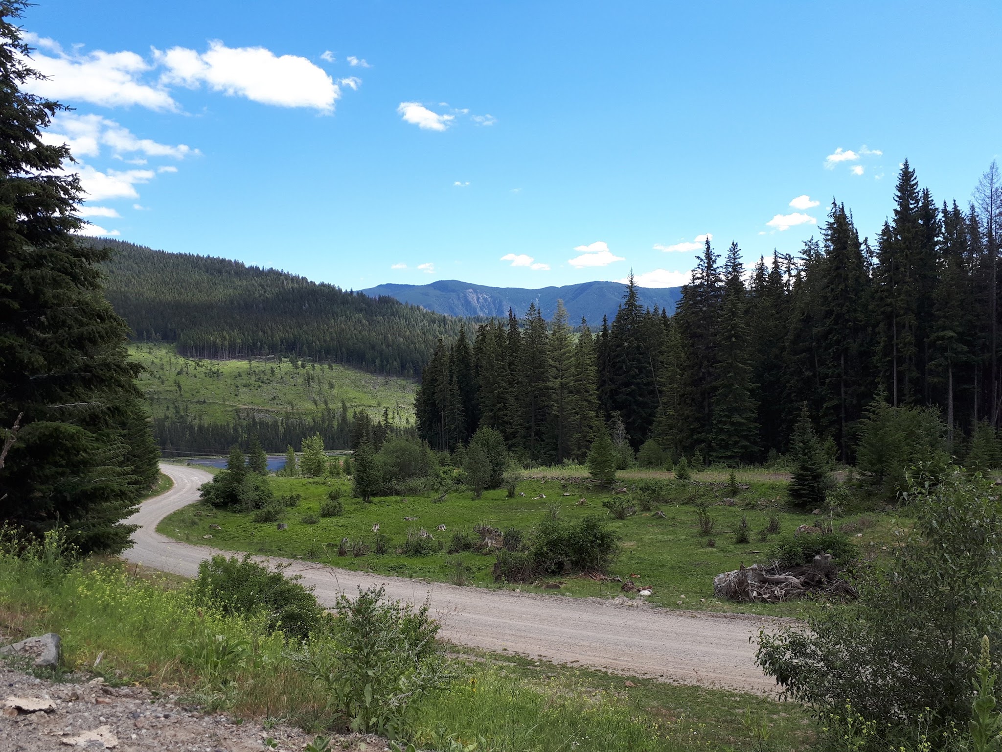
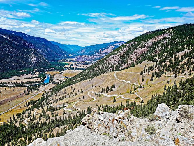
The bottom half is the hard part. A run of tight switchbacks lifts you out of the valley, followed by steeper, looser sections around rock outcrops, all with wide views of the Similkameen Valley. Once you enter the forest the surface improves and the grade slackens, and you emerge into alpine country as the road passes the former Nickel Plate mine on its way to a gentle summit near Nickel Plate Lake. A small cemetery with unmarked graves from the mining days sits beside the road near the top.
Once you leave Highway 3 behind you may not meet a single vehicle until you reach the Apex ski village, which is mostly deserted in summer, so this is a remote ride. The climb has a southern exposure and can be very hot in summer. A rockfall closed the Nickel Plate Road about 2 km (1.2 mi) east of Hedley on December 9, 2025, pending a geotechnical assessment, so confirm with AIM Roads that the road is open before you ride.
PLAN YOUR ROUTE
 We've partnered with Sherpa-Map.com to bring you the best route planning tool. With a PRO Membership you can use this climb as a reference when creating your route.
 Apex from Hedley climbs from 536 m (1,757 ft) to 1,876 m (6,154 ft), gaining 1,364 m (4,476 ft) over 21.1 km (13.1 mi) at an average grade of 6.4% (7% climb only). 55% of the climb is at 5-10% and 15% is at 10-15%.
The profile splits neatly in two. The first 10.5 km (6.5 mi) gain about 889 m (2,917 ft) at 8.5% through the switchbacks and steep, rocky sections. The remaining 10.6 km (6.6 mi) gain about 452 m (1,483 ft) at 4.3%, easing through the forest and alpine sections with a couple of nearly flat kilometers near the top.
The steepest 500 m averages 11.3%, the steepest kilometer 11.0%, the steepest 2 km 10.1%, the steepest 5 km 8.8% and the steepest 10 km 8.7%. In miles, the steepest 100 yards (91 m) average 12.0%, the steepest quarter-mile (0.4 km) 11.5%, the steepest half-mile (0.8 km) 11.1% and the steepest mile (1.6 km) 10.3%.
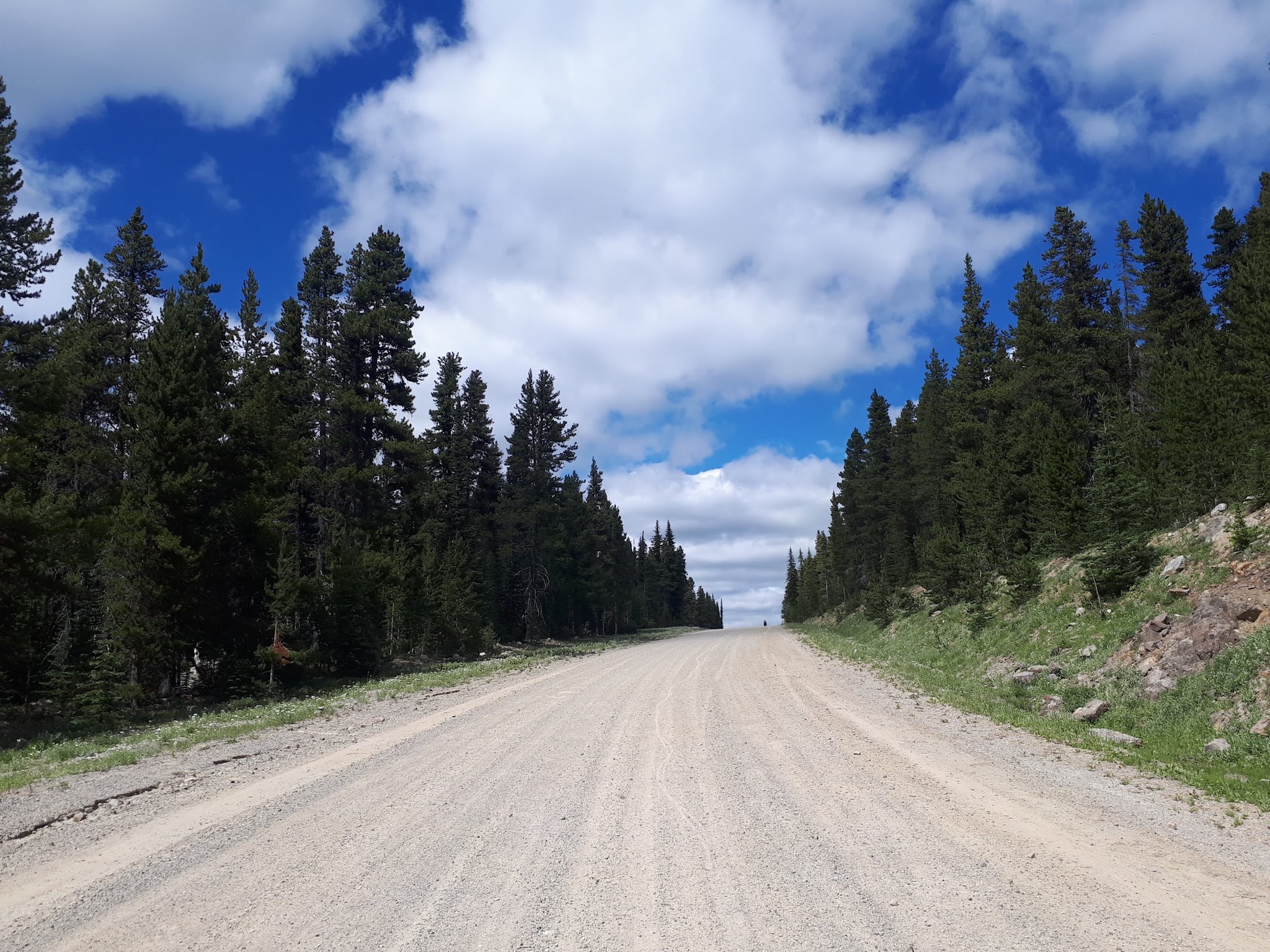
Roadway: The Nickel Plate Road is gravel from bottom to top and is generally well graded, but the loose sections around the rock outcrops above the switchbacks call for care. It is manageable on a road bike, though larger tires are recommended, and puncture-resistant rubber is wise because of the sharp rocks. A rockfall closed the road about 2 km (1.2 mi) east of Hedley on December 9, 2025, pending a geotechnical assessment - confirm with AIM Roads that it is open before you go.
Traffic: Minimal. Expect a handful of vehicles at most once you leave Highway 3, and the Apex ski village at the top is mostly deserted in summer.
Parking: On the side of the road at the start of the climb - Map; Street View.
Provisions: There is no place to get food or water on the climb. Stock up in Hedley three kilometers north of the start: the Hedley Country Market has groceries and the Grand Union Cafe serves coffee and baked goods, and there is a store you can see on this map (Map; Street View). Past the finish, you might find something at the Gunbarrel Saloon six kilometers beyond the top (Map), but do not count on it outside ski season.
Gear: This climb is all gravel, so a gravel bike is recommended, although the ride can be done on a road bike. On a road bike, use at least 28mm tires, and consider a compact crankset with a wide cassette - one of our contributors climbed it on a Roubaix with a 34-tooth chainring and a 32-tooth cassette. The climb has a southern exposure, so carry plenty of water, and check conditions at the finish with our Weather tool before you go.
Before heading out on any cycling adventure check out our Things to Bring on a Cycling Trip and use our interactive check list to ensure you don't forget anything.
A great out and back would be this climb + Apex from Penticton - 111 kilometers and 3,217 meters (Map). If you would like a bigger day, The Gravel Cyclist's Guide to British Columbia lists a 157 km (97.6 mi) loop from Oliver with 3,219 m (10,561 ft) of climbing over the Fairview and Apex gravel climbs.
Hedley grew up around the Nickel Plate gold mine, and the nearby Mascot Mine, which operated from 1936 to 1949, hung on a cliff above town with an aerial tramway carrying ore down to the mill. The Hedley Heritage Museum and Visitor Info on Daly Avenue is worth a stop before or after the ride, though it is open seasonally. Near the top of the climb, Nickel Plate Provincial Park, established in 1938, centers on Nickel Plate Lake, and Stemwinder Provincial Park near Hedley has camping.
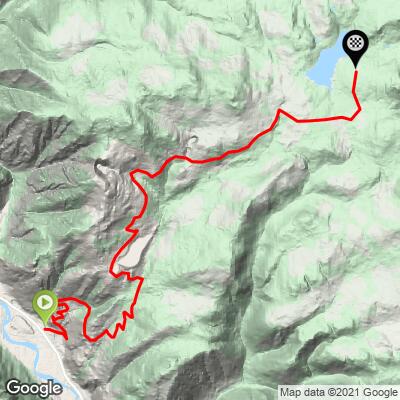
ROUTE MAP
MEMBER RATING
CURRENT WEATHER
PJAMM TRIPS ADVENTURE STARTER BUNDLES
Check out PJAMM Adventure's prepackaged (self-guided) cycling trips. They will help you plan, document and conquer your next adventure.
NEARBY CLIMBS (0) RADIAL PROXIMITY
FROM No Climbs Found
MEMBER REVIEWS & COMMENTS
Let us know what you thought of this climb. Signup for our FREE membership to write a review or post a comment.
Already have an account?
LOG IN HERE
NealC
July 2023 - this is definitely not rideable on a road bike. On 42C tires @ 34/36 PSI, I was losing traction in places and the descent was very rough.