30.3
PDI
15.7 mi
DISTANCE
5,044 ft
GAINED
6 %
AVG. GRADE
FULL CLIMB STATS
Page Contributor(s): Bruce Hamilton, La Quinta, CA, USA; Stacy Topping, Tacoma, WA, USA
INTRO
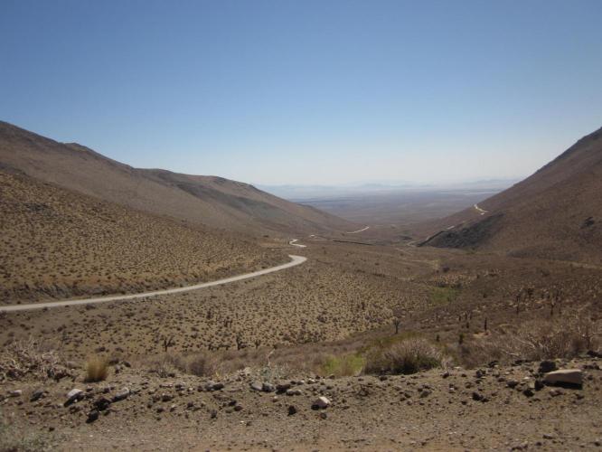
The Nine Mile Canyon Climb is really 15.7 miles. The climb begins a bit west of Death Valley, and the temperatures during the summer can be stifling. The average high temperature during July and August exceeds 100 degrees. The scenery through the first 10 miles is high desert, stark and barren, but does give way to a slightly more alpine-like setting as we climb. Miles 2-4 are 8.1%, mile 5 averages 8.9%, while miles 8.2-9.2 spike to 10% average (very tough in 100 degree weather).
PLAN YOUR ROUTE
Average grade is 6% (6.4% climb only). 46% of the climb is at 5-10% and 14% is at 10-15%. The steepest quarter-mile is 12.2%.
Use the “Routes in Area” button on the menu bar to see other bike climbs in this area.
Roadway: Two lane road in good condition with no shoulder.
Traffic: Minimal.
Parking: Just off Highway 395 at the start of the climb - Map; Street View.
Provisions: None on the climb. There is a gas station with snacks and beverages three miles south on Highway 395 (just past the Uniroyal Gal statue on the east side of Highway 395) or 8.7 miles past the finish of the climb at Kennedy Meadows Store - Map.
Weather: This climb begins in the Mojave Desert, so beware the brutally hot summers. The average high from June-August is 98-102 degrees.
Before heading out on any cycling adventure check out our Things to Bring on a Cycling Trip and use our interactive check list to ensure you don't forget anything.
We've done the Nine Mile Canyon - Sherman Pass West out-and-back and it is a pure brute - 137 miles and 17,700' gained (Map).
Use the “Routes in Area” button on the menu bar to see other bike climbs in this area.
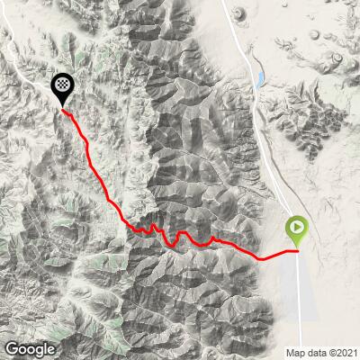
ROUTE MAP
MEMBER RATING
CURRENT WEATHER
PJAMM TRIPS ADVENTURE STARTER BUNDLES
Check out PJAMM Adventure's prepackaged (self-guided) cycling trips. They will help you plan, document and conquer your next adventure.
NEARBY CLIMBS (0) RADIAL PROXIMITY
FROM No Climbs Found
MEMBER REVIEWS & COMMENTS
Let us know what you thought of this climb. Signup for our FREE membership to write a review or post a comment.
Already have an account?
LOG IN HERE
dfergusonpm
Very exposed to the sun throughout the ride. Weather was cool when I did it on 5/8/24, but I would not want to do it when it is hotter. Some good steep ramps provide a good climbing challenge. Not the most stunning views, but overall pretty enjoyable. Road surface was good, especially on the Inyo county side.
lirizar1
Hot hot hot! Started at 105 degrees getting up to 118 degrees. Don't start this climb at 1pm even in May. You are out in the open the entire climb with no shade. Some cars but the road is wide enough they don't bother you. Nice climb off the beaten path!