![]()
Climb summary by PJAMM’s John Johnson.
The Sherman Pass bike climb in California is a very challenging climb in a remote region of the southern Sierra Nevada Mountain Range in the Sequoia National Forest. Before you get excited about seeing Sequoia National Forest, a la Bear Creek Road, Whitaker Forest, Highway 198, and the like, don’t be misled. While this climb will surely test your climbing abilities, it should not be mistaken for climbs on the southwestern side of the Sierra with much lusher surroundings, not to mention actual Sequoia Redwoods along the routes.
![]()
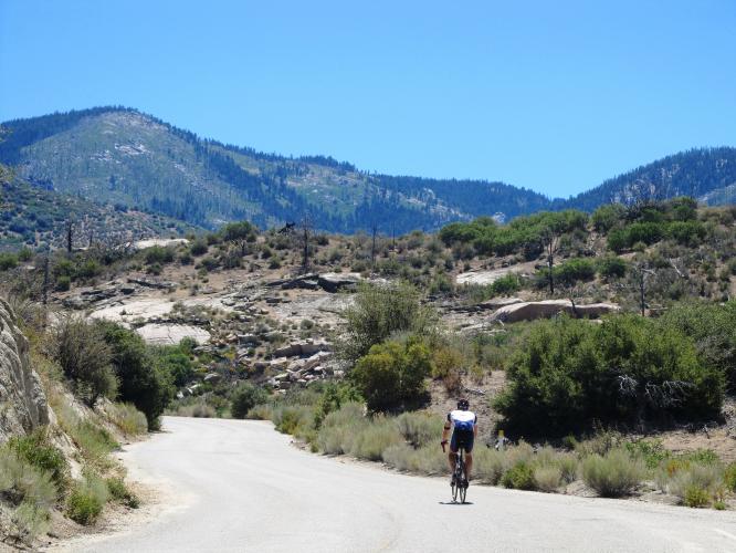
Sherman Pass is a hot, dry, private climb on a narrow road with minimal traffic. If you are one to check off the toughest climbs in a state/country/the world, then this is a good climb for you. If views precede challenge on your priority list, you may rethink this one. Its landscape has sadly been decimated by wildfires over the years and it lacks a bit on the forest side. We have climbed this brute twice and know it fairly well.
![]()
Climb begins at Highway 99 adjacent to the Kern River.
“There are some ascents out there that are difficult to get to but worth the effort. This climb up the west side of Sherman Pass certainly qualifies as one of the most difficult in the United States. Isolated and with its start from the scenic Kern River, the road immediately heads up along a ridge above a drainage at a fairly steady grade. Dry and desert-like over the lower stretches, you gradually leave the harsh terrain behind and ascend into a bit more semi alpine scenery including some big trees near the top. Be prepared before you tackle this one as this long hill will test you over a stout grade and through multiple turns. There is a bit of exposure over part of its length as well and keep in mind there is no water along the route (and little shade). Near the top the grade eases a bit and the listed climb ends just shy of the actual pass at over 9,000 feet (listed top is just beyond the cattle guard)...” (This quote is presented with the approval of John Summerson, from his book, The Complete Guide to Climbing (by Bike), 2nd Edition, pg. 154.)
![]()
Most of our surroundings are high desert and dry.
![]()
Gate at mile 6 . . .
. . . not a problem 😉😉
![IMG_4246.JPG]()
Our cycling friend and frequent contributor, Ron Hawks, toward and at the top of the climb.
![]()
Thank you Ron (left) and Bruce (right)!!
Although the views throughout the majority of the Sherman Pass bike climb are generally of arid landscape and distant mountainous terrain, we do enter an alpine setting for the top last third of the climb.
Beware that the heat during the summer can be stifling. The temperatures when we first climbed Sherman Pass in August 2011 hit 106°F at the bottom of the climb.
Traffic and Roadway Surface Report: The roadway surface is rough, but major potholes and cracks had been patched within a week of our climb in August 2014. Descend with caution, as there is gravel/dirt/sand in places, which create a real hazard for the unwary. The road is narrow with no shoulder, bike lane or center line, although the very few vehicles you will encounter along the way generally travel at low speed.

 We've partnered with Sherpa-Map.com to bring you the best route planning tool. With a PRO Membership you can use this climb as a reference when creating your route.

