![Daylight Pass Death Valley Cycling Daylight Pass Death Valley - view of road and valley below]()
View back down to Death Valley from Beatty Rd/Daylight Pass Rd while cycling up Daylight Pass
Ride 12.8 miles gaining 4,131’ to elevation 4,314’ at 6.1% average grade.
Visit our Death Valley National Park page
The climb begins in the heart of Death Valley National Park and ends just west of the California/Nevada state line. This is the easier approach to Daylight Pass and shares its last 6 miles with the Daylight Pass Road climb (Daylight Pass Road to Junction: 6.6 miles at 6.1% gaining 2,109’; Beatty Road to Junction: 9.8 miles at 4.6% gaining 2,391’). From the junction to the Pass is 6 miles at 6.3% gaining 1,950’
The first several miles of this climb are on a long, straight road that can be demoralizing in the heat. Views along this route while not as spectacular as Dantes View or Artist Drive are very good and this is a climb well worth your time if you are travelling to Death Valley for a cycling trip. There is no water along this route and bringing enough (too much) water is highly recommended.
![Daylight Pass Death Valley Bike climb Daylight Pass Death Valley - road and mountains]()
Start climb at the intersection Beatty Road and Hwy 190
Mile 9.8 is the merge of Daylight Pass and Beatty Cutoff Roads (Hell's Gate - view on banner photo, above) where there is a picnic table and shade.
![]()
Junction of Daylight Pass Road (left) and Beatty Road (right).
Daylight Pass is 6 miles through the canyon above the junction.
![Daylight Pass Death Valley Cycling Daylight Pass Death Valley - PJAMM Stacy Topping on road with bike]()
Stacy taunting Death Valley at Hell’s Gate 😈
![Daylight Pass Death Valley Cycling Daylight Pass Death Valley , road and mountains]()
Beatty-Daylight Pass Junction.
![Daylight Pass Death Valley Cycling Daylight Pass Death Valley , road and mountains]()
The only shade in 13 miles - junction Beatty-Daylight Pass Roads.
![Daylight Pass Death Valley Cycling Daylight Pass Death Valley , road and mountains]()
Just past junction of Beatty and Daylight Pass Roads.
![Daylight Pass Death Valley Cycling Daylight Pass Death Valley , road and mountains]()
Stark desert scenes and formations along the climb.
![Daylight Pass Death Valley Cycling Daylight Pass Death Valley , road and mountains]()
Mile 8 - Corkscrew Peak upper right third of photo.
![Daylight Pass Death Valley Bicycle ride Daylight Pass Death Valley - bicyclist on bike on road]()
Mile markers from the start of the climb to the pass.
![Daylight Pass Death Valley Cycling Daylight Pass Death Valley , road and mountains]()
Bring lights if you start mid afternoon or later -
There can be a brutal headwind climbing Daylight Pass.
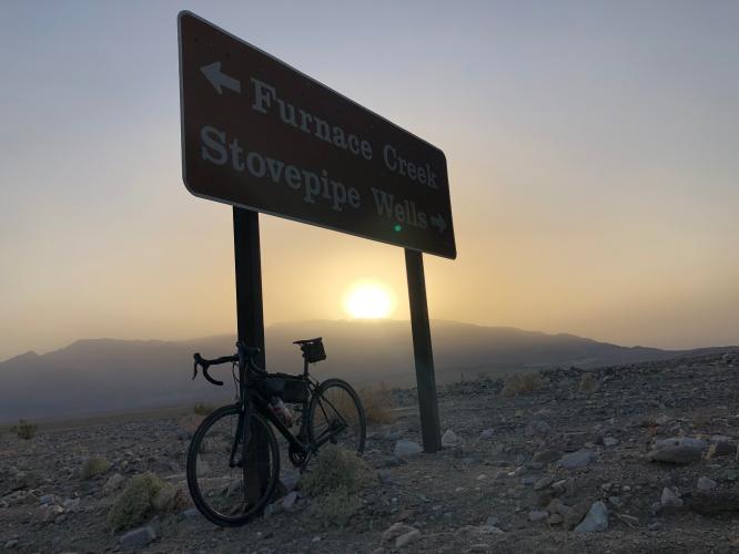
![Daylight Pass Death Valley Cycling Daylight Pass Death Valley - cyclist at pass sign with bike]()
PJAMM finishing up #6 of our 10 DV climbs in 2014.
![]()
A nice hike off this route (junction at mile 5.6) is the Keane Wonder Mine
AllTrails.com: “Keane Wonder Mine Trail is a 8.1 mile lightly trafficked out and back trail located near Death Valley, California that offers the chance to see wildlife and is rated as difficult. The trail is primarily used for hiking and nature trips.”
![]()
![]()
That’s a wrap!!
![Daylight Pass Death Valley Cycling Daylight Pass Death Valley - bike leaning against state border nevada sign]()
Finish is at the California-Nevada border
DEATH VALLEY WEATHER
![]()
National Park Service Death Valley Weather Chart
Dangerously hot during the day from June through September with average monthly highs during that time ranging from 106 to 116.5. Cycling is not recommended during the summer and certainly never without good SAG support. The heat can be stifling (if not truly dangerous) and supplies are few and far between.
The hottest temperature ever recorded on earth was in Furnace Creek on July 10, 1913 (134℉/56.7℃) and, while that record has been challenged, the “alternate” record is also held by Death Valley (2013 in a tie with Mitribah, Kuwait in 2016 at 129.2℉/54.0℃).
Traffic and Roadway report: As of October, 2019, the roadway surface was good condition throughout this ride but the shoulder is fairly narrow. There is minimal (similar to Daylight Pass the 2 times we have climbed this route) but the occasional vehicles can move whiz by at 60-65 mph.

 We've partnered with Sherpa-Map.com to bring you the best route planning tool. With a PRO Membership you can use this climb as a reference when creating your route.

