![]()
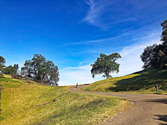
Cycling Bullfrog Pond, Armstrong Woods State Natural Reserve, West Sonoma County, California.
Ride 3.1 miles gaining 1,298’ at 8% average grade.
This is a hidden jewel of cycling and climbing by bike in Sonoma County. Situated in Armstrong Woods Natural Reserve, this is one of our Sonoma County Top 5 Scenic Bike Climbs. While the scenery along the climb and views at the top are exceptional, this climb also qualifies as one of the more challenging in the area due to “The Wall” near the end of the climb, which reaches 20% and averages 16% for a quarter mile.
![]()
![]()
Armstrong Woods State Natural Reserve is a 6,000 acre park located in the Russian River resort town of Guerneville, California. Guerneville is one of many beautiful, rural towns in west Sonoma County, and Armstrong Woods is a beautiful gem within this eclectic river community. Visiting Armstrong Woods is, in many ways, like strolling back in time. The ancient redwood trees dwelling here remind us what the area looked like before logging began in the area in the 19th century. Much of the wood that rebuilt cities like San Francisco after the devastating fire that destroyed the city in 1906 came from this area. If you’re visiting Sonoma County to cycle, you’d be remiss to not make a day out of exploring the beauty of Armstrong Woods and the surrounding area locals refer to as “West County.” For more information on Armstrong Woods, visit the Exploring Redwoods site here.
![]()
The Wall - 1/10th at 21.5%.
![]()
Pond Farm; an American artists’ colony that began in the 1940’s.
Currently consists of two small residences and a historic barn repurposed as a pottery studio. (Pond Farm)
Mile 1.5 of the climb.
Note - technically Bullfrog pond and the top of the climb are in the Austin Creek Recreational Area because we leave Armstrong Woods at about mile 1.4 of the climb at the left hairpin just below Pottery Farm.
![]()
That’s a wrap!!

 We've partnered with Sherpa-Map.com to bring you the best route planning tool. With a PRO Membership you can use this climb as a reference when creating your route.

