15.6
PDI
12.6 mi
DISTANCE
2,743 ft
GAINED
4.1 %
AVG. GRADE
FULL CLIMB STATS
INTRO
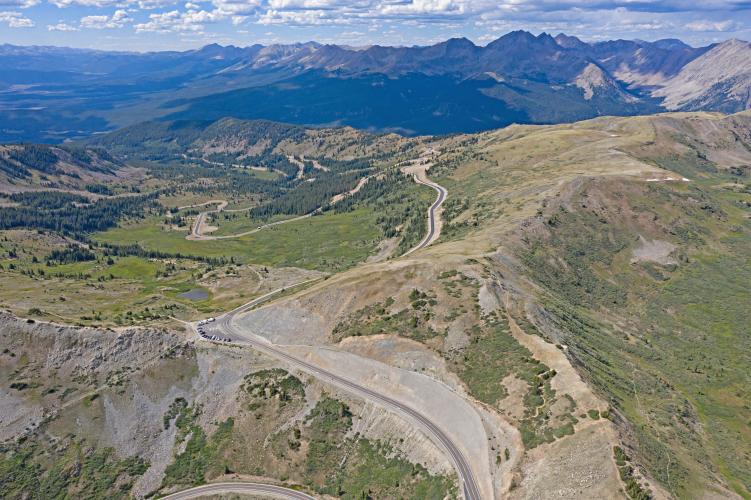
This 12.6 mile bike climb is located in CO, USA. The average gradient is 4.1% and there is a total elevation gain of 2,743 ft, finishing at 12,110 ft.
Use the profile tool, route map, and weather forecast to conquer this cycling climb.
Use the profile tool, route map, and weather forecast to conquer this cycling climb.
PLAN YOUR ROUTE
See more details and tools regarding this climb's grade via our interactive Profile Tool.
Information Not Available
If you have any information regarding this climb, we'd like to hear from you. Click the CONTRIBUTE button to share your thoughts with us.
Information Not Available
If you have any information regarding this climb, we'd like to hear from you. Click the CONTRIBUTE button to share your thoughts with us.
Before heading out on any cycling adventure check out our Things to Bring on a Cycling Trip and use our interactive check list to ensure you don't forget anything.
Information Not Available
If you have any information regarding this climb, we'd like to hear from you. Click the CONTRIBUTE button to share your thoughts with us.
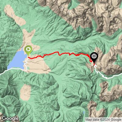
ROUTE MAP
MEMBER RATING
CURRENT WEATHER
PJAMM TRIPS ADVENTURE STARTER BUNDLES
Check out PJAMM Adventure's prepackaged (self-guided) cycling trips. They will help you plan, document and conquer your next adventure.
NEARBY CLIMBS (0) RADIAL PROXIMITY
FROM No Climbs Found
MEMBER REVIEWS & COMMENTS
Let us know what you thought of this climb. Signup for our FREE membership to write a review or post a comment.
Already have an account?
LOG IN HERE
TobyGadd
A beautiful and challenging climb, especially if ridding from BV and back. The road is freshly paved and as smooth as glass, so an amazing descent awaits. I rode on 9/13/2024 (a Thursday), and there was a lot of traffic--including many trailers and RVs, probably due to hunting season. Not much shoulder, unfortunately. Might be more fun before hunting season. A beautiful and challenging climb. The road is as smooth as glass, so an amazing descent awaits. I rode on 9/13/2024 (a Thursday), and there was a lot of traffic--including many trailers and RVs, probably due to hunting season. Not much shoulder, unfortunately. Might be more fun before hunting season. I highly recommend riding both sides of the pass (BV to the reservoir, and back to BV).
grock333
Start this climb early (7am). Traffic picks up by 9am and there is no shoulder. Although not very steep the altitude will guarantee slow progress no matter how fit you are. The views are A++ especially the final third. This is a must do if your in the area.