Reids Gap East Bike Climb - PJAMM Cycling

10.9
PDI
4.3 mi
DISTANCE
1,686 ft
GAINED
7.4 %
AVG. GRADE

FULL CLIMB STATS

Page Contributor(s): Dan Razum, San Jose, CA

INTRO

Cycle the entire Blue Ridge Parkway – see PJAMM’s March 2022, 467-mile adventure on the PJAMM Adventures App: Blue Ridge Parkway.  See also our Climbs of the BRP (NC to VA) and Climbs of the BRP (VA to NC).

See more details and tools regarding this climb's grade via our interactive Profile Tool.
Information Not Available

If you have any information regarding this climb, we'd like to hear from you. Click the CONTRIBUTE button to share your thoughts with us.

Information Not Available

If you have any information regarding this climb, we'd like to hear from you. Click the CONTRIBUTE button to share your thoughts with us.

Before heading out on any cycling adventure check out our Things to Bring on a Cycling Trip and use our interactive check list to ensure you don't forget anything.
Information Not Available

If you have any information regarding this climb, we'd like to hear from you. Click the CONTRIBUTE button to share your thoughts with us.

ROUTE MAP

MEMBER RATING

Not Yet Rated
-
Road
-
Traffic
-
Scenery

CURRENT WEATHER

PJAMM TRIPS ADVENTURE STARTER BUNDLES

Check out PJAMM Adventure's prepackaged (self-guided) cycling trips. They will help you plan, document and conquer your next adventure.
ALL TRIPS
Browse all of our prepackaged trips and find your next adventure!
Smoky Mountain National Park
United States (NC,TN)
17 ROUTES
31 POIs
ROUTE STATS (TOTAL)
181.8
mi
DISTANCE
34,253
ft
ELEV. GAIN
The Blue Ridge Parkway (North)
United States (NC,TN,VA)
38 ROUTES
70 POIs
ROUTE STATS (TOTAL)
716.5
mi
DISTANCE
75,697
ft
ELEV. GAIN
The Blue Ridge Parkway (South)
United States (NC,TN,VA)
30 ROUTES
63 POIs
ROUTE STATS (TOTAL)
690.7
mi
DISTANCE
74,180
ft
ELEV. GAIN

NEARBY CLIMBS (0) RADIAL PROXIMITY

FROM
No Climbs Found

MEMBER REVIEWS & COMMENTS

Let us know what you thought of this climb. Signup for our FREE membership to write a review or post a comment.
Already have an account?
ROUTE MAP
PROFILE TOOL
Route Data
S.G. (%)
hide
Segment Data
hide
CLIMB SUMMARY

Cycling Reids Gap East

Ride 4.3 miles gaining 1,686’ at 7.4%

Climb summary by PJAMM ambassador Dan Razum.

Start of climb.

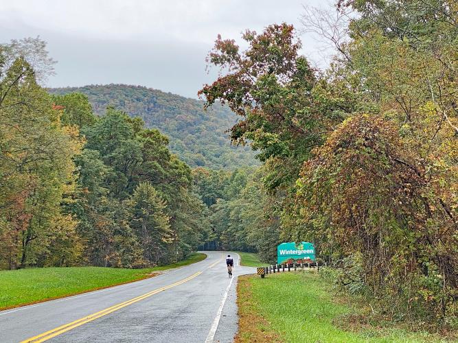
The start of this climb is fairly mellow, not too steep at all. The gradient slowly increases as we  continue, so we don't notice at first but the last mile is entirely above 10% and we certainly notice when  we reach that! The punch on this climb is packed into the last mile.

The first 3 miles or so of this climb are in common with the Wintergreen climb.  When we reach the  intersection with Wintergreen, we just continue on Rte 664, for another quad busting mile.

Wintergreen is the hardest bike climb in Virginia -

The first 3.4 miles (6.4%) of Reids gap overlaps with Wintergreen.

The road is in good condition, the pavement is smooth but there isn't much of a shoulder.  There is some traffic although not a whole lot, and it is less after the turn off for Wintergreen.  We didn't have any problems with the cars, the drivers were courteous but since there is some traffic you want to make sure you don't weave out into the road on the steep sections.

The climb ends at the Blue Ridge Parkway, with plenty of great riding in several directions, from more steep climbing on the other side of Rte 664 to gentle rolling hills and climbs along the BRP.