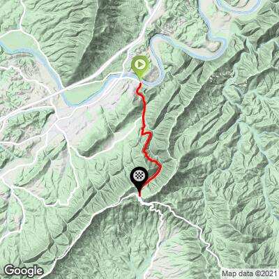
8.1
PDI
4.1 mi
DISTANCE
1,381 ft
GAINED
6.5 %
AVG. GRADE
FULL CLIMB STATS
INTRO
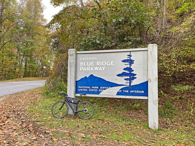
Route 43 North to the Blue Ridge Parkway is the steepest 2.5 mile segment of any full or half Ironman Triathlon in the world.
PLAN YOUR ROUTE
See more details and tools regarding this climb's grade via our interactive Profile Tool.
Information Not Available
If you have any information regarding this climb, we'd like to hear from you. Click the CONTRIBUTE button to share your thoughts with us.
Information Not Available
If you have any information regarding this climb, we'd like to hear from you. Click the CONTRIBUTE button to share your thoughts with us.
Before heading out on any cycling adventure check out our Things to Bring on a Cycling Trip and use our interactive check list to ensure you don't forget anything.
Information Not Available
If you have any information regarding this climb, we'd like to hear from you. Click the CONTRIBUTE button to share your thoughts with us.
ROUTE MAP
MEMBER RATING
CURRENT WEATHER
PJAMM TRIPS ADVENTURE STARTER BUNDLES
Check out PJAMM Adventure's prepackaged (self-guided) cycling trips. They will help you plan, document and conquer your next adventure.
NEARBY CLIMBS (0) RADIAL PROXIMITY
FROM No Climbs Found
MEMBER REVIEWS & COMMENTS
Let us know what you thought of this climb. Signup for our FREE membership to write a review or post a comment.
Already have an account?
LOG IN HERE
Kylnman
The first 1 1/4 miles out of Buchanan (pronounced buck-cannon) provide a mild warmup, but once you pass the Pico Rd junction, stuff gets real. The next 3 miles are relentless with the only ease in slope taking place early on, but greatly desired later as the climb grinds upward. Upon reaching the Blue Ridge Parkway, take that southward towards Roanoke for yet another .6 mile climb, adding nearly 200' more of gain.