Cascade Springs Bike Climb - PJAMM Cycling

16.7
PDI
12.6 mi
DISTANCE
3,345 ft
GAINED
3.9 %
AVG. GRADE

FULL CLIMB STATS

Page Contributor(s): Bruce Hamilton and Stacy Topping, Midway, UT

INTRO

This 12.6 mile bike climb is located in UT, USA. The average gradient is 3.9% and there is a total elevation gain of 3,345 ft, finishing at 8,032 ft.

Use the profile tool, route map, and weather forecast to conquer this cycling climb.

See more details and tools regarding this climb's grade via our interactive Profile Tool.
Information Not Available

If you have any information regarding this climb, we'd like to hear from you. Click the CONTRIBUTE button to share your thoughts with us.

Information Not Available

If you have any information regarding this climb, we'd like to hear from you. Click the CONTRIBUTE button to share your thoughts with us.

Before heading out on any cycling adventure check out our Things to Bring on a Cycling Trip and use our interactive check list to ensure you don't forget anything.
Information Not Available

If you have any information regarding this climb, we'd like to hear from you. Click the CONTRIBUTE button to share your thoughts with us.

ROUTE MAP

MEMBER RATING

Not Yet Rated
-
Road
-
Traffic
-
Scenery

CURRENT WEATHER

PJAMM TRIPS ADVENTURE STARTER BUNDLES

Check out PJAMM Adventure's prepackaged (self-guided) cycling trips. They will help you plan, document and conquer your next adventure.
ALL TRIPS
Browse all of our prepackaged trips and find your next adventure!
The American Southwest
United States (AZ,NM,UT)
18 ROUTES
27 POIs
ROUTE STATS (TOTAL)
215.4
mi
DISTANCE
34,866
ft
ELEV. GAIN
Utah: Moab, Arches & Canyonlands
United States (UT)
19 ROUTES
21 POIs
ROUTE STATS (TOTAL)
325.3
mi
DISTANCE
32,871
ft
ELEV. GAIN
Utah: Zion National Park
United States (UT)
20 ROUTES
32 POIs
ROUTE STATS (TOTAL)
256.5
mi
DISTANCE
39,649
ft
ELEV. GAIN

NEARBY CLIMBS (0) RADIAL PROXIMITY

FROM
No Climbs Found

MEMBER REVIEWS & COMMENTS

Let us know what you thought of this climb. Signup for our FREE membership to write a review or post a comment.
Already have an account?
ROUTE MAP
PROFILE TOOL
Route Data
S.G. (%)
hide
Segment Data
hide
CLIMB SUMMARY

Cycling Cascade Springs

Cycling 12.6 miles gaining 3,356’ at 3.9% average grade.

This is a fabulous bike climb that has a misleading average grade because of two substantial descents within it that reduce the overall gradient average.

Climb summary from PJAMM great friend and contributor Bruce Hamilton:

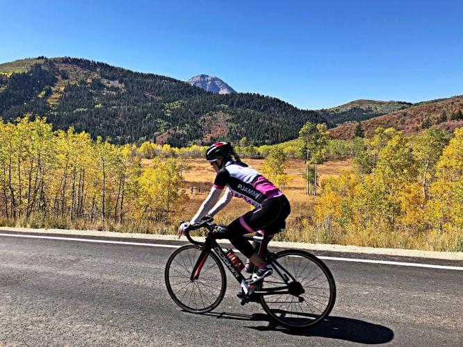
This road is exceptional.  It’s called Cascade Springs road and it was dirt until this September. I rode it last year on my mountain bike but when we were in Midway in September, 2020 they had just completed paving it. We had just come from CO doing spectacular rides in autumn leaves and even by those standards this road was stunning. In fact, I think the road between Ouray and Silverton is the most scenic in the USA and we’d just done it under ideal conditions and this new Cascade Springs road might be even better. Certainly up in the top few with Glacier Park, Mt Lemmon, Ouray-Silverton, etc.

It starts in Midway and goes to the Alpine Summit (the same summit as the two Alpine Summit East and Alpine Summit West) but it has two descents along the way. Starts around 5,500’ in Midway and ends at just over 8,000’ but it’s about 3,100’ of climbing as there are two 300+ foot descents as you’re going up. We rode it almost every day we were there. Not that we needed even more spectacular climbing in that area. We ended up thinking it’s the nicest ride in the country.