0
PDI
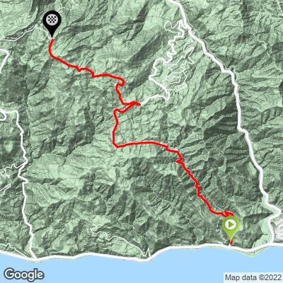
6.4 mi
DISTANCE
2,418 ft
GAINED
7.2 %
AVG. GRADE
FULL CLIMB STATS
INTRO
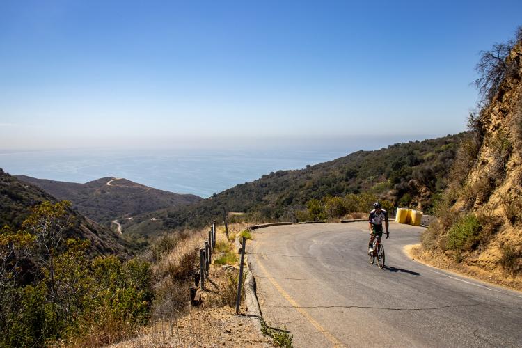
After Deer Creek Road, this is the steepest climb in the Santa Monica Mountains, actually including a steeper 1 mile segment than Deer Creek. After a brutal first 2 miles, the grade eases up. Las Flores Canyon Road barely beats this climb for the hardest in the region.
PLAN YOUR ROUTE
See more details and tools regarding this climb's grade via our interactive Profile Tool.
Roadway & Traffic:
Pavement surface is great. There are a few blind turns to watch out for cars, so hug the yellow line on the right side and listen for cars. Parking:
There is free parking all along the Pacific Coast Highway. If you're traffic averse, park as close to you can to the start of the climb you're doing. Despite the PCH being one of the most popular cycling roads in the United States, it's known to be a dangerous place for cyclists.
Alternatively, there is parking up in the mountains at Tuna Canyon Park, or on Saddle Peak.
A house on Stunt Road kindly provides a water fountain for cyclists on this driveway, about a mile past the top of the climb.
Before heading out on any cycling adventure check out our Things to Bring on a Cycling Trip and use our interactive check list to ensure you don't forget anything.
ROUTE MAP
MEMBER RATING
CURRENT WEATHER
PJAMM TRIPS ADVENTURE STARTER BUNDLES
Check out PJAMM Adventure's prepackaged (self-guided) cycling trips. They will help you plan, document and conquer your next adventure.
NEARBY CLIMBS (0) RADIAL PROXIMITY
FROM No Climbs Found
MEMBER REVIEWS & COMMENTS
Let us know what you thought of this climb. Signup for our FREE membership to write a review or post a comment.
Already have an account?
LOG IN HERE
joelmblatt
Road is closed, because storms have caused serious damage. I walked around trees and navigated gates, but did it. Although, you will find two shorter segments in Strava, which map to the actual Tuna Canyon climb, because it dips down briefly before last little climb. 3/4 of climb is 1-way coming down the hill, but again there are no cars!
Tinypip
A great climb, steep without being brutal. There is some traffic, but doesn't feel unsafe.