35
PDI
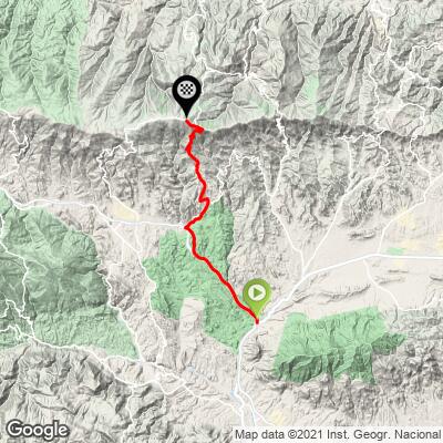
22.3 mi
DISTANCE
6,508 ft
GAINED
5.1 %
AVG. GRADE
FULL CLIMB STATS
Page Contributor(s): Jill and Bryant Robbins, Palmer, AK, USA
INTRO
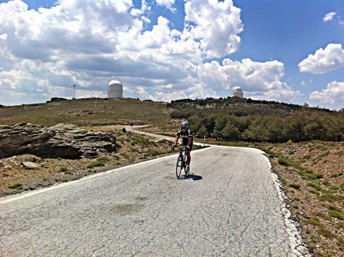
Ride from the Desierto de Tabernas to Observatorio Calar Alto, one of the largest observatories in Europe (Google Map + Reviews). This climb has been included in the Vuelta a España five times since 2004, most recently in 2017 (as of 2020). Calar Alto is the highest peak in the Sierra de Los Filabres mountains of the Andalusia mountain chain. The climb is in the Almeria Province of Spain which is one of the driest in Europe and one of the reasons the observatory was built where it was.
PLAN YOUR ROUTE
This climb has a 5.1% average grade (6.2% climb only). 36% of the climb is at grade 5-10%, 11% is at 10-15%, 3% is at 15-20%, and a fraction at 20%. The steepest kilometer is 11.3%.
Roadway: Two lane road that parallels busy A-92 for much of the climb (but never puts you onto it). The road is in good condition
Traffic: Mild.
Parking: There is not a lot of parking in the area - try a spot on the side of the road about 750 meters up from the start and then ride back down (Map; Street View).
Provisions: Montellano Asador Restaurante at kilometer 14.8 (Google Map + Reviews).
Before heading out on any cycling adventure check out our Things to Bring on a Cycling Trip and use our interactive check list to ensure you don't forget anything.
On the right one kilometer from the start is the exit for Western Leone, an old movie set featuring Western style buildings (Map; Street View), however, it gets bad reviews (Google Map + Reviews). But, just 850 meters east of the start on N-340a is the hugely popular "Mini Hollywood" which gets very good reviews and seems like it would be fun to visit (Map; Street View; Google Map + Reviews).
While in the area be sure to ride the iconic and more peaceful Alto Velefique which essentially runs parallel to Calar Alto to the east.
ROUTE MAP
MEMBER RATING
CURRENT WEATHER
PJAMM TRIPS ADVENTURE STARTER BUNDLES
Check out PJAMM Adventure's prepackaged (self-guided) cycling trips. They will help you plan, document and conquer your next adventure.
NEARBY CLIMBS (0) RADIAL PROXIMITY
FROM No Climbs Found
MEMBER REVIEWS & COMMENTS
Let us know what you thought of this climb. Signup for our FREE membership to write a review or post a comment.
Already have an account?
LOG IN HERE