
65.6
PDI
44.2 mi
DISTANCE
11,172 ft
GAINED
4.7 %
AVG. GRADE
FULL CLIMB STATS
Page Contributor(s): Ties Arts, Bussum, Netherlands; Jelmer Brinkman, Lent, Netherlands; Bryan Kevan, Berkeley, CA, USA
INTRO
An extremely long climb in rural Peru that never seems to let up.
This climb will give you an experience like no other, giving an intimate experience of rural Peru that the normal tourist would never see.
PLAN YOUR ROUTE
See more details and tools regarding this climb's grade via our interactive Profile Tool.
Roadway & Traffic:
Most of the climb is good pavement, but there is a 20km section in the middle which is being repaved (Dec 2021), which unfortunately means that as of 2021, the steepest 5mi/10km section of the climb is on dirt. We still rode it on 25mm tires, but weren't thrilled about it. We have no idea when the re-paving will be completed.
This is the most popular truck route from Lima to Huaraz, two of the biggest cities in the region. Traffic can be heavy on this road with big trucks and buses driving recklessly on the winding mountain roads (as is customary in much of South America).
Parking:
The best place to park, stage, and start your ride is in the town of Chasquitambo. There are hotels, stores, restaurants, and other accommodations here. The town of Conococha at the summit is the next best place to park.
When you're in an area like rural Peru you never know exactly what you're going to get till you're there. Fortunately if you're cycling in Peru, you're definitely the adventurous type. We recommend smooth tires above 30mm for all of these rides, but 25s will work. We also highly recommend bringing a spare tire with you on your trip.
One of the things that makes this climb so tough is the drastic altitude change. Bring gear for all sorts of weather conditions like fog, rain, and snow can appear in an instant in the Andes.
We recommend carrying a stick; while most of the dogs in the region are friendly, there a few dogs that will chase you and could bite if you don't have something to fend them off with.
Before heading out on any cycling adventure check out our Things to Bring on a Cycling Trip and use our interactive check list to ensure you don't forget anything.
The best place to park, stage, and start your ride is in the town of Chasquitambo. There are hotels, stores, and restaurants here. However, you may have better luck and more options staying in Lima, 2 hours south of the climb.
When we climbed here in 12/2021, we stayed the night at Hospedaje fe y Alegría, and ate some excellent authentic Peruvian food at a restaurant here (too new to be on google maps).
We really recommend traveling to Peru with a guide - it made our trip far easier and way more enjoyable. contact us to be put in contact with some trusted guides.
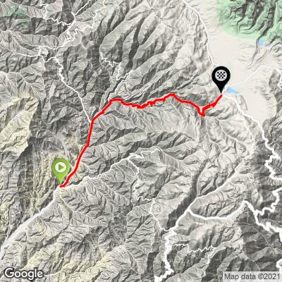
ROUTE MAP
MEMBER RATING
CURRENT WEATHER
PJAMM TRIPS ADVENTURE STARTER BUNDLES
Check out PJAMM Adventure's prepackaged (self-guided) cycling trips. They will help you plan, document and conquer your next adventure.
NEARBY CLIMBS (0) RADIAL PROXIMITY
FROM No Climbs Found
MEMBER REVIEWS & COMMENTS
Let us know what you thought of this climb. Signup for our FREE membership to write a review or post a comment.
Already have an account?
LOG IN HERE
ayale

This is another otherwise-awesome Peruvian climb made difficult by stray dogs. I wouldn't recommend it unless you are vaccinated for rabies and very comfortable dealing with aggressive dogs. I actually thought they were worse than Punta Callan. One dog was not deterred by the waving of my selfie stick and I thwacked it on the head. It still persisted for a few seconds before it jogged off. The plentiful towns are otherwise very friendly and good for resupply but they are full of dogs that will chase you.
https://www.strava.com/activities/10589851187