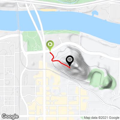
3.2
PDI
0.3 mi
DISTANCE
246 ft
GAINED
18.5 %
AVG. GRADE
FULL CLIMB STATS
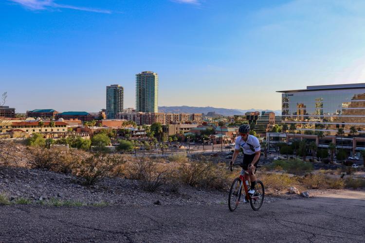
INTRO
This climb may be short, but don't underestimate it: this climb has the one of the steepest average gradients in the world (that we've discovered so far!)
PLAN YOUR ROUTE
See more details and tools regarding this climb's grade via our interactive Profile Tool.
There is a public parking lot at the base of the climb near the lightrail tracks, as well as street parking all along Mill Avenue, as well as free parking at Tempe Beach Park. There is free parking across the Mill Avenue bridge, on the north side of Tempe Lake, a 5 minute ride from the start of the climb.
This is a very popular walking path. Biking is perfectly legal, but be wary of pedestrians, especially on the descent.
The actual paved surface is horrible, but its still asphalt - you can do this climbs on 23s.
There are public restrooms and water fountains at the Tempe Beach Park across the street
Before heading out on any cycling adventure check out our Things to Bring on a Cycling Trip and use our interactive check list to ensure you don't forget anything.
If you're going to do this climb, don't miss out on the chance to spend the entire day in Tempe, Arizona! Here are some of our favorite post-ride hangout spots:
Brunch: Daily Jam
Lunch/Dinner: Maskadores Taco Shop; Culinary Dropout
Local Brews (☕️+🍻): Any of the bars along Mill Avenue - party like a true Arizona State University student. Don't miss out on local favorite Cartel Coffee Lab either.
ROUTE MAP
MEMBER RATING
CURRENT WEATHER
PJAMM TRIPS ADVENTURE STARTER BUNDLES
Check out PJAMM Adventure's prepackaged (self-guided) cycling trips. They will help you plan, document and conquer your next adventure.
NEARBY CLIMBS (0) RADIAL PROXIMITY
FROM No Climbs Found
MEMBER REVIEWS & COMMENTS
Let us know what you thought of this climb. Signup for our FREE membership to write a review or post a comment.
Already have an account?
LOG IN HERE
dreidtri
Hard to grade against the likes of Pikes Peak or Palomar Mtn., but it is a brute.