![]()
Cycling Onion Valley Road: The highest ranked road bike climb in California
Ride 12.9 miles to 9,180’ gaining 5,388’ at 7.7%
A California Top 10 Most Epic Climb.
If you are not familiar with Onion Valley Road or Owen’s Valley, be sure to download the PJAMM Adventure App and Owen’s Valley PJAMM Tour to help you navigate, keep track of your trip mates, share your adventure with others, maintain an itinerary and interactive map along with other helpful travel tools.
Note: Check weather conditions with the Inyo National Forest Service for each climb you intend to do and the Inyo County road conditions website before traveling to Owens Valley to cycle anytime after September or before June.
Climb summary by PJAMM’s John Johnson.
![]()
“Onion Valley is an amazing climb, perhaps the most difficult in California and is among the most difficult and spectacular in the world. You will likely understand the beauty of the eastern Sierra Nevada at its starting point. Enjoy the first few miles through the boulder field (and the views of the wall of mountains in front of you) as they are just about the only break you will get on this hill. As you ascend the grade generally increases with the last ten miles averaging over 8%. Just under 3 miles in you encounter steeper grade as the roadway begins to flow through multiple S curves. With more solid grade comes a switchback to the right as the climbing gets down to serious business and a more alpine feel. More switchbacks are encountered as you climb the ridge along solid grade and over several more cattle guards.
The long ramps and solid grade continue as you ride along the ridge of the massive Sierra Nevada Mountains. Approximately halfway through the ascent a very dramatic section of stacked switchbacks with views and exposure must be negotiated which may be the visual highlight of the ascent. As you ride higher a view stately pines are encountered and you can often hear (but not see) a rushing creek in the large defile to your south. The views of massive Owens Valley here are amazing as you ride through multiple switchbacks and mostly steady grade over this stretch of climbing. After this section several graceful S curves take you into an upper canyon and further up the wall with snow-capped mountain views most of the year. A straight section due west then carries you toward the summit over still solid grade. The grade only eases just before the summit and the hill ends at a parking area for hikers (the end is considered where the road splits at the beginning of the upper parking area - sign 9200 feet) in an alpine bowl. The pavement continues for a short distance beyond this lower parking area and you will likely always find hikers at the summit. Onion Valley is one of those relatively rare hills where you may rue the end of the climb.
Some report that due to the relatively steady grade and scenery they float up the road and due not consider the climb super difficult. Just keep in mind this is a long and steep hill so go prepared. The descent is hair-raising and perhaps the top overall downhill in the United States. Onion Valley is significantly longer and almost as steep as Alp d’Huez, steeper and longer than the Tourmalet and the Galibier, and longer and as steep as the Madeleine, all famed French climbs that are regularly included in the Tour de France and considered among the most difficult used in that Tour…” (This quote is presented with the approval of John Summerson, from his book, The Complete Guide to Climbing (by Bike), 2nd Edition, pg. 138.)
![]()
Start climb in Independence, CA.
Onion Valley Road is rated as the most difficult bike climb in California (CA Top 10), #5 in the United States (US Top 10), and #81 in the world (see PJAMM Home Page for Top 100 World list) , with a Fiets Index score of 14.5.
![]()
Start
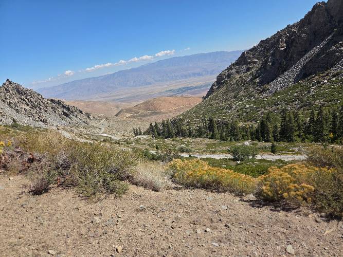
This magnificent climb is located in the heart of Owens Valley, which, with a base elevation of 4,500' and surrounded by multiple 14,000' peaks, is one of the deepest valleys in the U.S. Owens Valley is a graben “down dropped” block of land situated between two vertical faults, creating the unparalleled extended steep grades along the valley’s eastern border with the Sierra Nevada Mountains. The Owens Valley is a mecca for road bike climbing and boasts the greatest concentration of Top 100 Climbs of any area in the country. For more information on other rides in the area, check out our Owens Valley Climb Area Page.
![Near top Cycling near the top of Onion Valley Road, Owens Valley CA]()
The steepest ¼ mile is 15% and begins ½ mile past this sign.
![Near top Cycling near the top of Onion Valley Road, Owens Valley CA]()
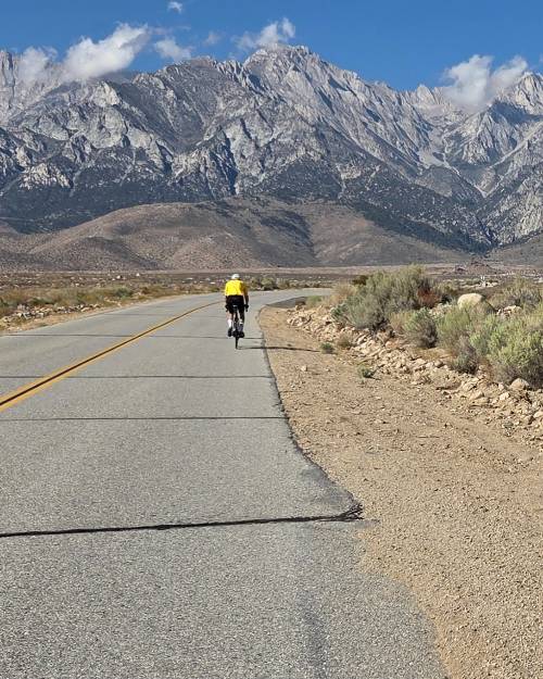
Eastern Sierra Mountains -- extremely steep.
The 13 mile climb averages nearly 8%, and I did not see my Garmin go below 7% over the last eight miles. And lets just say that was looking at it (read: down) a lot! The grade is very steady at 8-9% with some segments reaching 12% and others 7% over the last half of the climb -- that, coupled with altitude, makes this a very challenging bike climb.
![Horseshoe Meadows Road View of Horseshoe Meadows Road from Onion Valley Road]()
Horseshoe Valley Road to the left as we begin the climb.
When to Climb Onion Valley Road by Bike: Well, more like when not to do the climb -- we are too close to Death Valley to be doing anything in the Owens Valley in the summer. OK, honestly, we have done rides in and near Death Valley in the summer a lot, but do not recommend it. The average high temperatures for the summer time frame are 92° in June, 98° in July, and 96° in August. We suggest May or September, as the months just before or after could put you into a snowstorm as we climb towards the top of this dead-end climb that tops out just above 9,000’.
![Looking East from top Cyclist nearing the top of Onion Valley Road]()
How to Climb Onion Valley Road by Bike: Pick the right time and train well, as this is the hardest climb in California at 13 miles and 7.7% average grade (¼ mile at 13.4% and ½ mile at 11.7%). The climb begins in Independence, California, at the corner of North Webster Street and Onion Valley Road (Strava Onion Valley segment start; Latitude: 36.80159, Longitude, -118.20197). We commonly stay in Bishop (40 miles north of Independence, and the start of the Onion Valley Climb) at the Creekside Inn, next to Erick Schat’s Bakery. Together, the inn and the bakery make the 40 mile trip to the climb worthwhile.
![]()
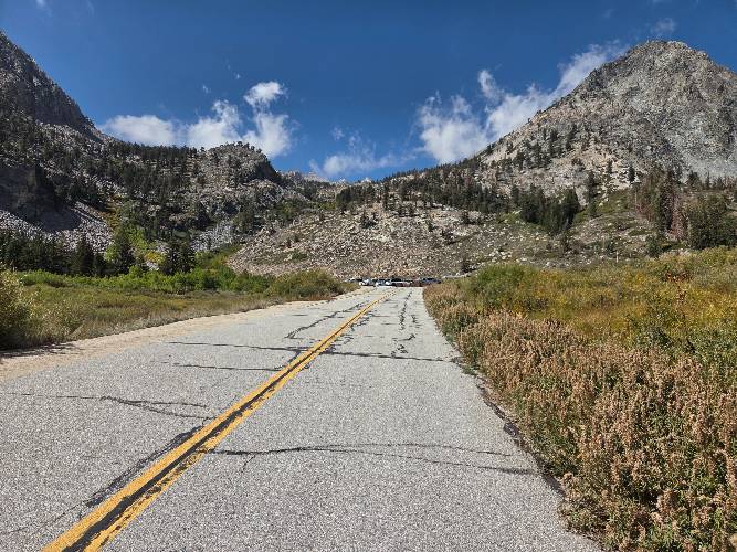
Except for the first couple of miles, this climb averages nearly 8% -- it is a very challenging climb.
While there is at least one climb in the area that rivals Onion Valley (U.S. 100 #7/World #91 Horseshoe Meadows), Onion Valley Road is almost uniformly considered the most difficult road bike climb in California, and rightly so. There are no provisions along this route and the temperatures during the summer will often exceed 100℉ for the first half of the climb. Cross winds are also a factor on the descent.
![Inyo Forest Inyo National Forest sign on Onion Valley Road, Independence, CA]()
Enter Inyo National Forest at mile 3.8.
![]()
![Onion Valley Road Bicycle climb Onion Valley Road - Independence, Owens Valley and road leading from Indpendence]()
Photo Center: Independence is the green area.
HAIRPIN HEAVEN
(10 giant hairpins)
![Onion Valley Road Cycling Onion Valley Road - hairpins and owens valley]()
We make our way through the middle set of the hairpins.
![Onion Valley Road Climbing Onion Valley Road by bike - cyclist on giant hairpin with mountains in background]()
Last hairpin, one mile to the finish.
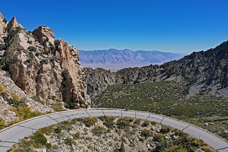
There are eight giant hairpins from miles 9.2 to 11.8, over an average and consistent 8.1% grade. Although Onion Valley Road’s eight hairpins fall 40 short of Stelvio’s . . . there is a bit of a resemblance, don’t you think??
![Onion Valley Road Cycling Onion Valley Road - hairpins and owens valley]()
Seven of the last eight hairpins on OVR, compared to . . .
![Onion Valley Road Bicycle ride Onion Valley Road - hairpins]()
. . . Passo Dello Stelvio, Italy -- the most famous hairpins in the world.
![Summit Onion Valley Road Cyclist at Onion Valley Road Elevation 9200 sign]()
Photos clockwise from top right -
2011, 2019, 2014, 2017.
Roadway Surface and Traffic Report: The roadway surface as of October, 2019 was good and traffic has been very light the six times we have climbed Onion Valley Road between 2011 and 2019. The only irritation are the freeze joints in the road which are noticeable on the descent (see photo above).
![]()
Those joints get old after a while on the descent. 😞
![]()
That’s a wrap!!
 We've partnered with Sherpa-Map.com to bring you the best route planning tool. With a PRO Membership you can use this climb as a reference when creating your route.
