
19.7
PDI
6.1 mi
DISTANCE
2,710 ft
GAINED
8.5 %
AVG. GRADE
FULL CLIMB STATS
Page Contributor(s): Carl Hansen, Guernsey, UK
INTRO
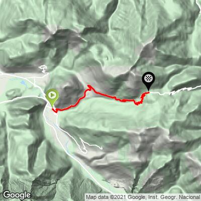
The Col de Mente climbs 9.7 km (6.0 mi) from Saint-Béat in the Garonne valley, gaining 826 m (2,710 ft) at an average grade of 8.5%. The pass, at 1,349 m (4,426 ft), links the Garonne and Ger valleys in the Haute-Garonne, and our route finishes at 1,331 m (4,368 ft), just below the summit.
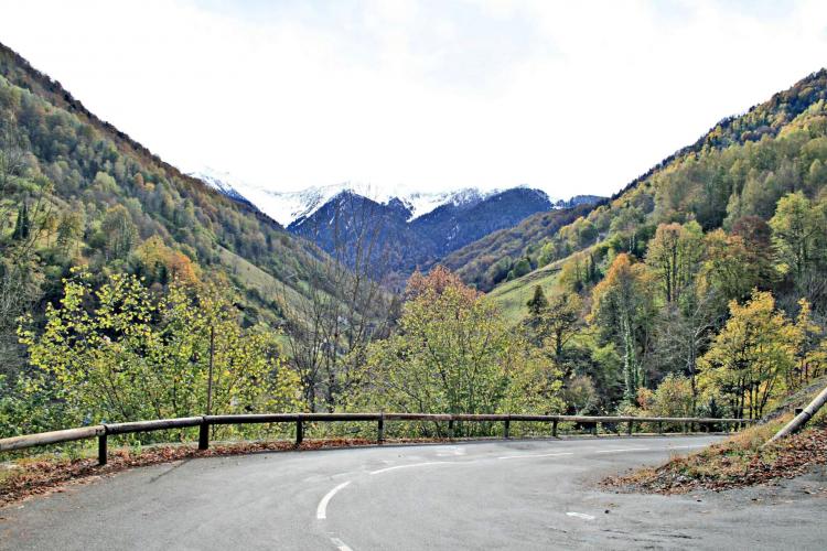
Almost the whole climb sits between 5% and 10%, with very few flat spots to recover. After the nearly flat first 360 m (0.2 mi) past a campsite, the road turns left and ramps up, eases a little before Boutx, then steepens again beyond it. The last 3 km (1.9 mi) are hairpins through dense forest, and there is little shade or view for most of the way, so this is a hot climb on a summer afternoon.
The Col de Mente has been part of the Tour de France since 1966 and has featured more than 20 times. It is best known for the 1971 Tour, when race leader Luis Ocaña crashed on the descent in a storm after Eddy Merckx skidded ahead of him, and was then hit by Joop Zoetemelk, ending his Tour. A plaque cemented into the rock on this west side, about 3.5 km (2.2 mi) below the summit, marks the spot. The pass is also the gateway to the Le Mourtis ski station, about 1.5 km (1 mi) further.
PLAN YOUR ROUTE
 We've partnered with Sherpa-Map.com to bring you the best route planning tool. With a PRO Membership you can use this climb as a reference when creating your route.
8.5% average grade over 9.7 km (6.0 mi), and remarkably consistent: about 85% of the climb is at 5-10%, 10% is at 10-15% and only 5% is at 0-5%. The steepest 0.4 km (0.25 mi) is 10.3%, the steepest 1.6 km (1 mi) is 9.4% and the steepest 5 km (3.1 mi) is 9.1%.
Gradients are steadier than on many Pyrenean passes, so pace yourself from the start rather than waiting for a rest.
Roadway: Paved and wide, in generally good condition. Rider reports over the years have mentioned loose gravel after resurfacing and work on the hairpins, so watch the surface on the way down.
Traffic: Light. The road is sometimes closed to motor traffic on Tour de France days.
Parking: Saint-Béat is a small village and the start sits just beyond it, so park in the village and roll out. The first 360 m (0.2 mi) are nearly flat, which makes a short warm-up before the road kicks up.
Provisions: Carry plenty of water. There are few fountains on the climb, and the only reliable water is at the lavoirs (public washhouses) in Boutx.
Weather and Gear: Shade is limited for most of the climb, so go early or late in summer. Cloud can rise from the valley in the afternoon and hide the views, and the summit is in woods with no real viewpoint.
Before heading out on any cycling adventure check out our Things to Bring on a Cycling Trip and use our interactive check list to ensure you don't forget anything.
Saint-Béat sits in a narrow stretch of the Garonne between two of the region's most visited sites, Saint-Bertrand-de-Comminges and Luchon. The Romans knew it as Passus lupi (the Wolf's Pass) and quarried its marble, and the village still has a feudal castle and 12th-century Romanesque churches, plus a marble and sculpture festival.
The Col de Mente combines naturally with its neighbors: the east side from Boutx is on our Col de Mente page, and the Col de Portet d'Aspet can be linked with it. If you want a gentler option, riders use the Col des Ares and Col de Buret to the north. Our Routes in the Area tool shows what else is within reach.
For those looking to stay in the area we would recommend the Pyrenees Cycling Lodge. Located in the beautiful medieval village of Saint Savin and hosted by Mark & Niamh, the Lodge is run by cyclists for cyclists. It is a great location for any cycling adventure in the Pyrenees with several renowned climbs within 100 km (62 mi) of the property and 6 Tour de France climbs within 15 km (9.3 mi). Visit their website or contact them directly at pyreneescyclinglodge@gmail.com.
ROUTE MAP
MEMBER RATING
CURRENT WEATHER
PJAMM TRIPS ADVENTURE STARTER BUNDLES
Check out PJAMM Adventure's prepackaged (self-guided) cycling trips. They will help you plan, document and conquer your next adventure.
NEARBY CLIMBS (0) RADIAL PROXIMITY
FROM No Climbs Found
MEMBER REVIEWS & COMMENTS
Let us know what you thought of this climb. Signup for our FREE membership to write a review or post a comment.
Already have an account?
LOG IN HERE
