8.7
PDI
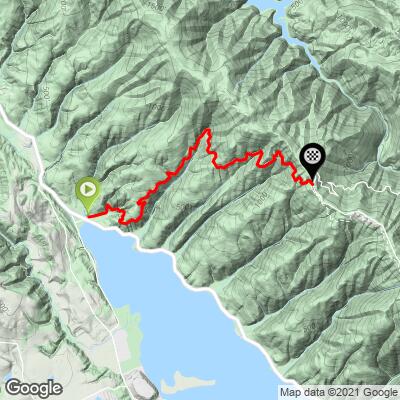
4.4 mi
DISTANCE
1,507 ft
GAINED
6.4 %
AVG. GRADE
FULL CLIMB STATS
INTRO
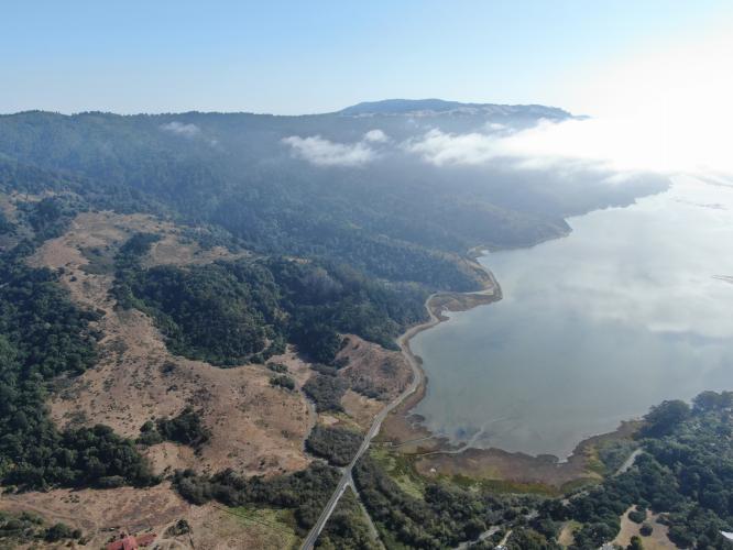
Like many of these extremely peaceful and scenic western Marin County climbs, we are surrounded by redwoods much of the way. "BoFax" as it is referred to locally, begins at the northern end of Bolinas Lagoon and climbs to the three-way intersection of Ridgecrest Boulevard (the route from this point to the top of Mt. Tam)- Fairfax-Bolinas Road- Bolinas Ridge Road. It is not uncommon to encounter more cyclists than vehicles on this route - as of August 19, 2015 there were 19,682 "attempts" (rides) by 5,438 cyclists up this Strava segment; and as of January 10, 2021 there were 53,880 attempts by 11,086 cyclists.
PLAN YOUR ROUTE
The average grade is 6.3%; 31% (1.3 miles) is at 0-5%, and 58% (2.6 miles) is at 5-10% grade. The steepest quarter-mile is 10.3% and steepest half-mile is 9.2%.
See more details and tools regarding this climb's grade via the “Profile Tool” button.
Roadway; Fully paved and in good condition. The road is very narrow with no center strips. Beware of debris on the descent.
Traffic: Minimal to none - this is a safe ride.
Parking: You can park at the junction at the climb finish (Map; Street View) or start (Map; Street View).
Provisions: Stinson Beach Market four miles south on Highway 1 or Fairfax 15 miles northeast.
Before heading out on any cycling adventure check out our Things to Bring on a Cycling Trip and use our interactive check list to ensure you don't forget anything.
See the Routes in Area button on the menu bar above or our climb area page for more great bike climbs in this area - Marin County.
While there are lodging options in Marin County you can always elect to stay in nearby San Francisco and enjoy the city while on your cycling adventure. There are some house rental options in Marin County too.
ROUTE MAP
MEMBER RATING
CURRENT WEATHER
PJAMM TRIPS ADVENTURE STARTER BUNDLES
Check out PJAMM Adventure's prepackaged (self-guided) cycling trips. They will help you plan, document and conquer your next adventure.
NEARBY CLIMBS (0) RADIAL PROXIMITY
FROM No Climbs Found
MEMBER REVIEWS & COMMENTS
Let us know what you thought of this climb. Signup for our FREE membership to write a review or post a comment.
Already have an account?
LOG IN HERE