INTRO
PLAN YOUR ROUTE
 We've partnered with Sherpa-Map.com to bring you the best route planning tool. With a PRO Membership you can use this climb as a reference when creating your route.
 ROUTE MAP


 We've partnered with Sherpa-Map.com to bring you the best route planning tool. With a PRO Membership you can use this climb as a reference when creating your route.
Cycling Mt. Tamalpais, Marin County from Fairfax-Bolinas Road
Ride 9.8 miles gaining 2,638’ at 4.7% average grade.
Climb to Mt. Tam West Peak | Strava Attempts as of 2-1-2023 |
31,122 | |
26,755 | |
8,735 | |
7,603 | |
7,195 | |
3872 | |
863 |
Popularity of top routes up Mt. Tam
It doesn’t get more quintessentially Marin County than cycling Mt. Tamalpais. Mt. Tam is commonly considered the symbol of Marin County, and cycling this gorgeous climb up a landmark mountain in a world class cycling area is bound to be the making of a great day in the Bay. Like many of these extremely peaceful and scenic western Marin County climbs, we are surrounded by redwoods much of the way. The climb begins at the northern end of Bolinas Lagoon and climbs to the three-way intersection of Ridgecrest Boulevard (the route from this point to the top of Mt. Tam) / Fairfax-Bolinas Road / Bolinas Ridge Road.
Before heading to the bay area on your cycling adventure, be sure to rely on our list of Things to Bring on a Cycling Trip, and use our interactive checklist to ensure you don't forget anything.
There are 3 segments to Alpine Dam to Mt. Tam road bike climb.
SEGMENT ONE - HWY 1 TO INTERSECTION OF BOLINAS FAIRFAX AND RIDGECREST
This climb begins at the intersection of Fairfax-Bolinas Road and Hwy 1. This segment is a climb onto itself at 4.3 miles gaining 1,470’ at 6.5% average grade. These 4.3 miles are on a narrow and minimally travelled road - this is just a great climb onto itself!
Start of the climb - Hwy 1-Fairfax-Bolinas Road
1600’ view of climb start - Fairfax-Bolinas Rd bottom-middle of photo
After a very brief open section we are initially surrounded by oak and high brush . . .
. . . then by redwood trees.
Photo at the finish of this segment.
SEGMENT TWO - RIDGECREST TO PANTOLL
From Fairfax-Bolinas Road we turn right and follow rollers along Ridgecrest Boulevard for four miles to the intersection of Pantoll Road and Ridgecrest Boulevard.
Beginning of the second segment . . .
. . . RIDE 4 MILES AT 2.4%
Views open up at mile 3.
Ride the rolling roadway atop a true ridgeline for 2 ½ miles at 3% average grade.
Alpine Dam as seen from 1600’ above the ridgeline.
View north - photo left center is where the views open up.
Aerial view of the southern portion of the 3 mile ridgeline ride.
Along these four miles are the Pacific Ocean to our right and views of Eastern Marin to the left . . . .
Some stunning views on this segment (Bolinas Bay to the left).
. . . and, on a clear day ,Mt. St. Helena in Napa/Sonoma County to the north.
SEGMENT THREE - EAST RIDGECREST BLVD TO WEST PEAK
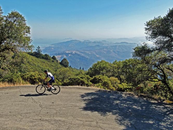
The final leg up to the top of Mt. Tam West Peak is 1.5 miles at 6.5%, with a gain of 517'. The views of San Francisco and the Bay along this segment are absolutely spectacular - the best anywhere, in our opinion.
Pass the entrance to the old Cold War Air Force Station ¼ mile from the top.
We took a detour to the old radar dome (note - the road is marked “no trespass”)
A bit hazy this day, but San Francisco is center of photo.
Come for the ride, stay for the views.
That’s a wrap . . . for Mt. Tam anyway . . .
And we are just a stone’s throw from the Golden Gate and San Francisco.