INTRO
PLAN YOUR ROUTE
 We've partnered with Sherpa-Map.com to bring you the best route planning tool. With a PRO Membership you can use this climb as a reference when creating your route.
 ROUTE MAP


 We've partnered with Sherpa-Map.com to bring you the best route planning tool. With a PRO Membership you can use this climb as a reference when creating your route.
Cycling Mt. Tamalpais via Panoramic Highway South
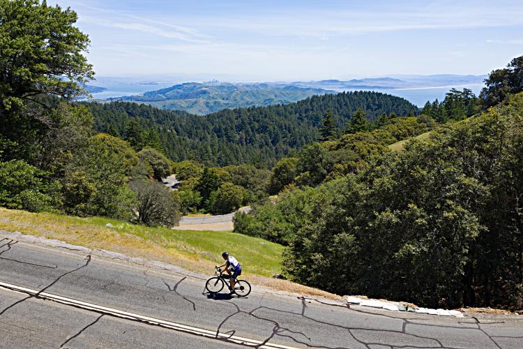
View from Pan Toll Road South
Ride 10.3 miles gaining 2,724’ at 4.7% average grade.
Climb to Mt. Tam West Peak | Strava Attempts as of 2-1-2023 |
31,122 | |
26,755 | |
8,735 | |
7,603 | |
7,195 | |
3872 | |
863 |
Popularity of top routes up Mt. Tam
Before heading to the bay area on your cycling adventure, be sure to rely on our list of Things to Bring on a Cycling Trip, and use our interactive checklist to ensure you don't forget anything.
This climb is one of the four primary routes in Marin County to the top of Mt. Tamalpais.
Mt. Tamalpais is the highest mountain in the Marin County and has two peaks: the East Peak (2,574') and West Peak (2,563'). The white radar dome that sits upon Mt. Tam's slightly lower western peak is quite discernible from afar. An exceptionally scenic and unique riding opportunity is to ride from the Golden Gate Bridge to the top of Mt. Tam (see details at GGB page).
This climb is divided into three parts:
Mile 2.2 (just after turning onto Panoramic Highway).
Working our way up the mountain.
Top left: Dome as seen from Ridgecrest Boulevard (from Alpine Dam and Fairfax-Bolinas routes)
Bottom left: Dome as seen from Panoramic Highway (north/south) and Muir Woods routes.
Bootjack Campground mile 7. Intersection of Shoreline and Pantoll Road at mile 7.3.
Turn right onto Pantoll Road at the intersection.
Junction of Pantoll Road and Ridgecrest Boulevard
Make this climb part of your Bay Area vacation.
That’s a wrap!!