
18.7
PDI
5.2 mi
DISTANCE
2,470 ft
GAINED
9.1 %
AVG. GRADE
FULL CLIMB STATS
Page Contributor(s): Giacomo Rizzo, Madrid, Spain
INTRO
Passo Cuvignone North climbs 8.3 km (5.2 mi) from the hamlet of Sarigo in Castelveccana, just above the Lombard shore of Lake Maggiore, to the Passo del Cuvignone at 1044 m (3425 ft). It gains 753 m (2470 ft) at a relentless 9.1% average and currently ranks #1145 in the world in our database.
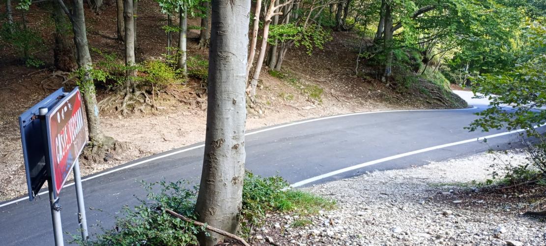
This is a climb with very little relief. The road leaves Castelveccana on the SP7 and works up through the forest to the Valico di Sant'Antonio, a small saddle where the church of Sant'Antonio sul Monte looks out over the lake, then picks up the SP8 for the final push to the pass. After a gentler first kilometer, the grade rarely drops below 9%, and the steepest 5 km (3.1 mi) average 10.1%. The upper road is narrow and almost entirely wooded, passing Alpe di Cuvignone before a run of tight hairpins brings you to the top.
The pass is a forested saddle beneath Monte Nudo (1235 m / 4052 ft), with Lake Maggiore roughly 800 m (2625 ft) below. Note that the SP8 on the far side of the pass, down to Vararo and Cittiglio, was closed for much of 2026 after a heavy March snowfall brought down trees and rock above Vararo. This climb is unaffected, but plan your descent accordingly - see Roadway & Parking for details.
PLAN YOUR ROUTE
 We've partnered with Sherpa-Map.com to bring you the best route planning tool. With a PRO Membership you can use this climb as a reference when creating your route.
Passo Cuvignone North is 8.3 km (5.2 mi) long and climbs 753 m (2470 ft) at an average of 9.1%, from 291 m (955 ft) at Sarigo to 1044 m (3425 ft) at the top. There is no descending at all along the way.
The first kilometer is the gentlest at about 6%. The second kicks up to nearly 10%, the third eases back to about 6.5%, and from there the climb never lets go: every remaining kilometer averages between 9% and 11%. The steepest kilometer, from about km 6 to km 7 (mile 3.7 to 4.3), averages 11.4%, and the steepest mile averages the same 11.4%.
The steepest 2 km (1.2 mi) average 11.0%, and the steepest 5 km (3.1 mi), which make up most of the second half of the climb, average 10.1%.
Roadway: Paved all the way. The SP7 from Castelveccana to the Valico di Sant'Antonio and the SP8 from there to the pass are narrow mountain roads, winding through forest with tight hairpins in the upper section, and September 2025 Street View imagery shows sound asphalt throughout. Loose stones and forest debris can collect on the road, especially after storms, and the shifting light and shade under the trees makes them hard to spot on the way down. On the far side of the pass, the Provincia di Varese closed the SP8 between Vararo and the Cuvignone to all traffic, cyclists included, after a heavy snowfall on March 15, 2026 brought down trees and rocks; the closure was extended to at least September 1, 2026, so check the province's road notices before planning to descend toward Cittiglio.
Traffic: Very light. Beyond the houses scattered along the lower road and a few cars heading to Sant'Antonio, you'll see very little motor traffic on this side of the pass.
Parking: The start in Sarigo is on a narrow road through a small hamlet, with no dedicated parking. The easier option is to base yourself along the Castelveccana lakeshore below and ride up to the start as a short warm-up.
Provisions: There is a restaurant at the Valico di Sant'Antonio, roughly two-thirds of the way up, but otherwise nothing on the climb itself, so fill bottles and pick up food in the lakeside villages before you start.
Gear: With nearly 6 km (3.7 mi) at 9-11%, low gearing makes this climb far more enjoyable - think a compact crankset with a 32- or 34-tooth cog. The road is shaded and the pass is about 750 m (2460 ft) above the lake, so it can be noticeably cooler at the top; bring a layer for the descent.
Before heading out on any cycling adventure check out our Things to Bring on a Cycling Trip and use our interactive check list to ensure you don't forget anything.
Castelveccana is a collection of small hamlets spread between the lakeshore and the hills, and the climb starts in one of the best of them. Sarigo is the town's best-preserved rustic corner, with stone houses and the Romanesque church of San Giorgio, which still has its original apse and bell tower. Down by the water, Caldè was known for centuries for its lime, produced in kilns from the 1200s to the early 1800s, and the church of Santa Veronica sits just below the Rocca, the promontory above the hamlet. The Cascata della Froda, a waterfall of about 100 m (328 ft) fed by water from the Cuvignone, is another worthwhile detour.
The pass can also be climbed from Cittiglio via Vararo on our Passo Cuvignone South page and from the Valcuvia via the painted village of Arcumeggia on Passo Cuvignone East, and Alpe di Neggia (Maccagno) starts a short way up the same shore. Our Routes in the Area tool lists the other climbs around this side of the lake and lets you build a custom route that links them.
ROUTE MAP

MEMBER RATING
CURRENT WEATHER
PJAMM TRIPS ADVENTURE STARTER BUNDLES
Check out PJAMM Adventure's prepackaged (self-guided) cycling trips. They will help you plan, document and conquer your next adventure.
NEARBY CLIMBS (0) RADIAL PROXIMITY
FROM No Climbs Found
MEMBER REVIEWS & COMMENTS
Let us know what you thought of this climb. Signup for our FREE membership to write a review or post a comment.
Already have an account?
LOG IN HERE
