Page Contributor(s): Dan Razum, Campbell, CA, USA
INTRO
PLAN YOUR ROUTE
 We've partnered with Sherpa-Map.com to bring you the best route planning tool. With a PRO Membership you can use this climb as a reference when creating your route.
 ROUTE MAP


Page Contributor(s): Dan Razum, Campbell, CA, USA
 We've partnered with Sherpa-Map.com to bring you the best route planning tool. With a PRO Membership you can use this climb as a reference when creating your route.
Cycling Sonora Pass East.
9.7 miles gaining 2,905’ at 5.3% average grade.
This is the less traveled and less known of the Sonora Pass climbs. However, this hidden climbing jewel has some serious pop to it. It is perhaps even more difficult (if you just consider the climb segments and eliminate the 0.6 to 0.7 of flat along the ascent). The first and last miles of this climb exceed 10% (see elevation grid, below) and there are 5 8+% segments along this bruiser.
Before heading out to tackle Sonora Pass, be sure to rely on our list of Things to Bring on a Cycling Trip, and use our interactive checklist to ensure you don't forget anything.
As with the duplicate sign at the beginning of Sonora West, this is not correct.
The steepest grades we experienced were in the 15% range.
The climb begins just west of the Marine Corps Mountain Warfare Training Center with wide open, but not spectacular views. However, not too much later we are climbing through thick forest with many open views of the Sierra Nevada Mountains that we are climbing towards and over.
The first road over Sonora Pass was completed in 1865.
The climb from the east is also a bit easier and includes several brief descents which knocks down its overall average grade to 5.3% -- it is harder than that!
First time we encountered such a sign.
The climb is in the Humboldt-Toiyabe National Forest (6,289,821 acres, est. 1907).
Mile 2.5 -- beginning of the steepest mile (11.1%; 7,130’).
Mile 3.2 in the middle of a one mile 11% grade.
Sierra Nevada Mountains and West Walker River.
At the hairpin mile three, view east.
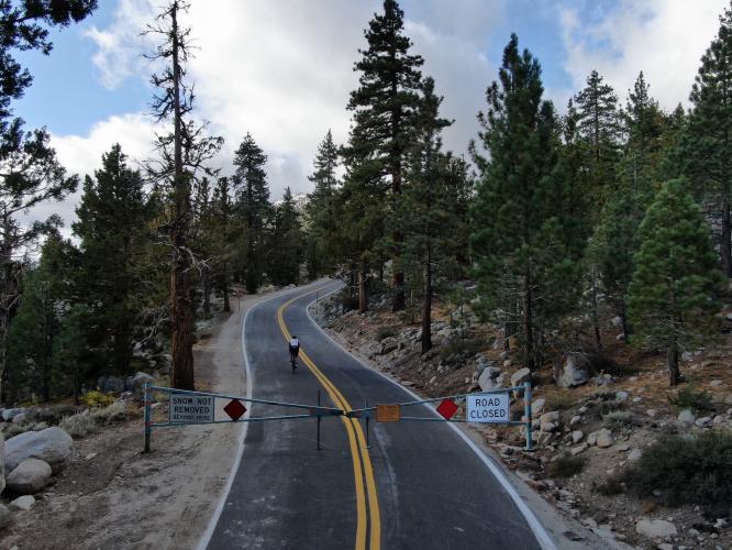
We ran into a brief obstacle in October 2019.
Mile 7.5.
The Pacific Crest Trail crosses the summit of Sonora Pass East/West.
Traffic and Roadway Surface Report: The roadway surface is excellent throughout this ride and although there is minimal shoulder, traffic is light and this seems to be a safe ride.
This climb can be done as an out and back from Kennedy Meadows (the beginning of U.S. Top 100 Climb #46, Sonora Pass West). As with Sonora Pass West, the views along this route are very scenic and worth the torture of the climb. Unlike the southeastern Sierra climbs, there is no long shallow entry to Sonora West or East -- you are challenged immediately and the tone of that introduction continues throughout the climb.
That’s a wrap!!