INTRO
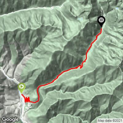
Belvédère (nord) climbs 16.4 km (10.2 mi) from the valley floor at Roquebillière to the end of the road at Pont du Countet in the Vallon de la Gordolasque, gaining 1104 m (3,622 ft) at a 6.7% average and topping out close to 1700 m (5,577 ft). It is the northern approach to Belvédère: instead of the southern branch of the M71, this side stacks its first 4.0 km (2.5 mi) into a tidy ladder of hairpins through the hamlet of Serre, climbing at a steady 5-6% with Roquebillière shrinking beneath your back wheel on every turn.
Once you reach Belvédère the two approaches merge, and the character changes completely. The road swings north into the Gordolasque, a deep glacial valley on the edge of the Mercantour National Park, and the real work begins: from about km 6 to km 12 the grade holds at 7.5-10%, with the steepest kilometer at 10.0%. Higher up, the stone chapel at the tiny hamlet of Saint-Grat marks the start of a near-flat breather along the valley floor before a last ramp to the road end.
This is a dead-end road with no through traffic, big granite walls on both sides, and a real sense of heading into the high mountains - the summits ringing the head of the valley top 3000 m. Roquebillière, at the start, has its own story too: after a deadly landslide in 1926, most of the village moved across the Vésubie, and the valley was hit hard again by Storm Alex in 2020.
PLAN YOUR ROUTE
 We've partnered with Sherpa-Map.com to bring you the best route planning tool. With a PRO Membership you can use this climb as a reference when creating your route.
 Belvédère (nord) is 16.4 km (10.2 mi) long with 1104 m (3,622 ft) of elevation gain, an average grade of 6.7%.
The opening 4.0 km (2.5 mi) from Roquebillière to Belvédère are the gentle part of the day: a steady 5-6% through the hairpins at Serre, easy to settle into and ideal as a warm-up. The next 2 km past the village stay around 5-6% as the road turns into the Gordolasque valley.
From about km 6 the climb gets serious. Km 6-7 averages 7.4%, and km 8-9 is the hardest of the day at 10.0%, followed by a run of kilometers between 7.5% and 9% up to about km 12. The grade then eases to around 6.5% for two kilometers, flattens to about 3% along the valley floor past Saint-Grat, and kicks back up to around 7% for the final ramp to Pont du Countet.
Steepest sections: 0.5 km (0.3 mi) at 11.9%, 1 km (0.6 mi) at 10.0%, 1 mi (1.6 km) at 9.3%, 2 km (1.2 mi) at 9.4%, 5 km (3.1 mi) at 8.8%, and 10 km (6.2 mi) at 7.6%.
Roadway: Paved throughout. The lower section is the northern branch of the M71, a narrow road that climbs from Roquebillière to Belvédère through a stack of hairpins at Serre; above Belvédère you join the Gordolasque valley road (the M171) to its dead end at Pont du Countet. The Vésubie and Gordolasque valleys were badly damaged by Storm Alex in October 2020, and while the road is open, a few rebuilt and narrowed sections remain in the upper valley. Near 1700 m, the top can hold snow well into spring, so check conditions before an early- or late-season ride.
Traffic: Very light on the Serre hairpins, which mainly serve local homes and the hamlet itself. Above Belvédère, traffic is light too, with most cars heading up to the Pont du Countet trailhead on summer weekends.
Parking: Roquebillière is the obvious base - park in the village and ride a few minutes north along the Avenue de Verdun to the start. There is also a free trailhead car park at Pont du Countet at the top if you're being supported or want to hike after the ride.
Provisions: Roquebillière has bakeries, cafés and small shops - the last full services on the route, so fill bottles and pockets before you roll out. Belvédère, 4 km up, is a good place to top off before the long valley section, and the Relais des Merveilles near the top of the Gordolasque serves food in season.
Gear: The first 4 km won't trouble anyone, but the middle of the climb holds 8-10% for several kilometers, so bring a compact or lower gearing. The Gordolasque is a deep, shaded valley and the descent is long, so pack a jacket even on a warm day.
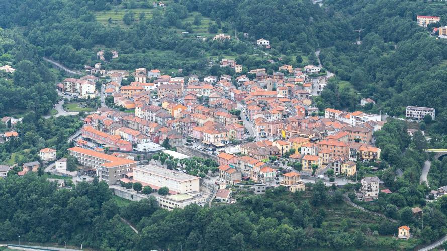
Before or after the ride, take a look around Roquebillière. The Saint-Michel-de-Gast church, a few hundred meters from the start, dates back to a chapel given to the Knights Hospitaller in 1141; the present church was completed in 1533 and is a listed historic monument, with a Gothic triple nave and a 16th-century altarpiece of Saint Anthony. The old village, Roquebillière-Vieux, sits across the Vésubie from the modern center - most residents left it for the other bank after the deadly landslide of November 24, 1926, and a street in the new village is named for that date. Up a side valley above the village, the hamlet of Berthemont-les-Bains sits on the commune's sulfurous hot springs.
At the top, hikers usually head for the Vallée des Merveilles, but there's an easier reward for tired legs: the Cascade de l'Estrech, a big waterfall about 1.5 km (0.9 mi) up the valley on foot from the Pont du Countet car park, around 45 minutes' walk, with a good chance of spotting ibex along the way. The Belvédère village and the upper valley are covered on our Belvédère (sud) page, and Col de Turini, Col de la Colmiane and Madone de Fenestre all start within a few kilometers of Roquebillière - see other climbs nearby, or build a custom route from here, with our Routes in the Area tool.
ROUTE MAP