
23.1
PDI
18.5 mi
DISTANCE
4,718 ft
GAINED
4.4 %
AVG. GRADE
FULL CLIMB STATS
INTRO
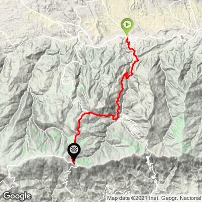
Alto Collado Vento Luisa - more commonly written Collado de Venta Luisa - climbs 29.7 km (18.5 mi) from the town of Tíjola, in Almería's Valle del Almanzora, up into the Sierra de los Filabres. It gains 1,438 m (4,718 ft) at a 4.4% average grade, topping out near 1,966 m (6,451 ft) on a high pass of the same range that's home to Calar Alto, the largest astronomical observatory in continental Europe.
This is a genuine piece of Grand Tour terrain: the collado was a categorized climb on Stage 9 of the 2021 Vuelta a España, part of a string of ascents - Alto de Cuatro Vientos, this collado, and Alto de Castro de Filabres - that the peloton crossed before the day's summit finish at Alto de Velefique. It's a long, steady grind rather than a series of steep ramps, more about sustained effort and remoteness than any single brutal pitch.
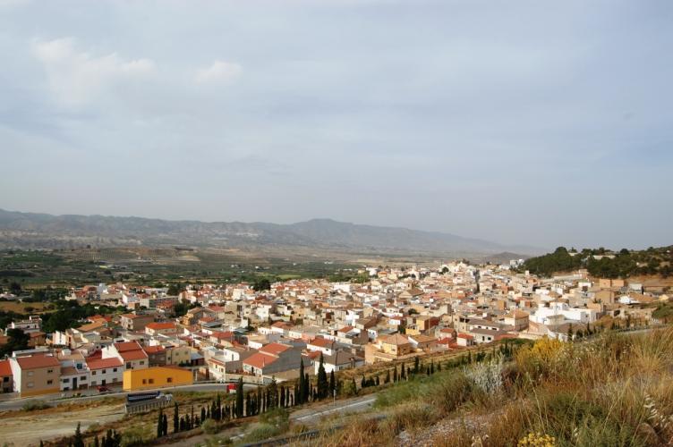
The terrain is classic Almería high country - stark, sparsely populated, and largely treeless above the mid-slopes, with the Filabres range's characteristic pale rock and long sightlines. Pavement holds up well through the Tíjola side, but expect rougher, more patched asphalt in the final kilometers near the collado, typical of the more remote roads in this range.
PLAN YOUR ROUTE
 We've partnered with Sherpa-Map.com to bring you the best route planning tool. With a PRO Membership you can use this climb as a reference when creating your route.
 From Tíjola, Alto Collado Vento Luisa gains 1,438 m (4,718 ft) over 29.7 km (18.5 mi) at a 4.4% average grade - a long climb built more on distance than steepness. The opening quarter-mile is the hardest stretch, averaging 13.0%, and the first half-mile still averages 11.9%.
From there the grade settles quickly: the first mile averages 10.5%, the first 4 km (2.5 mi) average 9.6%, the first 8 km (5 mi) average 7.9%, and the first 10 km (6.2 mi) average 6.4% - a steady taper toward the long, more moderate upper two-thirds of the climb. This climb's #707 world-difficulty ranking reflects a demanding day out built on distance and remoteness more than any single steep section.
Roadway: Paved throughout. The surface is in solid condition on the lower Tíjola side, but pavement quality drops off in the final kilometers near the collado - patched, somewhat rougher asphalt is typical of these remote Sierra de los Filabres roads.
Traffic: Light. This is a rural mountain road serving small Almería towns, not a through-route, so traffic is minimal outside of local farm and utility vehicles.
Parking: Tíjola has ordinary street parking near the town center, an easy, well-signed place to start from.
Gear: A wide-range cassette pays off on the steep opening quarter-mile out of Tíjola, but this is otherwise a climb for pacing rather than power - the long, more moderate upper two-thirds rewards a steady, sustainable gear over a big one.
Provisions: Tíjola has cafes and small shops for a pre-ride stock-up. There's nothing along the climb itself, so carry what you need for close to 30 km of remote, largely uninhabited mountain road.
Before heading out on any cycling adventure check out our Things to Bring on a Cycling Trip and use our interactive check list to ensure you don't forget anything.
Tíjola sits in the Almanzora valley, a quieter, lesser-visited corner of Almería than the coast or the Tabernas desert - a good base if you'd rather stay in a real working town than a tourist hub. The valley is known locally for marble quarrying, a trade that's shaped the area for generations.
If you want to keep going past the collado, the road continues toward the Calar Alto observatory and, eventually, down the Tabernas side of the range - see our page for the Calar Alto climb for what's on that side, including the famous spaghetti-Western film sets near Tabernas.
For anyone building a bigger day around this climb, our Routes in the Area tool is a good way to see what else is nearby in the Filabres range.
ROUTE MAP
MEMBER RATING
CURRENT WEATHER
PJAMM TRIPS ADVENTURE STARTER BUNDLES
Check out PJAMM Adventure's prepackaged (self-guided) cycling trips. They will help you plan, document and conquer your next adventure.
NEARBY CLIMBS (0) RADIAL PROXIMITY
FROM No Climbs Found
MEMBER REVIEWS & COMMENTS
Let us know what you thought of this climb. Signup for our FREE membership to write a review or post a comment.
Already have an account?
LOG IN HERE
