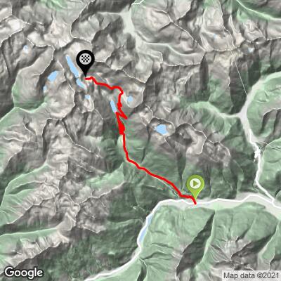
39.5
PDI
12.6 mi
DISTANCE
5,517 ft
GAINED
7.5 %
AVG. GRADE
FULL CLIMB STATS
Page Contributor(s): Erwan Treguier, Brittany, France.
INTRO
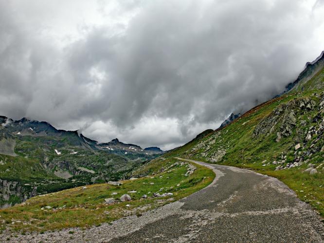
We have ridden the first portion of this climb as part of the #19 World Climb, Grosser Oscheniksee. Instead of turning right onto the private road up to the Oscheniksee Reservoir at mile 7 / kilometer 11.3, we continue up the main road, past the Power Station at mile 8 / kilometer 12.9, past Molitaler Gletscherbahnen ski station at mile 8.8 (km 14) to the end of the road and end of the Molltaler Gletscherexpress gondola line that begins at the base of the ski resort.
PLAN YOUR ROUTE
See more details and tools regarding this climb's grade via our interactive Profile Tool.
Information Not Available
If you have any information regarding this climb, we'd like to hear from you. Click the CONTRIBUTE button to share your thoughts with us.
Information Not Available
If you have any information regarding this climb, we'd like to hear from you. Click the CONTRIBUTE button to share your thoughts with us.
Before heading out on any cycling adventure check out our Things to Bring on a Cycling Trip and use our interactive check list to ensure you don't forget anything.
Information Not Available
If you have any information regarding this climb, we'd like to hear from you. Click the CONTRIBUTE button to share your thoughts with us.
ROUTE MAP
MEMBER RATING
CURRENT WEATHER
PJAMM TRIPS ADVENTURE STARTER BUNDLES
Check out PJAMM Adventure's prepackaged (self-guided) cycling trips. They will help you plan, document and conquer your next adventure.
NEARBY CLIMBS (0) RADIAL PROXIMITY
FROM No Climbs Found
MEMBER REVIEWS & COMMENTS
Let us know what you thought of this climb. Signup for our FREE membership to write a review or post a comment.
Already have an account?
LOG IN HERE