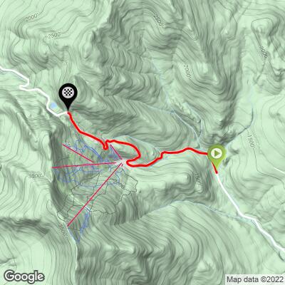
9.2
PDI
2.8 mi
DISTANCE
1,268 ft
GAINED
8.7 %
AVG. GRADE
FULL CLIMB STATS
Page Contributor(s): John Summerson, The Complete Guide to Climbing (By Bike), 2nd Edition
INTRO
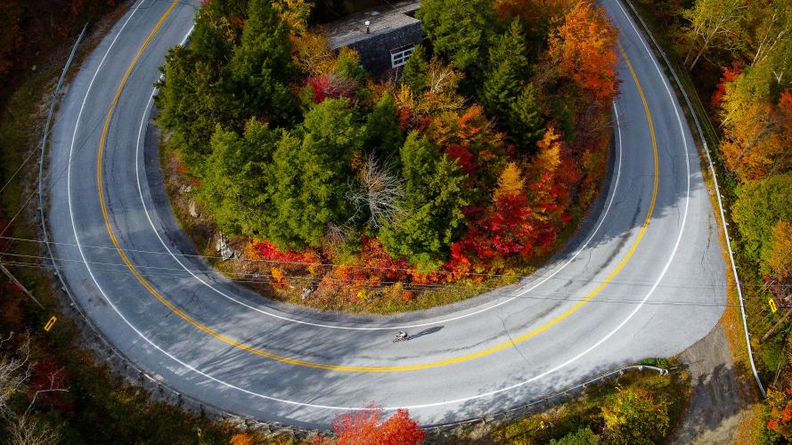
“The east side of Appalachian Gap in scenic central Vermont might surprise you. Its grade is fairly steady (steep) over much of its length which belies its overall steep nature. The road is somewhat narrow and does not carry a lot of traffic most of the time. It begins as stout grade, eases a bit for a short stretch and then steepens again, a pattern that is repeated as you ascend west. The steepest section on this hill is toward the top and the grade only eases over the last 0.2 miles of the route. The view at the obvious top (looking west) is one of the best in Vermont. The annual race on its slopes runs the full length of the hill which includes a shallow start…” (This quote is provided with the approval of John Summerson from his book The Complete Guide to Climbing (by Bike) in the Northeast, pg. 162.)
PLAN YOUR ROUTE
The average grade on this climb is 8.3%. 62% of the climb is at grade 5-10% and 26% is at 10-15%. The steepest quarter-mile is 12%.
See more details and tools regarding this climb's grade via the “Profile Tool” button.
Roadway: This is a two lane state highway in good condition with a slight shoulder most of the climb.
Traffic: Mild to low moderate at times.
Parking: At the parking lot at the top where you can stage to ride down to the start of the climb on each side of the pass, or just off the road or on a side road at the start of the climb - Map; Street View.
Provisions: The closest provisions on this route are in Irasville, 3.5 miles southeast of the climb start - Map.
Before heading out on any cycling adventure check out our Things to Bring on a Cycling Trip and use our interactive check list to ensure you don't forget anything.
Doing both the east side as well as Appalachian Gap West is a nice out and back - 11 miles 2,340' (Map). Also, use the “Routes in Area” button on the menu bar above to see other bike climbs in this area.
ROUTE MAP
MEMBER RATING
CURRENT WEATHER
PJAMM TRIPS ADVENTURE STARTER BUNDLES
Check out PJAMM Adventure's prepackaged (self-guided) cycling trips. They will help you plan, document and conquer your next adventure.
NEARBY CLIMBS (0) RADIAL PROXIMITY
FROM No Climbs Found
MEMBER REVIEWS & COMMENTS
Let us know what you thought of this climb. Signup for our FREE membership to write a review or post a comment.
Already have an account?
LOG IN HERE
Mikey62481
Coming up from the east side of the App Gap, it is a more sustained climb than the West side, especially once you reach the Mad River Glen Cooperative Ski Resort...at that point it gets harder and you can get into a good rhythm! Views were great and road was in great condition on the descent! Some cars but not too bad