
17
PDI
10.3 mi
DISTANCE
3,131 ft
GAINED
5.7 %
AVG. GRADE
FULL CLIMB STATS
INTRO
The Borgomaro side of the Colle d'Oggia starts on a smooth, freshly surfaced valley road and slowly turns into something rougher and lonelier. By the time you're in the woods above Ville San Sebastiano the asphalt has shrunk to a single lane of patches and cracks, with gravel at the edges and low stone walls on the hairpins, and you can ride for a long time without meeting anyone.
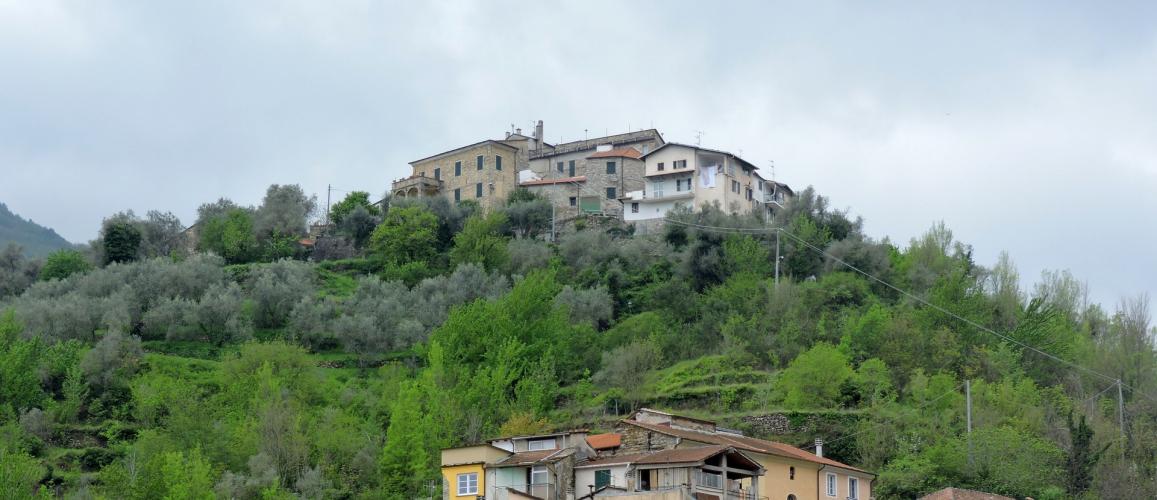
That's the appeal. It's 16.6 km (10.3 mi) with 954 m (3131 ft) of climbing at a steady 5.7%, never steeper than 8.3% for a full kilometer, up to 1138 m where the road meets the SP21 at the pass, on the ridge between the Impero and Argentina valleys. The first 7 km are easy, under 5%, as the SP24 leaves Borgomaro, swings below Maro Castello on its olive-terraced hill and runs up the valley to Ville San Sebastiano. The work comes between km 7 and about km 12.4, which hold 7 to 8% through a string of hairpins. It eases for a couple of kilometers in the trees, then finishes at 6% across open, scrubby hillside where the view finally opens up.
Riders who know the area say the road stays quiet partly because it's been left to itself for years, and the upper half shows it. It's fine on a road bike - just ride it like the back road it is, especially on the way down. Over the top, the road drops through Carpasio and Montalto into the Valle Argentina, the climb on our Colle d'Oggia page.
PLAN YOUR ROUTE
 We've partnered with Sherpa-Map.com to bring you the best route planning tool. With a PRO Membership you can use this climb as a reference when creating your route.
From 185 m (608 ft) at the bottom of Borgomaro to 1138 m (3735 ft) at the pass, the climb gains 954 m (3131 ft) in 16.6 km (10.3 mi) at an average of 5.7%, with almost no descending. The steepest kilometer averages 8.3%, the steepest 2 km 7.9%, the steepest 5 km 7.5% and the steepest 10 km 6.7%.
Km 0-7: 4.7% on the wider lower SP24, past Maro Castello to Ville San Sebastiano.
Km 7-12.4: 7.4%, the hardest stretch, on a single-lane road with hairpins; the steepest kilometer is in here.
Km 12.4-14.5: 4.7%, a breather through the woods.
Km 14.5-16.6: 6.0% up open hillside to the Colle d'Oggia.
Roadway: Asphalt from bottom to top, but it changes character. The lower SP24 out of Borgomaro is wide and recently resurfaced. From around Ville San Sebastiano it narrows to a single lane, and the upper half is patched and cracked, with loose gravel at the edges and on some of the hairpins, and low stone walls rather than guardrails in places. It's rideable on 25 mm tires, but 28s are kinder on the way down.
Traffic: Very light, and lighter the higher you go - mostly residents of the Borgomaro hamlets and the odd farm vehicle. Riders who know it say it's quiet in every season.
Parking: Park in Borgomaro, where the climb starts. The village is laid out on a straight grid rather than the usual Ligurian tangle, so finding a legal spot near the main road is easier than in most hill towns. Don't leave a car on the narrow road above the village.
Gear: A compact with a 28 or 30 at the back is plenty - the gradient never really bites. The lower valley is open and hot in summer, so start early, and stuff a gilet in a pocket - the pass is over 1100 m and the way down is long and shaded.
Provisions: Stock up before you leave the valley floor in Borgomaro. Above Ville San Sebastiano it's woods and hillside with nowhere to buy anything, and the pass itself is just a junction, so carry enough for the full 16.6 km.
Before heading out on any cycling adventure check out our Things to Bring on a Cycling Trip and use our interactive check list to ensure you don't forget anything.
Borgomaro is worth a slow coffee before or after. Unusually for Liguria it's built on a straight grid, with palazzi from a more prosperous past - Palazzo Cassio Amelio, now the town hall, has statues and frescoes - and an old fountain, donated in 1892, whose stone rim still carries the grooves where shepherds and farmers sharpened their tools. Up a side valley, the hamlet of Conio has its own castle and grows the Conio bean, a Slow Food presidium with its own festival.
For a bigger day, ride over the top and down through Carpasio and Montalto to the Valle Argentina, then back along the coast to Imperia and up the Valle Impero. Passo Teglia, Colle Melosa and Monte Ceppo are all in the same knot of valleys if you're staying a few days. Imperia, on the coast, has the train station and most of the hotels.
ROUTE MAP

MEMBER RATING
CURRENT WEATHER
PJAMM TRIPS ADVENTURE STARTER BUNDLES
Check out PJAMM Adventure's prepackaged (self-guided) cycling trips. They will help you plan, document and conquer your next adventure.
NEARBY CLIMBS (0) RADIAL PROXIMITY
FROM No Climbs Found
MEMBER REVIEWS & COMMENTS
Let us know what you thought of this climb. Signup for our FREE membership to write a review or post a comment.
Already have an account?
LOG IN HERE
