Cherryville - Fenhurst Road Bike Climb - PJAMM Cycling

6.2
PDI
1.2 mi
DISTANCE
710 ft
GAINED
11 %
AVG. GRADE

FULL CLIMB STATS

INTRO

This 1.2 mile bike climb is located in South Australia, Australia. The average gradient is 11% and there is a total elevation gain of 710 ft, finishing at 1,840 ft.

Use the profile tool, route map, and weather forecast to conquer this cycling climb.

See more details and tools regarding this climb's grade via our interactive Profile Tool.
Information Not Available

If you have any information regarding this climb, we'd like to hear from you. Click the CONTRIBUTE button to share your thoughts with us.

Information Not Available

If you have any information regarding this climb, we'd like to hear from you. Click the CONTRIBUTE button to share your thoughts with us.

Before heading out on any cycling adventure check out our Things to Bring on a Cycling Trip and use our interactive check list to ensure you don't forget anything.
Information Not Available

If you have any information regarding this climb, we'd like to hear from you. Click the CONTRIBUTE button to share your thoughts with us.

ROUTE MAP

MEMBER RATING

Not Yet Rated
-
Road
-
Traffic
-
Scenery

CURRENT WEATHER

PJAMM TRIPS ADVENTURE STARTER BUNDLES

Check out PJAMM Adventure's prepackaged (self-guided) cycling trips. They will help you plan, document and conquer your next adventure.
ALL TRIPS
Browse all of our prepackaged trips and find your next adventure!
Australia
Australia
24 ROUTES
41 POIs
ROUTE STATS (TOTAL)
443.9
mi
DISTANCE
64,453
ft
ELEV. GAIN
Australia: Adelaide
Australia
21 ROUTES
34 POIs
ROUTE STATS (TOTAL)
130.4
mi
DISTANCE
22,651
ft
ELEV. GAIN

NEARBY CLIMBS (0) RADIAL PROXIMITY

FROM
No Climbs Found

MEMBER REVIEWS & COMMENTS

Let us know what you thought of this climb. Signup for our FREE membership to write a review or post a comment.
Already have an account?
ROUTE MAP
PROFILE TOOL
Route Data
S.G. (%)
hide
Segment Data
hide
CLIMB SUMMARY

bike parked next to street sign for Fernhurst Road, sign reads "No Through Road"

Cycling Cherryville - Fernhurst Roads, South Australia

Ride 1.9 kilometers gaining 202 meters at 10.2% average grade.

This is the #7 ranked climb in Southern Australia due exclusively to its steepness - 500 meters at 15.4% and double digits for the entire climb.

bike parked next to sign for Fernhurst Lane, private road; sign reads "Private Property No Admittance"

The Private Property is adjacent to our start.

This climb is fully paved and on a public road. đź‘Ť

photo collage shows nature views along the way, including large succulents, eucalyptus tree tunnels, and red hedges; road sign reads "Danger Keep Left"

Climb summary by PJAMM Cycling’s Brad Butterfield.

Take a trip back in time on this climb. Although very short, she packs a punch without any points of leveling out. As the name suggests, this area was once a prominent producer of cherries which are native to the area. I didn’t notice any cherries growing, but passed quite a few lemon trees. I didn’t see any other cyclists, cars, motorcycles or even any people on the day I rode. Take care on the descent as the road is wicked steep and there are a few hairpin corners.

informational sign about Cherryville gives history of the area

The area was settled in the 1850s and named after the abundance of cherry trees in the area.

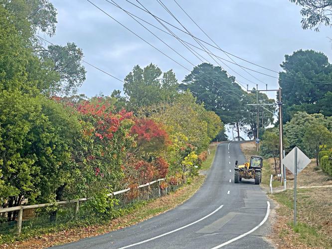
yellow tractor driving on roadway; two sheep look at camera

This is one of the more rural climbs out of Adelaide.

bike parked on roadway next to street sign for Cherryville Road

Take a sharp left off Cherryville onto Fenhurst at kilometer 1.4.

road sign warning of hairpin turn

Two great hairpins in the middle of the climb.

bike parked against guardrail at climb finish; intersection of Cherryville and Montacute Roads

Climb ends at the intersection of Cherryville and Montacute Roads. 

The finish of the climb is in close proximity to the Corkscrew and Montacute climbs.