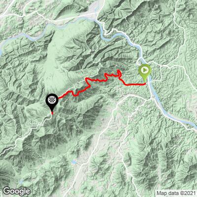
16.7
PDI
12.5 mi
DISTANCE
3,344 ft
GAINED
5 %
AVG. GRADE
FULL CLIMB STATS
Page Contributor(s): John Summerson, The Complete Guide to Climbing (By Bike), 2nd Edition.
INTRO
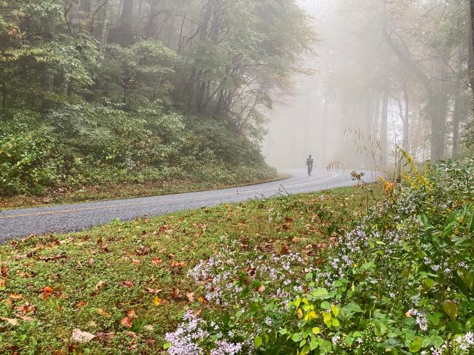
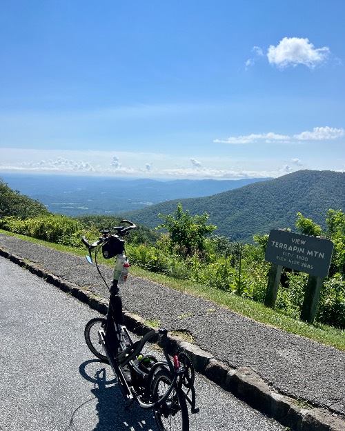
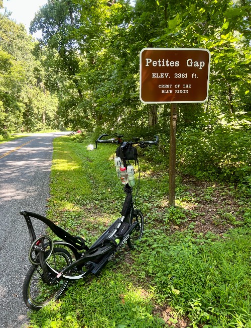
This is the fifth most difficult bike climb in Virginia. The grade is manageable, only very briefly moving into double digits a few times. As this is part of the spectacular Blue Ridge Parkway, we suspect the views from the viewpoints and openings in the forest bordering the roadway are spectacular. Unfortunately on the day we rode this climb, it was foggy and raining, hampering any distant views. The climb gets its name from a ridgeline near the end of the climb over which the Appalachian Trail passes. This climb takes us to the highest point on the Blue Ridge Parkway in Virginia -- Apple Orchard Mountain. The route is entirely on the magnificent Blue Ridge Parkway (VA to NC).
PLAN YOUR ROUTE
5% average grade. 43% of the climb is at 0-5% and 50% is at 5-10%. The steepest quarter-mile is 8%.
Use the “Routes in Area” button on the menu bar to see other bike climbs in this area.
Roadway: Excellent - completely on the Blue Ridge Parkway. No shoulder but this is a safe ride.
Traffic: Mild to moderate (during peak season during summer and fall colors).
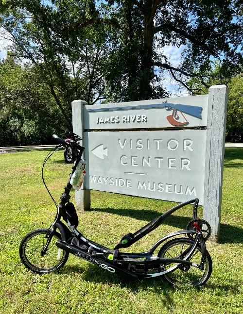
Parking: At the James River Visitor Center 100 yards east of climb start - Map; Street View.
Provisions: Water at Janes River Visitor Center. There is a market and restaurant in Monroe, 1.6 miles south of the start of the climb (Map).
Before heading out on any cycling adventure check out our Things to Bring on a Cycling Trip and use our interactive check list to ensure you don't forget anything.
Consider riding the Blue Ridge Parkway from beginning to end - Blue Ridge Parkway (VA to NC). Use the “Routes in Area” button on the menu bar above to see other bike climbs in this area.
Cycle the entire Blue Ridge Parkway – see PJAMM’s March 2022, 467-mile adventure on the PJAMM Adventures App: Blue Ridge Parkway. See also our Climbs of the BRP (NC to VA) and Climbs of the BRP (VA to NC).
ROUTE MAP
MEMBER RATING
CURRENT WEATHER
PJAMM TRIPS ADVENTURE STARTER BUNDLES
Check out PJAMM Adventure's prepackaged (self-guided) cycling trips. They will help you plan, document and conquer your next adventure.
NEARBY CLIMBS (0) RADIAL PROXIMITY
FROM No Climbs Found
MEMBER REVIEWS & COMMENTS
Let us know what you thought of this climb. Signup for our FREE membership to write a review or post a comment.
Already have an account?
LOG IN HERE
jpleftyjp
Did this ride back in August 2023 in the morning. Awesome views and very little traffic on the road. However, it was hot and a little humid even in the morning. Easier to ride back down to the Visitor Center 🤣😂
PatCarroll


The climb is a remarkable display of engineering in that the gradient almost never changes. This was my first HC climb and it was a blast. There are intermittent cracks which become tiring on the way down. There’s a convenient rest area at the foot for parking.
BirdLaw900

Have ridden this many times. Strangely, cannot find a good photo, so the one I posted is from Skyline Drive 50 miles north of here, but you'll never know the difference. This is what 95% of the climb looks like! Good pavement, quiet and generally respectful traffic, never super difficult but a grind at 13 miles with zero flat spots. Weather can be fickle from sun to clouds to rain all in the same day. Beautiful in the fall! Keep going north or south on the Parkway and it's up & down for as long as you care to ride, the entire BRP & Skyline are magic to ride on.
BirdLaw900
I rode this many times when I lived in Richmond. There is a campground & store 2 miles north of the start at Otter Creek, and if you keep riding south over the summit, a descent and then climb into Peaks of Otter about 10 miles later, a very nice lodge/food/campground. Makes for a great & challenging 50 mile out & back. The climb is pretty consistent, never very steep, but a grind. The views are 100% Shenandoah Valley and not much variation. It's an isolated stretch, so little traffic. Weather can be crazy & changing, often with a cloud/fog line as low as 2,000 MSL. I've descended this many times in rain or heavy fog. No sharp turns, but still sketchy. Easily the longest climb in the area; Wintergreen to the north is very steep, and you can link these together for an epic day. Thunder Ridge holds a special place for me as my girlfriend was looking for a challenge years ago and gave this a try, and when we got to the top I proposed. Still married 15 years later :-).