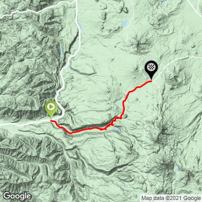
14.7
PDI
21.8 mi
DISTANCE
3,729 ft
GAINED
3.1 %
AVG. GRADE
FULL CLIMB STATS
Page Contributor(s): Steve Jones, Olympia, WA, USA; John Berude, Berkeley, CA, USA
INTRO
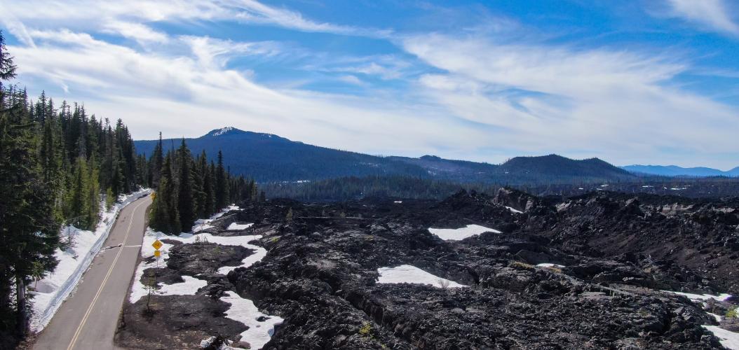
Located in the Cascade Range subrange of the Pacific Coast Mountain Range, McKenzie Pass (5,325') is one of the great Oregon road climbs. The west side of McKenzie Pass starts at the intersection of State Routes 126 and 242 (elev. 1,669'), near Belknap Hot Springs, in the heart of the Oregon Cascade Mountains, east of Eugene, Oregon.
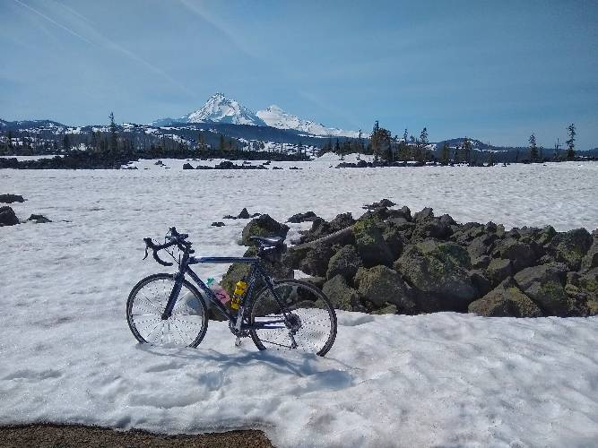
"The west side of McKenzie Pass in central Oregon is...one of the most scenic climbs in the United States. It is a long and varied ascent that begins in thick woods and ends among open lava fields near the top. The lower section is steeper and through tight switchbacks in places and very dark woods. The upper section is more straight and shallow but open with views..." (This quote is presented with the approval of John Summerson, from his book, The Complete Guide to Climbing (by Bike), 2nd Edition, p. 207.)
PLAN YOUR ROUTE
This climb's average grade is 3.1% (3.7% climb only). 11% of the climb is descent, 57% is at 0-5% grade, and 32% is at 5-10%. The steepest quarter-mile is 7.1% and steepest mile 6%.
Roadway: Two lane highway in good condition with no shoulder.
Traffic: Light.
Parking: On the side of State Route 126 just east of the climb start (Map; Street View).
Provisions: None on the climb, but some can be found 4.6 miles west at the McKenzie General Store and Grill (Map).
Before heading out on any cycling adventure check out our Things to Bring on a Cycling Trip and use our interactive check list to ensure you don't forget anything.
The climb ends at the Dee Wright Observatory, an old stone structure with images designating the distant mountains in the area (Google Maps + Reviews). See a list of the Top 10 trails in Willamette National Forest: All Trails Willamette Top 10. Also consider adding McKenzie Pass East for a nice 70 mile 6,000' out and back.
ROUTE MAP
MEMBER RATING
CURRENT WEATHER
PJAMM TRIPS ADVENTURE STARTER BUNDLES
Check out PJAMM Adventure's prepackaged (self-guided) cycling trips. They will help you plan, document and conquer your next adventure.
NEARBY CLIMBS (0) RADIAL PROXIMITY
FROM No Climbs Found
MEMBER REVIEWS & COMMENTS
Let us know what you thought of this climb. Signup for our FREE membership to write a review or post a comment.
Already have an account?
LOG IN HERE
tcott1966


Riding great right now. Road is supposed to be closed to traffic until mid-June. The West side is still blocked by snow just below the summit, but hopefully they will have that cleared in a couple of weeks.
josephbcoolman
This is a beautiful ride. And you can ride it without cars. You must climb it when the winter gates are closed. They open around or after Memorial Day. The climb is fun, switchbacks and changing scenery . You start in small trees and ride into the forest , then you'll be in the lava fields at the top. It's one of my favorite rides of all time.
joelmblatt
I live here; it is my weekly climb. I love it. You can start in Sisters or closer at Cold Springs Campground, which I prefer. Official start of climb is at gate and goes up and over Pass. I like to start at campground and go about 22.5 miles and return for ~4000 feet of elevation. Otherwise, extend it and go to where 242 meets 126. Better yet, extend it and capture Aufderheide, which is I've also reviewed on this site.